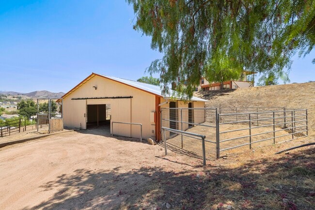
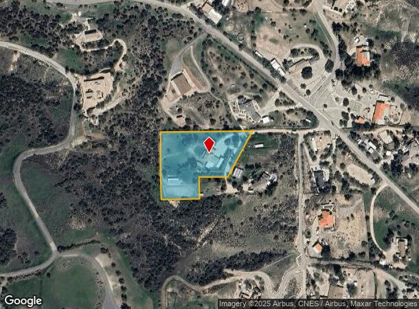
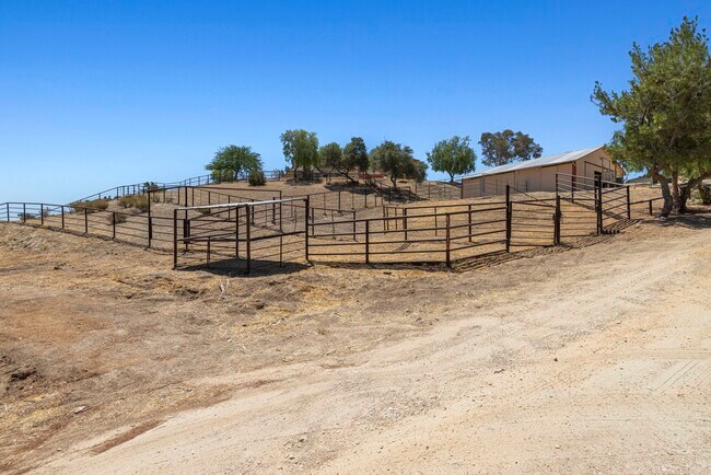
Property Record
13620 Pales Rd, Santa Clarita, CA 91390

Current Lease Availabilities
NEARBY LISTINGS FOR SALE OR LEASE
-
-
View all Santa Clarita listings for lease on LoopNet.com
Property Detail
13620 Pales Rd
Los Angeles-Long Beach-Glendale, CA
Los Angeles
3211-007-049
California
Sfr
2.26 AC
X
Santa Clarita Valley
06037C0855G
Los Angeles
3,013 SF
DEMOGRAPHICS near 13620 Pales Rd
1 Mile
3 Mile
5 Mile
2024 Total Population
290
7,197
21,319
2029 Population
288
7,105
20,971
Pop Growth 2024-2029
(0.69%)
(1.28%)
(1.63%)
Average Age
44
43
41
2024 Total Households
98
2,315
6,745
HH Growth 2024-2029
(1.02%)
(1.47%)
(1.76%)
Median Household Inc
$119,117
$126,663
$126,072
Avg Household Size
2.90
3.10
3.10
2024 Avg HH Vehicles
3.00
3.00
3.00
Median Home Value
$793,269
$781,163
$771,611
Median Year Built
1979
1984
1985
Nearby Places
- Restaurants
- Banks
- Shops
- Fitness
- Groceries
PUBLIC TRANSPORTATION
COMMUTER RAIL
Via Princessa (Antelope Valley Line - Southern California Regional Rail Authority (Metrolink))
DRIVE
WALK
Distance
Via Princessa (Antelope Valley Line - Southern California Regional Rail Authority (Metrolink))
15 min
8.6 mi
Vista Canyon Metrolink Station (Metrolink Antelope Valley Line - Metrolink Trains)
DRIVE
WALK
Distance
Vista Canyon Metrolink Station (Metrolink Antelope Valley Line - Metrolink Trains)
18 min
9.4 mi
AIRPORT
Bob Hope
DRIVE
WALK
Distance
Bob Hope
39 min
28.3 mi
Freight Ports
Port of Long Beach
DRIVE
WALK
Distance
Port of Long Beach
82 min
64.8 mi
Nearby Properties
Address
Land Use
TOTAL SIZE
Lot Size
Zoning
Address
Land Use
TOTAL SIZE
Lot Size
Zoning
165.83 AC
LCR1
Address
Land Use
TOTAL SIZE
Lot Size
Zoning
112.98 AC
LCA1
Address
Land Use
TOTAL SIZE
Lot Size
Zoning
27.39 AC
LCM1-A11*
Address
Land Use
TOTAL SIZE
Lot Size
Zoning
Address
Land Use
TOTAL SIZE
Lot Size
Zoning
840 SF
31.53 AC
LCC3-A11*
Address
Land Use
TOTAL SIZE
Lot Size
Zoning
148.76 AC
LCC3-A11-R
Address
Land Use
TOTAL SIZE
Lot Size
Zoning
Address
Land Use
TOTAL SIZE
Lot Size
Zoning
3.89 AC
LCM1-A11*
Address
Land Use
TOTAL SIZE
Lot Size
Zoning
976 SF
11.55 AC
LCM11/2*
Address
Land Use
TOTAL SIZE
Lot Size
Zoning
17,350 SF
4.32 AC
LCR3
Address
Land Use
TOTAL SIZE
Lot Size
Zoning
19.86 AC
LCC3-A11*
Address
Land Use
TOTAL SIZE
Lot Size
Zoning
1,360 SF
2.02 AC
LCC4*
Address
Land Use
TOTAL SIZE
Lot Size
Zoning
43,967 SF
40.97 AC
LCM11/2*
Address
Land Use
TOTAL SIZE
Lot Size
Zoning
7,640 SF
2.63 AC
LCC1
Address
Land Use
TOTAL SIZE
Lot Size
Zoning
17,325 SF
9.94 AC
LCM1-A11*
Address
Land Use
TOTAL SIZE
Lot Size
Zoning
7,444 SF
1.84 AC
LCM1*
Address
Land Use
TOTAL SIZE
Lot Size
Zoning
4,638 SF
10.71 AC
LCM1
Address
Land Use
TOTAL SIZE
Lot Size
Zoning
27.30 AC
LCA21*
Address
Land Use
TOTAL SIZE
Lot Size
Zoning
25.20 AC
LCA21*
Address
Land Use
TOTAL SIZE
Lot Size
Zoning
3,318 SF
10.07 AC
LCRR1*
Address
Land Use
TOTAL SIZE
Lot Size
Zoning
3,893 SF
21.08 AC
LCA11*
Address
Land Use
TOTAL SIZE
Lot Size
Zoning
6,345 SF
26.72 AC
LCC4-A1200
Address
Land Use
TOTAL SIZE
Lot Size
Zoning
2,960 SF
12.42 AC
LCC3-A1L*
Address
Land Use
TOTAL SIZE
Lot Size
Zoning
6,015 SF
14.87 AC
LCA11*
Address
Land Use
TOTAL SIZE
Lot Size
Zoning
4,000 SF
9.57 AC
LCM1-A21*
Address
Land Use
TOTAL SIZE
Lot Size
Zoning
7,048 SF
2.66 AC
LCC4
The World's #1 Commercial Real Estate Marketplace
Connect with us
© 2025 CoStar Group
The information above has been obtained from sources believed reliable. While we do not doubt its accuracy we have not verified it and make no guarantee, warranty or representation about it. It is your responsibility to independently confirm its accuracy and completeness. Any projections, opinions, assumptions, or estimates used are for example only and do not represent the current or future performance of the property. The value of this transaction to you depends on tax and other factors which should be evaluated by your tax, financial, and legal advisors. You and your advisors should conduct a careful, independent investigation of the property to determine to your satisfaction the suitability of the property for your needs.