Property Record
13623 N 32Nd St, Phoenix, AZ 85032

Save to a Folder
{{folder.Name}}
{{folder.ListingIds.length}} Properties
{{folder.ListingIds.length}} Property
Create a New Folder
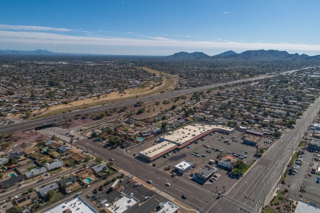
Property Detail
13623 N 32Nd St
166-51-116H
PARADISE VALLEY OASIS 2 LOTS 77-191 & TR A MCR 96/24
Restaurantbuilding
Maricopa
C2
Arizona
C and X Area of minimal flood hazard, usually depicted on FIRMs as above the 500-year flood level.
a
2025
0.83 AC
2025
East Phoenix
103400
Phoenix
3,663 SF
Phoenix-Mesa-Chandler, AZ
NEARBY LISTINGS FOR SALE OR LEASE
DEMOGRAPHICS near 13623 N 32Nd St
1 mile
3 mile
5 mile
2025 Total Population
13,849
117,483
277,764
2030 Population
14,175
121,092
287,316
Pop Growth 2025-2030
+ 2.35%
+ 3.07%
+ 3.44%
Average Age
40
42
41
2025 Total Households
5,159
48,270
116,039
HH Growth 2025-2030
+ 2.25%
+ 3.18%
+ 3.56%
Median Household Inc
$90,318
$88,887
$90,565
Avg Household Size
2.60
2.30
2.30
2025 Avg HH Vehicles
2.00
2.00
2.00
Median Home Value
$448,565
$505,831
$534,442
Median Year Built
1975
1982
1984
Nearby Places
Map Layers
Map Styles
 Street
 Aerial
Layers
 Traffic
 Biking
Places
Listings with unknown addresses are not visible on the map
- Restaurants
- Banks
- Shops
- Fitness
- Groceries
PUBLIC TRANSPORTATION
AIRPORT
Phoenix Sky Harbor International
Drive
Walk
Distance
Phoenix Sky Harbor International
23 min
15.6 mi
Phoenix-Mesa Gateway
Drive
Walk
Distance
Phoenix-Mesa Gateway
55 min
42.3 mi
Freight Ports
Port of San Diego
Drive
Walk
Distance
Port of San Diego
410 min
368.0 mi
Nearby Properties
Address
Land Use
TOTAL SIZE
Lot Size
Zoning
Address
Land Use
TOTAL SIZE
Lot Size
Zoning
17.81 AC
Address
Land Use
TOTAL SIZE
Lot Size
Zoning
128,046 SF
9.97 AC
C2
Address
Land Use
TOTAL SIZE
Lot Size
Zoning
33,244 SF
5.93 AC
C-2
Address
Land Use
TOTAL SIZE
Lot Size
Zoning
4.67 AC
Address
Land Use
TOTAL SIZE
Lot Size
Zoning
342,574 SF
85.69 AC
R-18
Address
Land Use
TOTAL SIZE
Lot Size
Zoning
39.21 AC
Address
Land Use
TOTAL SIZE
Lot Size
Zoning
302,647 SF
27.82 AC
C-1
Address
Land Use
TOTAL SIZE
Lot Size
Zoning
359,170 SF
37.47 AC
R-14
Address
Land Use
TOTAL SIZE
Lot Size
Zoning
580,563 SF
9 AC
C-T
Address
Land Use
TOTAL SIZE
Lot Size
Zoning
512,499 SF
23.03 AC
R3A
Address
Land Use
TOTAL SIZE
Lot Size
Zoning
323,288 SF
40.56 AC
R1-10
Address
Land Use
TOTAL SIZE
Lot Size
Zoning
482,581 SF
20.45 AC
C-C
Address
Land Use
TOTAL SIZE
Lot Size
Zoning
3.27 AC
C-C
Address
Land Use
TOTAL SIZE
Lot Size
Zoning
167,532 SF
30 AC
R-14
Address
Land Use
TOTAL SIZE
Lot Size
Zoning
211,239 SF
12.33 AC
M-M
Address
Land Use
TOTAL SIZE
Lot Size
Zoning
1.26 AC
Address
Land Use
TOTAL SIZE
Lot Size
Zoning
28,805 SF
2.67 AC
C-C
Address
Land Use
TOTAL SIZE
Lot Size
Zoning
345,339 SF
17.01 AC
M-H
Address
Land Use
TOTAL SIZE
Lot Size
Zoning
316,766 SF
13.32 AC
M-H
Address
Land Use
TOTAL SIZE
Lot Size
Zoning
415,053 SF
6.29 AC
Address
Land Use
TOTAL SIZE
Lot Size
Zoning
127,252 SF
0.89 AC
C-C
Address
Land Use
TOTAL SIZE
Lot Size
Zoning
245,623 SF
5.09 AC
I-P
Address
Land Use
TOTAL SIZE
Lot Size
Zoning
281,018 SF
9.26 AC
M-H
Address
Land Use
TOTAL SIZE
Lot Size
Zoning
135,939 SF
19.35 AC
R1-8
Address
Land Use
TOTAL SIZE
Lot Size
Zoning
113,611 SF
1.43 AC
C-C
Address
Land Use
TOTAL SIZE
Lot Size
Zoning
115,983 SF
4.85 AC
R-14
Address
Land Use
TOTAL SIZE
Lot Size
Zoning
208,370 SF
19.49 AC
Address
Land Use
TOTAL SIZE
Lot Size
Zoning
135,017 SF
10.42 AC
C-R
Address
Land Use
TOTAL SIZE
Lot Size
Zoning
362,106 SF
15.60 AC
M-H
Address
Land Use
TOTAL SIZE
Lot Size
Zoning
81,692 SF
8.65 AC
R-10
The World's #1 Commercial Real Estate Marketplace
Connect with us
© 2026 CoStar Group
The information above has been obtained from sources believed reliable. While we do not doubt its accuracy we have not verified it and make no guarantee, warranty or representation about it. It is your responsibility to independently confirm its accuracy and completeness. Any projections, opinions, assumptions, or estimates used are for example only and do not represent the current or future performance of the property. The value of this transaction to you depends on tax and other factors which should be evaluated by your tax, financial, and legal advisors. You and your advisors should conduct a careful, independent investigation of the property to determine to your satisfaction the suitability of the property for your needs.