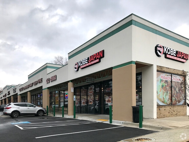
Property Record
13625 Georgia Ave, Silver Spring, MD 20906

Property Detail
13625 Georgia Ave
13-00951976
PAR C ASPEN MANOR SH OPPING CTR
Storebuilding
Montgomery
NR0.7
Maryland
B and X Area of moderate flood hazard, usually the area between the limits of the 100-year and 500-year floods.
2.29 AC
2024
Kensington/Wheaton
2025
Washington, DC
703214
Washington-Arlington-Alexandria, DC-VA-MD-WV
40,507 SF
NEARBY LISTINGS FOR SALE OR LEASE
DEMOGRAPHICS near 13625 Georgia Ave
1 mile
3 mile
5 mile
2025 Total Population
28,947
155,196
333,470
2030 Population
29,759
159,526
343,085
Pop Growth 2025-2030
+ 2.81%
+ 2.79%
+ 2.88%
Average Age
38
42
42
2025 Total Households
8,886
54,236
122,368
HH Growth 2025-2030
+ 2.90%
+ 2.93%
+ 2.94%
Median Household Inc
$84,059
$105,045
$119,469
Avg Household Size
3.10
2.70
2.60
2025 Avg HH Vehicles
2.00
2.00
2.00
Median Home Value
$492,649
$517,117
$625,637
Median Year Built
1971
1970
1972
Nearby Places
Map Layers
Map Styles
 Street
 Aerial
Layers
 Traffic
 Biking
Places
Listings with unknown addresses are not visible on the map
- Restaurants
- Banks
- Shops
- Fitness
- Groceries
PUBLIC TRANSPORTATION
COMMUTER RAIL
Kensington Marc Eb (BRUNSWICK - WASHINGTON - Maryland Transit Administration)
Drive
Walk
Distance
Kensington Marc Eb (BRUNSWICK - WASHINGTON - Maryland Transit Administration)
8 min
4.5 mi
Garrett Park Marc Eb (BRUNSWICK - WASHINGTON - Maryland Transit Administration)
Drive
Walk
Distance
Garrett Park Marc Eb (BRUNSWICK - WASHINGTON - Maryland Transit Administration)
12 min
5.7 mi
AIRPORT
Ronald Reagan Washington Ntl
Drive
Walk
Distance
Ronald Reagan Washington Ntl
36 min
18.5 mi
Washington Dulles International
Drive
Walk
Distance
Washington Dulles International
51 min
30.0 mi
Baltimore/Washington International Thurgood Marshall
Drive
Walk
Distance
Baltimore/Washington International Thurgood Marshall
43 min
32.1 mi
Freight Ports
Port of Baltimore
Drive
Walk
Distance
Port of Baltimore
48 min
35.0 mi
Nearby Properties
Address
Land Use
TOTAL SIZE
Lot Size
Zoning
Address
Land Use
TOTAL SIZE
Lot Size
Zoning
1,332,482 SF
3.79 AC
CR2.0
Address
Land Use
TOTAL SIZE
Lot Size
Zoning
515,000 SF
5.23 AC
CR1.5
Address
Land Use
TOTAL SIZE
Lot Size
Zoning
431,630 SF
25.77 AC
R60
Address
Land Use
TOTAL SIZE
Lot Size
Zoning
223,520 SF
2.77 AC
CR2.0
Address
Land Use
TOTAL SIZE
Lot Size
Zoning
330,650 SF
2.89 AC
MXTD
Address
Land Use
TOTAL SIZE
Lot Size
Zoning
465,983 SF
1.38 AC
CR3.0
Address
Land Use
TOTAL SIZE
Lot Size
Zoning
643,335 SF
29.18 AC
R20
Address
Land Use
TOTAL SIZE
Lot Size
Zoning
429,137 SF
1.80 AC
CR4.0
Address
Land Use
TOTAL SIZE
Lot Size
Zoning
515,740 SF
19.97 AC
R20
Address
Land Use
TOTAL SIZE
Lot Size
Zoning
460,492 SF
3.56 AC
CR4.0
Address
Land Use
TOTAL SIZE
Lot Size
Zoning
152,330 SF
CR
Address
Land Use
TOTAL SIZE
Lot Size
Zoning
276,462 SF
15.11 AC
R60
Address
Land Use
TOTAL SIZE
Lot Size
Zoning
258,000 SF
6.34 AC
PRC
Address
Land Use
TOTAL SIZE
Lot Size
Zoning
164,307 SF
16.45 AC
R90
Address
Land Use
TOTAL SIZE
Lot Size
Zoning
164,764 SF
15.42 AC
NR0.7
Address
Land Use
TOTAL SIZE
Lot Size
Zoning
316,973 SF
29.64 AC
R90
Address
Land Use
TOTAL SIZE
Lot Size
Zoning
131,521 SF
13.40 AC
PRC
Address
Land Use
TOTAL SIZE
Lot Size
Zoning
202,300 SF
4.01 AC
MXB
Address
Land Use
TOTAL SIZE
Lot Size
Zoning
187,691 SF
3.03 AC
R90
Address
Land Use
TOTAL SIZE
Lot Size
Zoning
294,082 SF
12.18 AC
R20
Address
Land Use
TOTAL SIZE
Lot Size
Zoning
193,966 SF
18.25 AC
CR2.0
Address
Land Use
TOTAL SIZE
Lot Size
Zoning
427,500 SF
25.70 AC
R30
Address
Land Use
TOTAL SIZE
Lot Size
Zoning
195,864 SF
2.85 AC
PDTC
Address
Land Use
TOTAL SIZE
Lot Size
Zoning
425,295 SF
15.72 AC
CRT22
Address
Land Use
TOTAL SIZE
Lot Size
Zoning
215,937 SF
2.91 AC
CR2.0
Address
Land Use
TOTAL SIZE
Lot Size
Zoning
428,220 SF
18.66 AC
CR3.0
Address
Land Use
TOTAL SIZE
Lot Size
Zoning
321,840 SF
13.95 AC
R20
Address
Land Use
TOTAL SIZE
Lot Size
Zoning
283,516 SF
9.18 AC
R90
Address
Land Use
TOTAL SIZE
Lot Size
Zoning
332,133 SF
28.24 AC
R90
Address
Land Use
TOTAL SIZE
Lot Size
Zoning
85,246 SF
6.71 AC
CR2.0
The World's #1 Commercial Real Estate Marketplace
Connect with us
© 2026 CoStar Group
The information above has been obtained from sources believed reliable. While we do not doubt its accuracy we have not verified it and make no guarantee, warranty or representation about it. It is your responsibility to independently confirm its accuracy and completeness. Any projections, opinions, assumptions, or estimates used are for example only and do not represent the current or future performance of the property. The value of this transaction to you depends on tax and other factors which should be evaluated by your tax, financial, and legal advisors. You and your advisors should conduct a careful, independent investigation of the property to determine to your satisfaction the suitability of the property for your needs.