Property Record
13635 Sycamore Ave, San Martin, CA 95046


NEARBY LISTINGS FOR SALE OR LEASE
-
-
View all San Martin listings for lease on LoopNet.com
Property Detail
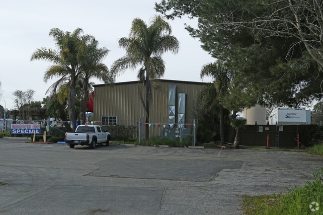
13635 Sycamore Ave
825-14-051
San Martin Ranch Map 03
Storebuilding
Santa Clara
AE
California
06085C0628H
75
2024
5.28 AC
2025
Morgan Hill
512402
South Bay/San Jose
3,200 SF
San Jose-Sunnyvale-Santa Clara, CA
DEMOGRAPHICS near 13635 Sycamore Ave
1 Mile
3 Mile
5 Mile
2024 Total Population
1,803
17,646
65,561
2029 Population
1,651
16,650
62,507
Pop Growth 2024-2029
(8.43%)
(5.64%)
(4.66%)
Average Age
43
43
41
2024 Total Households
519
5,775
20,575
HH Growth 2024-2029
(8.86%)
(5.82%)
(4.89%)
Median Household Inc
$132,042
$135,678
$140,964
Avg Household Size
3.10
2.90
3.10
2024 Avg HH Vehicles
3.00
3.00
3.00
Median Home Value
$1,109,794
$1,068,336
$1,014,916
Median Year Built
1973
1979
1985
Nearby Places
Map Layers
Map Styles
 Street
 Aerial
- Restaurants
- Banks
- Shops
- Fitness
- Groceries
PUBLIC TRANSPORTATION
COMMUTER RAIL
DRIVE
WALK
Distance
3 min
1.2 mi
San Martin (Caltrain - Caltrain (Caltrain))
DRIVE
WALK
Distance
San Martin (Caltrain - Caltrain (Caltrain))
4 min
1.2 mi
AIRPORT
Norman Y Mineta San Jose International
DRIVE
WALK
Distance
Norman Y Mineta San Jose International
37 min
29.5 mi
Monterey Regional
DRIVE
WALK
Distance
Monterey Regional
59 min
47.7 mi
Freight Ports
Port of Redwood City
DRIVE
WALK
Distance
Port of Redwood City
59 min
47.5 mi
SALE & LEASE HISTORY
LISTING DATE
SALE/LEASE

Mar 08, 2017
For Sale
Mar 05, 2021
For Lease
Nearby Properties
Address
Land Use
TOTAL SIZE
Lot Size
Zoning
Address
Land Use
TOTAL SIZE
Lot Size
Zoning
223,897 SF
8.25 AC
A-20A
Address
Land Use
TOTAL SIZE
Lot Size
Zoning
133,738 SF
5.66 AC
APD
Address
Land Use
TOTAL SIZE
Lot Size
Zoning
6,748 SF
26.12 AC
PUD
Address
Land Use
TOTAL SIZE
Lot Size
Zoning
23.56 AC
R1
Address
Land Use
TOTAL SIZE
Lot Size
Zoning
91,712 SF
4.03 AC
R3
Address
Land Use
TOTAL SIZE
Lot Size
Zoning
60,890 SF
1.73 AC
R3
Address
Land Use
TOTAL SIZE
Lot Size
Zoning
44,909 SF
0.50 AC
PUD
Address
Land Use
TOTAL SIZE
Lot Size
Zoning
100 SF
11.86 AC
PUD
Address
Land Use
TOTAL SIZE
Lot Size
Zoning
400 SF
3.67 AC
ML
Address
Land Use
TOTAL SIZE
Lot Size
Zoning
98,151 SF
4.55 AC
M
Address
Land Use
TOTAL SIZE
Lot Size
Zoning
53,997 SF
4.98 AC
C1
Address
Land Use
TOTAL SIZE
Lot Size
Zoning
39,166 SF
15.10 AC
HS
Address
Land Use
TOTAL SIZE
Lot Size
Zoning
58,472 SF
3.65 AC
R3
Address
Land Use
TOTAL SIZE
Lot Size
Zoning
63,518 SF
2.35 AC
CT
Address
Land Use
TOTAL SIZE
Lot Size
Zoning
604 SF
9.25 AC
C1
Address
Land Use
TOTAL SIZE
Lot Size
Zoning
22,000 SF
20.50 AC
A140
Address
Land Use
TOTAL SIZE
Lot Size
Zoning
46,952 SF
10.57 AC
HC
Address
Land Use
TOTAL SIZE
Lot Size
Zoning
76,000 SF
5.70 AC
CC
Address
Land Use
TOTAL SIZE
Lot Size
Zoning
11.26 AC
A
Address
Land Use
TOTAL SIZE
Lot Size
Zoning
151,650 SF
5.25 AC
MPUD
Address
Land Use
TOTAL SIZE
Lot Size
Zoning
144.93 AC
HS
Address
Land Use
TOTAL SIZE
Lot Size
Zoning
27,645 SF
5.52 AC
CS
Address
Land Use
TOTAL SIZE
Lot Size
Zoning
32,684 SF
2.23 AC
M1
Address
Land Use
TOTAL SIZE
Lot Size
Zoning
18,204 SF
1.20 AC
ML
Address
Land Use
TOTAL SIZE
Lot Size
Zoning
22,065 SF
2.48 AC
PUD
Address
Land Use
TOTAL SIZE
Lot Size
Zoning
65,160 SF
7.11 AC
M2
Address
Land Use
TOTAL SIZE
Lot Size
Zoning
56.95 AC
HS
Address
Land Use
TOTAL SIZE
Lot Size
Zoning
100,462 SF
6.34 AC
C1
Address
Land Use
TOTAL SIZE
Lot Size
Zoning
16,600 SF
2.12 AC
C1
The World's #1 Commercial Real Estate Marketplace
Connect with us
© 2026 CoStar Group
The information above has been obtained from sources believed reliable. While we do not doubt its accuracy we have not verified it and make no guarantee, warranty or representation about it. It is your responsibility to independently confirm its accuracy and completeness. Any projections, opinions, assumptions, or estimates used are for example only and do not represent the current or future performance of the property. The value of this transaction to you depends on tax and other factors which should be evaluated by your tax, financial, and legal advisors. You and your advisors should conduct a careful, independent investigation of the property to determine to your satisfaction the suitability of the property for your needs.