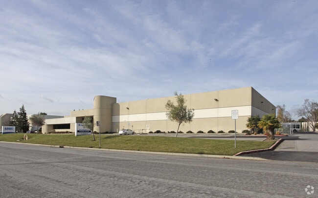
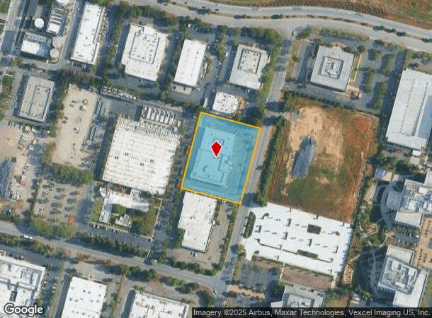
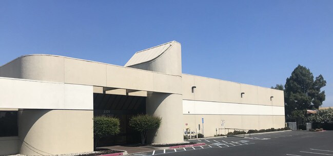
Property Record
1365 Geneva Dr, Sunnyvale, CA 94089

Current Lease Availabilities
NEARBY LISTINGS FOR SALE OR LEASE
Property Detail
1365 Geneva Dr
110-33-028
LOT 2 RECORDERS BOOK 651 PAGE 19
Industrialgeneral
Santa Clara
AE
California
06085C0045H
2.11 AC
2024
Moffett Park
2025
South Bay/San Jose
504602
San Jose-Sunnyvale-Santa Clara, CA
33,475 SF
DEMOGRAPHICS near 1365 Geneva Dr
1 mile
3 mile
5 mile
2024 Total Population
4,023
79,140
305,562
2029 Population
3,895
77,261
297,026
Pop Growth 2024-2029
(3.18%)
(2.37%)
(2.79%)
Average Age
39
37
37
2024 Total Households
1,697
30,732
119,243
HH Growth 2024-2029
(3.48%)
(2.43%)
(2.95%)
Median Household Inc
$159,028
$163,961
$169,319
Avg Household Size
2.30
2.50
2.50
2024 Avg HH Vehicles
2.00
2.00
2.00
Median Home Value
$345,625
$1,069,560
$1,107,740
Median Year Built
2000
1990
1979
Nearby Places
Map Layers
Map Styles
 Street
 Aerial
Transit
 Traffic
 Biking
Places
Listings with unknown addresses are not visible on the map
- Restaurants
- Banks
- Shops
- Fitness
- Groceries
PUBLIC TRANSPORTATION
COMMUTER RAIL
Great America (Altamont Corridor Express - Altamont Commuter Express (ACE))
Drive
Walk
Distance
Great America (Altamont Corridor Express - Altamont Commuter Express (ACE))
8 min
3.8 mi
Sunnyvale (Caltrain - Caltrain (Caltrain))
Drive
Walk
Distance
Sunnyvale (Caltrain - Caltrain (Caltrain))
10 min
3.9 mi
AIRPORT
Norman Y Mineta San Jose International
Drive
Walk
Distance
Norman Y Mineta San Jose International
13 min
7.3 mi
San Francisco International
Drive
Walk
Distance
San Francisco International
37 min
28.3 mi
Metro Oakland International
Drive
Walk
Distance
Metro Oakland International
46 min
35.2 mi
Freight Ports
Port of Redwood City
Drive
Walk
Distance
Port of Redwood City
22 min
15.1 mi
Nearby Properties
Address
Land Use
TOTAL SIZE
Lot Size
Zoning
Address
Land Use
TOTAL SIZE
Lot Size
Zoning
777,000 SF
17.84 AC
MS
Address
Land Use
TOTAL SIZE
Lot Size
Zoning
424,316 SF
22.37 AC
SU
Address
Land Use
TOTAL SIZE
Lot Size
Zoning
1,640,399 SF
101.23 AC
MP-I
Address
Land Use
TOTAL SIZE
Lot Size
Zoning
318,172 SF
60.47 AC
MP-TO
Address
Land Use
TOTAL SIZE
Lot Size
Zoning
107,203 SF
21.74 AC
MXD2
Address
Land Use
TOTAL SIZE
Lot Size
Zoning
16.72 AC
MSLSP
Address
Land Use
TOTAL SIZE
Lot Size
Zoning
73,425 SF
14.20 AC
MS
Address
Land Use
TOTAL SIZE
Lot Size
Zoning
4 AC
DSP/1
Address
Land Use
TOTAL SIZE
Lot Size
Zoning
181,709 SF
24.01 AC
MPI
Address
Land Use
TOTAL SIZE
Lot Size
Zoning
81,250 SF
14.73 AC
MPT
Address
Land Use
TOTAL SIZE
Lot Size
Zoning
431,256 SF
12.43 AC
PPSP
Address
Land Use
TOTAL SIZE
Lot Size
Zoning
350,633 SF
1.08 AC
MPTOD
Address
Land Use
TOTAL SIZE
Lot Size
Zoning
350,633 SF
1.27 AC
MPTOD
Address
Land Use
TOTAL SIZE
Lot Size
Zoning
23.19 AC
MP-I
Address
Land Use
TOTAL SIZE
Lot Size
Zoning
350,633 SF
1.08 AC
MPTOD
Address
Land Use
TOTAL SIZE
Lot Size
Zoning
587,826 SF
2.54 AC
DSP/1
Address
Land Use
TOTAL SIZE
Lot Size
Zoning
353,745 SF
14.82 AC
PPSP
Address
Land Use
TOTAL SIZE
Lot Size
Zoning
17.25 AC
MPI
Address
Land Use
TOTAL SIZE
Lot Size
Zoning
162,205 SF
18.69 AC
MS
Address
Land Use
TOTAL SIZE
Lot Size
Zoning
107.73 AC
CT
Address
Land Use
TOTAL SIZE
Lot Size
Zoning
23,709 SF
7.48 AC
PPSP
Address
Land Use
TOTAL SIZE
Lot Size
Zoning
22,400 SF
11.43 AC
MP-TO
Address
Land Use
TOTAL SIZE
Lot Size
Zoning
22.40 AC
PD
Address
Land Use
TOTAL SIZE
Lot Size
Zoning
22.40 AC
PD
Address
Land Use
TOTAL SIZE
Lot Size
Zoning
350,633 SF
1.27 AC
MPTOD
Address
Land Use
TOTAL SIZE
Lot Size
Zoning
350,633 SF
1.27 AC
MPTOD
Address
Land Use
TOTAL SIZE
Lot Size
Zoning
312,510 SF
23.46 AC
P41
Address
Land Use
TOTAL SIZE
Lot Size
Zoning
309,559 SF
5.69 AC
ML
Address
Land Use
TOTAL SIZE
Lot Size
Zoning
577,107 SF
3.65 AC
ML
Address
Land Use
TOTAL SIZE
Lot Size
Zoning
314,352 SF
0.95 AC
MP-TO
The World's #1 Commercial Real Estate Marketplace
Connect with us
© 2026 CoStar Group
The information above has been obtained from sources believed reliable. While we do not doubt its accuracy we have not verified it and make no guarantee, warranty or representation about it. It is your responsibility to independently confirm its accuracy and completeness. Any projections, opinions, assumptions, or estimates used are for example only and do not represent the current or future performance of the property. The value of this transaction to you depends on tax and other factors which should be evaluated by your tax, financial, and legal advisors. You and your advisors should conduct a careful, independent investigation of the property to determine to your satisfaction the suitability of the property for your needs.