Property Record
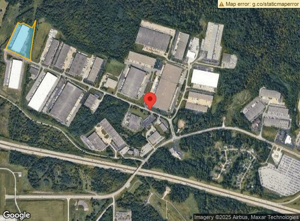
1365 Aviation Blvd, Hebron, KY 41048


NEARBY LISTINGS FOR SALE OR LEASE
Property Detail
1365 Aviation Blvd
Cincinnati, OH-KY-IN
Airport International Section 22
047.00-08-026.00
LOT 26 SEC 22 AIRPARK INTERNATIONAL
Publicstorage
Boone
X
Kentucky
21015C0110D
26
2025
9.50 AC
2025
Airport
070404
Cincinnati/Dayton
DEMOGRAPHICS near 1365 Aviation Blvd
1 Mile
3 Mile
5 Mile
2024 Total Population
375
20,448
91,755
2029 Population
399
21,103
93,145
Pop Growth 2024-2029
+ 6.40%
+ 3.20%
+ 1.51%
Average Age
35
39
40
2024 Total Households
127
7,140
34,031
HH Growth 2024-2029
+ 6.30%
+ 3.05%
+ 1.33%
Median Household Inc
$84,756
$92,855
$84,066
Avg Household Size
2.90
2.70
2.60
2024 Avg HH Vehicles
2.00
2.00
2.00
Median Home Value
$156,961
$211,197
$192,914
Median Year Built
2002
1986
1976
Nearby Places
Map Layers
Map Styles
 Street
 Aerial
- Restaurants
- Banks
- Shops
- Fitness
- Groceries
PUBLIC TRANSPORTATION
AIRPORT
Cincinnati/Northern Kentucky International
DRIVE
WALK
Distance
Cincinnati/Northern Kentucky International
17 min
6.2 mi
Freight Ports
Port of Toledo
DRIVE
WALK
Distance
Port of Toledo
260 min
218.8 mi
SALE & LEASE HISTORY
LISTING DATE
SALE/LEASE

Feb 14, 2018
For Lease
Nearby Properties
Address
Land Use
TOTAL SIZE
Lot Size
Zoning
Address
Land Use
TOTAL SIZE
Lot Size
Zoning
127,712 SF
185 AC
Address
Land Use
TOTAL SIZE
Lot Size
Zoning
Address
Land Use
TOTAL SIZE
Lot Size
Zoning
Address
Land Use
TOTAL SIZE
Lot Size
Zoning
Address
Land Use
TOTAL SIZE
Lot Size
Zoning
Address
Land Use
TOTAL SIZE
Lot Size
Zoning
4,150.90 AC
Address
Land Use
TOTAL SIZE
Lot Size
Zoning
Address
Land Use
TOTAL SIZE
Lot Size
Zoning
82.25 AC
Address
Land Use
TOTAL SIZE
Lot Size
Zoning
39.05 AC
Address
Land Use
TOTAL SIZE
Lot Size
Zoning
20.38 AC
Address
Land Use
TOTAL SIZE
Lot Size
Zoning
Address
Land Use
TOTAL SIZE
Lot Size
Zoning
48.90 AC
Address
Land Use
TOTAL SIZE
Lot Size
Zoning
21.76 AC
Address
Land Use
TOTAL SIZE
Lot Size
Zoning
38.10 AC
Address
Land Use
TOTAL SIZE
Lot Size
Zoning
737,000 SF
46.86 AC
Address
Land Use
TOTAL SIZE
Lot Size
Zoning
520,000 SF
26.09 AC
Address
Land Use
TOTAL SIZE
Lot Size
Zoning
177,092 SF
8.64 AC
Address
Land Use
TOTAL SIZE
Lot Size
Zoning
26.27 AC
Address
Land Use
TOTAL SIZE
Lot Size
Zoning
38.97 AC
Address
Land Use
TOTAL SIZE
Lot Size
Zoning
646,912 SF
25.34 AC
Address
Land Use
TOTAL SIZE
Lot Size
Zoning
605,850 SF
29.71 AC
Address
Land Use
TOTAL SIZE
Lot Size
Zoning
772,156 SF
63.91 AC
Address
Land Use
TOTAL SIZE
Lot Size
Zoning
713,360 SF
50.53 AC
Address
Land Use
TOTAL SIZE
Lot Size
Zoning
522,500 SF
25.10 AC
Address
Land Use
TOTAL SIZE
Lot Size
Zoning
64,481 SF
16.99 AC
Address
Land Use
TOTAL SIZE
Lot Size
Zoning
3.90 AC
RFC
Address
Land Use
TOTAL SIZE
Lot Size
Zoning
177,200 SF
16.27 AC
Address
Land Use
TOTAL SIZE
Lot Size
Zoning
26.62 AC
Address
Land Use
TOTAL SIZE
Lot Size
Zoning
300,432 SF
43.85 AC
Address
Land Use
TOTAL SIZE
Lot Size
Zoning
460,200 SF
28.39 AC
The World's #1 Commercial Real Estate Marketplace
Connect with us
© 2025 CoStar Group
The information above has been obtained from sources believed reliable. While we do not doubt its accuracy we have not verified it and make no guarantee, warranty or representation about it. It is your responsibility to independently confirm its accuracy and completeness. Any projections, opinions, assumptions, or estimates used are for example only and do not represent the current or future performance of the property. The value of this transaction to you depends on tax and other factors which should be evaluated by your tax, financial, and legal advisors. You and your advisors should conduct a careful, independent investigation of the property to determine to your satisfaction the suitability of the property for your needs.