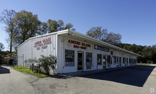
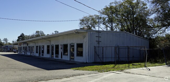
Property Record
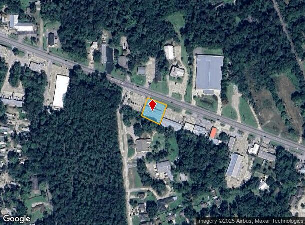
1365 Gause Blvd W, Slidell, LA 70460
NEARBY LISTINGS FOR SALE OR LEASE
Property Detail
1365 Gause Blvd W
New Orleans-Metairie, LA
Commercial Hwy 190 Td 28
110810
.42 ACRES IN SEC 4 9 14 INST NO 888850 [COMMERCIAL GAUSE BLVD WEST]
Commercialnec
St Tammany
ARE
Louisiana
2025
0.42 AC
2024
Slidell
041105
New Orleans/Metairie/Kenner
6,240 SF
DEMOGRAPHICS near 1365 Gause Blvd W
1 Mile
3 Mile
5 Mile
2024 Total Population
5,582
39,708
88,247
2029 Population
5,996
42,738
94,965
Pop Growth 2024-2029
+ 7.42%
+ 7.63%
+ 7.61%
Average Age
39
40
40
2024 Total Households
2,120
15,372
33,932
HH Growth 2024-2029
+ 7.41%
+ 7.68%
+ 7.65%
Median Household Inc
$53,465
$55,234
$60,016
Avg Household Size
2.60
2.50
2.50
2024 Avg HH Vehicles
2.00
2.00
2.00
Median Home Value
$157,764
$164,884
$193,700
Median Year Built
1979
1979
1989
Nearby Places
Map Layers
Map Styles
 Street
 Aerial
- Restaurants
- Banks
- Shops
- Fitness
- Groceries
PUBLIC TRANSPORTATION
COMMUTER RAIL
Slidell Amtrak Station (Crescent - Amtrak)
DRIVE
WALK
Distance
Slidell Amtrak Station (Crescent - Amtrak)
2 min
1.6 mi
Freight Ports
Port of New Orleans
DRIVE
WALK
Distance
Port of New Orleans
50 min
36.7 mi
SALE & LEASE HISTORY
LISTING DATE
SALE/LEASE

Sep 25, 2016
For Lease
Nearby Properties
Address
Land Use
TOTAL SIZE
Lot Size
Zoning
Address
Land Use
TOTAL SIZE
Lot Size
Zoning
318,479 SF
34.24 AC
Address
Land Use
TOTAL SIZE
Lot Size
Zoning
141,360 SF
30.70 AC
Address
Land Use
TOTAL SIZE
Lot Size
Zoning
120,000 SF
6.75 AC
Address
Land Use
TOTAL SIZE
Lot Size
Zoning
104,000 SF
2.89 AC
Address
Land Use
TOTAL SIZE
Lot Size
Zoning
205,496 SF
27.47 AC
Address
Land Use
TOTAL SIZE
Lot Size
Zoning
192,685 SF
Address
Land Use
TOTAL SIZE
Lot Size
Zoning
151,281 SF
19.39 AC
Address
Land Use
TOTAL SIZE
Lot Size
Zoning
208,769 SF
4.72 AC
Address
Land Use
TOTAL SIZE
Lot Size
Zoning
197,221 SF
1.60 AC
Address
Land Use
TOTAL SIZE
Lot Size
Zoning
157,561 SF
10.06 AC
Address
Land Use
TOTAL SIZE
Lot Size
Zoning
144,638 SF
0.88 AC
Address
Land Use
TOTAL SIZE
Lot Size
Zoning
62,506 SF
Address
Land Use
TOTAL SIZE
Lot Size
Zoning
137,402 SF
76.02 AC
Address
Land Use
TOTAL SIZE
Lot Size
Zoning
125,000 SF
10.84 AC
Address
Land Use
TOTAL SIZE
Lot Size
Zoning
59,987 SF
4.29 AC
Address
Land Use
TOTAL SIZE
Lot Size
Zoning
122,475 SF
12.88 AC
Address
Land Use
TOTAL SIZE
Lot Size
Zoning
127,681 SF
3 AC
Address
Land Use
TOTAL SIZE
Lot Size
Zoning
63,135 SF
12.49 AC
Address
Land Use
TOTAL SIZE
Lot Size
Zoning
67,517 SF
0.89 AC
Address
Land Use
TOTAL SIZE
Lot Size
Zoning
107,853 SF
8.97 AC
Address
Land Use
TOTAL SIZE
Lot Size
Zoning
105,633 SF
11 AC
Address
Land Use
TOTAL SIZE
Lot Size
Zoning
104,821 SF
10.09 AC
Address
Land Use
TOTAL SIZE
Lot Size
Zoning
1,940 SF
1.77 AC
Address
Land Use
TOTAL SIZE
Lot Size
Zoning
105,300 SF
8.75 AC
Address
Land Use
TOTAL SIZE
Lot Size
Zoning
53,331 SF
1.75 AC
Address
Land Use
TOTAL SIZE
Lot Size
Zoning
54,188 SF
1.50 AC
Address
Land Use
TOTAL SIZE
Lot Size
Zoning
118,344 SF
Address
Land Use
TOTAL SIZE
Lot Size
Zoning
144,674 SF
13.10 AC
Address
Land Use
TOTAL SIZE
Lot Size
Zoning
107,626 SF
0.50 AC
Address
Land Use
TOTAL SIZE
Lot Size
Zoning
131,548 SF
2.99 AC
The World's #1 Commercial Real Estate Marketplace
Connect with us
© 2025 CoStar Group
The information above has been obtained from sources believed reliable. While we do not doubt its accuracy we have not verified it and make no guarantee, warranty or representation about it. It is your responsibility to independently confirm its accuracy and completeness. Any projections, opinions, assumptions, or estimates used are for example only and do not represent the current or future performance of the property. The value of this transaction to you depends on tax and other factors which should be evaluated by your tax, financial, and legal advisors. You and your advisors should conduct a careful, independent investigation of the property to determine to your satisfaction the suitability of the property for your needs.