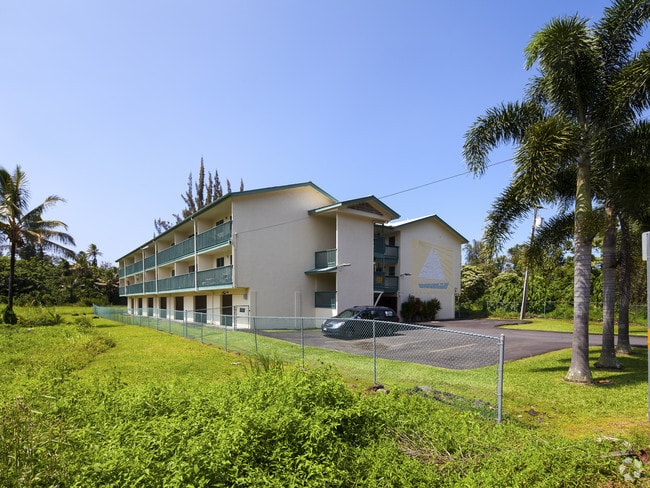
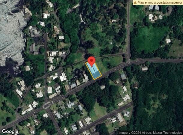
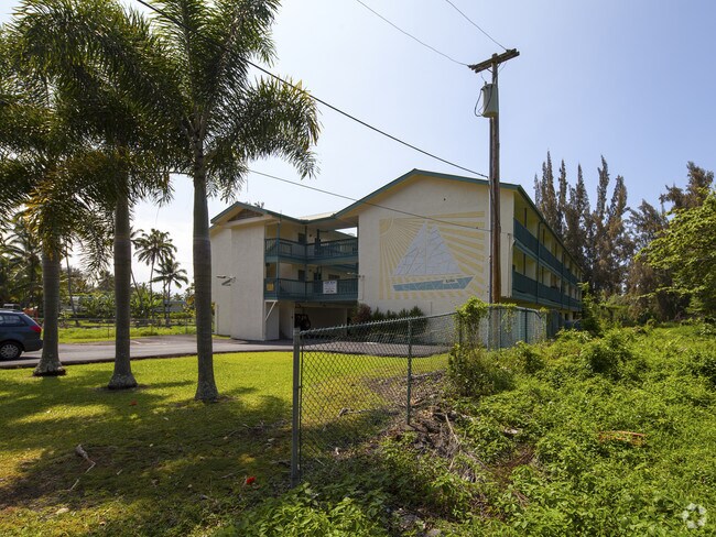
Property Record
1365 Kalanianaole St, Hilo, HI 96720
NEARBY LISTINGS FOR SALE OR LEASE
Property Detail
1365 Kalanianaole St
Hilo-Kailua, HI
Keokea Houselots
3-2-1-014-003-0000
LOT 6 23462 SF KEOKEO HOUSE LOTS
Apartment
Hawaii
VE
Hawaii
1551660910F
6
2024
0.54 AC
2025
Hilo
020600
Hawaii
18,810 SF
DEMOGRAPHICS near 1365 Kalanianaole St
1 Mile
3 Mile
5 Mile
2024 Total Population
2,256
6,755
35,750
2029 Population
2,435
7,374
38,631
Pop Growth 2024-2029
+ 7.93%
+ 9.16%
+ 8.06%
Average Age
40
41
42
2024 Total Households
704
2,741
13,325
HH Growth 2024-2029
+ 8.10%
+ 9.38%
+ 8.08%
Median Household Inc
$67,113
$49,817
$61,136
Avg Household Size
3.00
2.40
2.50
2024 Avg HH Vehicles
2.00
2.00
2.00
Median Home Value
$296,817
$351,010
$446,829
Median Year Built
1982
1978
1979
Nearby Places
Map Layers
Map Styles
 Street
 Aerial
- Restaurants
- Banks
- Shops
- Fitness
- Groceries
PUBLIC TRANSPORTATION
AIRPORT
Hilo International
DRIVE
WALK
Distance
Hilo International
10 min
1.9 mi
Nearby Properties
Address
Land Use
TOTAL SIZE
Lot Size
Zoning
Address
Land Use
TOTAL SIZE
Lot Size
Zoning
165,552 SF
8 AC
CG-7.5
Address
Land Use
TOTAL SIZE
Lot Size
Zoning
474,990 SF
36.50 AC
OPEN
Address
Land Use
TOTAL SIZE
Lot Size
Zoning
328,862 SF
858.74 AC
OPEN
Address
Land Use
TOTAL SIZE
Lot Size
Zoning
218,538 SF
15.57 AC
MCX-20
Address
Land Use
TOTAL SIZE
Lot Size
Zoning
121,312 SF
5 AC
V-.75
Address
Land Use
TOTAL SIZE
Lot Size
Zoning
2,369.87 AC
A-5a
Address
Land Use
TOTAL SIZE
Lot Size
Zoning
94,704 SF
2.95 AC
V-.75
Address
Land Use
TOTAL SIZE
Lot Size
Zoning
51,381 SF
4.04 AC
CG-7.5
Address
Land Use
TOTAL SIZE
Lot Size
Zoning
79,794 SF
6.54 AC
CG-7.5
Address
Land Use
TOTAL SIZE
Lot Size
Zoning
103,234 SF
10.69 AC
ML-20
Address
Land Use
TOTAL SIZE
Lot Size
Zoning
26,540 SF
442.49 AC
A-5a
Address
Land Use
TOTAL SIZE
Lot Size
Zoning
101,100 SF
13.59 AC
OPEN
Address
Land Use
TOTAL SIZE
Lot Size
Zoning
39,714 SF
14.52 AC
MG-1a
Address
Land Use
TOTAL SIZE
Lot Size
Zoning
134,564 SF
5.19 AC
CG-20
Address
Land Use
TOTAL SIZE
Lot Size
Zoning
103,932 SF
4.02 AC
CG-7.5
Address
Land Use
TOTAL SIZE
Lot Size
Zoning
90,060 SF
10.56 AC
MG-1a
Address
Land Use
TOTAL SIZE
Lot Size
Zoning
8,000 SF
25.32 AC
MG-1a
Address
Land Use
TOTAL SIZE
Lot Size
Zoning
12.77 AC
ML-20
Address
Land Use
TOTAL SIZE
Lot Size
Zoning
11,801 SF
3.43 AC
MG-1a
Address
Land Use
TOTAL SIZE
Lot Size
Zoning
1,270.50 AC
A-5a
Address
Land Use
TOTAL SIZE
Lot Size
Zoning
28,876 SF
1.09 AC
V-.75
Address
Land Use
TOTAL SIZE
Lot Size
Zoning
40.42 AC
OPEN
Address
Land Use
TOTAL SIZE
Lot Size
Zoning
32,552 SF
4.68 AC
CG-7.5
Address
Land Use
TOTAL SIZE
Lot Size
Zoning
61,210 SF
2.77 AC
CG-20
Address
Land Use
TOTAL SIZE
Lot Size
Zoning
84,452 SF
5.56 AC
MG-1a
Address
Land Use
TOTAL SIZE
Lot Size
Zoning
47,000 SF
3.57 AC
MG-1a
Address
Land Use
TOTAL SIZE
Lot Size
Zoning
3,357 SF
73.45 AC
MG-1a
Address
Land Use
TOTAL SIZE
Lot Size
Zoning
14,760 SF
1.12 AC
ML-20
Address
Land Use
TOTAL SIZE
Lot Size
Zoning
832 SF
20.06 AC
OPEN
Address
Land Use
TOTAL SIZE
Lot Size
Zoning
2,480 SF
36.61 AC
OPEN
The World's #1 Commercial Real Estate Marketplace
Connect with us
© 2026 CoStar Group
The information above has been obtained from sources believed reliable. While we do not doubt its accuracy we have not verified it and make no guarantee, warranty or representation about it. It is your responsibility to independently confirm its accuracy and completeness. Any projections, opinions, assumptions, or estimates used are for example only and do not represent the current or future performance of the property. The value of this transaction to you depends on tax and other factors which should be evaluated by your tax, financial, and legal advisors. You and your advisors should conduct a careful, independent investigation of the property to determine to your satisfaction the suitability of the property for your needs.