Property Record
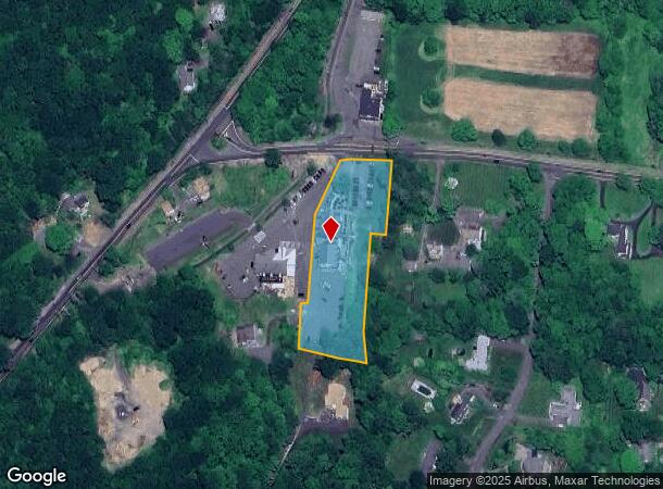
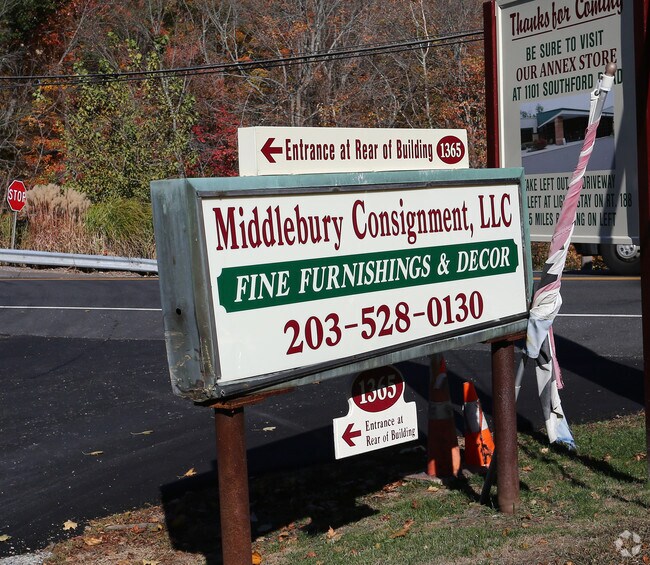
1365 West St, Middlebury, CT 06762

NEARBY LISTINGS FOR SALE OR LEASE
-
-
View all Middlebury listings for sale on LoopNet.com
Property Detail
1365 West St
MIDD-000608-000000-000113
New Haven
Commercialnec
Connecticut
X
113
09009C0095H
9.05 AC
2025
Middlebury
2025
Westchester/So Connecticut
344200
New Haven-Milford, CT
18,685 SF
DEMOGRAPHICS near 1365 West St
1 Mile
3 Mile
5 Mile
2024 Total Population
1,308
12,803
90,015
2029 Population
1,317
12,861
89,798
Pop Growth 2024-2029
+ 0.69%
+ 0.45%
(0.24%)
Average Age
44
43
41
2024 Total Households
514
4,899
35,799
HH Growth 2024-2029
+ 0.58%
+ 0.39%
(0.30%)
Median Household Inc
$136,824
$110,823
$70,694
Avg Household Size
2.50
2.50
2.40
2024 Avg HH Vehicles
2.00
2.00
2.00
Median Home Value
$432,000
$356,337
$233,059
Median Year Built
1970
1972
1964
Nearby Places
Map Layers
Map Styles
 Street
 Aerial
- Restaurants
- Banks
- Shops
- Fitness
- Groceries
PUBLIC TRANSPORTATION
COMMUTER RAIL
Naugatuck Station (New Haven Line - Metro-North Commuter Railroad Company (Metro-North))
DRIVE
WALK
Distance
Naugatuck Station (New Haven Line - Metro-North Commuter Railroad Company (Metro-North))
10 min
5.6 mi
Waterbury Station (New Haven Line - Metro-North Commuter Railroad Company (Metro-North))
DRIVE
WALK
Distance
Waterbury Station (New Haven Line - Metro-North Commuter Railroad Company (Metro-North))
11 min
5.9 mi
AIRPORT
Tweed/New Haven
DRIVE
WALK
Distance
Tweed/New Haven
48 min
29.0 mi
Freight Ports
Port of New Haven
DRIVE
WALK
Distance
Port of New Haven
43 min
26.1 mi
Nearby Properties
Address
Land Use
TOTAL SIZE
Lot Size
Zoning
Address
Land Use
TOTAL SIZE
Lot Size
Zoning
18.85 AC
T5
Address
Land Use
TOTAL SIZE
Lot Size
Zoning
207,001 SF
60.66 AC
M-2
Address
Land Use
TOTAL SIZE
Lot Size
Zoning
49,768 SF
4.35 AC
CO
Address
Land Use
TOTAL SIZE
Lot Size
Zoning
26.40 AC
RS-12
Address
Land Use
TOTAL SIZE
Lot Size
Zoning
81.26 AC
R80
Address
Land Use
TOTAL SIZE
Lot Size
Zoning
20.30 AC
IND
Address
Land Use
TOTAL SIZE
Lot Size
Zoning
40.53 AC
L200
Address
Land Use
TOTAL SIZE
Lot Size
Zoning
36.62 AC
L200
Address
Land Use
TOTAL SIZE
Lot Size
Zoning
13.12 AC
CA40
Address
Land Use
TOTAL SIZE
Lot Size
Zoning
13.52 AC
RM
Address
Land Use
TOTAL SIZE
Lot Size
Zoning
3,744 SF
23.33 AC
OS60
Address
Land Use
TOTAL SIZE
Lot Size
Zoning
8.19 AC
CA40
Address
Land Use
TOTAL SIZE
Lot Size
Zoning
1,832 SF
77.04 AC
L200
Address
Land Use
TOTAL SIZE
Lot Size
Zoning
62.31 AC
IND
Address
Land Use
TOTAL SIZE
Lot Size
Zoning
142,146 SF
6.63 AC
B-2
Address
Land Use
TOTAL SIZE
Lot Size
Zoning
58,136 SF
14.50 AC
R40
Address
Land Use
TOTAL SIZE
Lot Size
Zoning
30,861 SF
3.39 AC
CA40
Address
Land Use
TOTAL SIZE
Lot Size
Zoning
30 AC
L180
Address
Land Use
TOTAL SIZE
Lot Size
Zoning
56,304 SF
13 AC
R40
Address
Land Use
TOTAL SIZE
Lot Size
Zoning
58,390 SF
13.91 AC
R40
Address
Land Use
TOTAL SIZE
Lot Size
Zoning
7,088 SF
30.67 AC
R80
Address
Land Use
TOTAL SIZE
Lot Size
Zoning
19.53 AC
Address
Land Use
TOTAL SIZE
Lot Size
Zoning
50,937 SF
7.25 AC
GI40
Address
Land Use
TOTAL SIZE
Lot Size
Zoning
50,018 SF
Address
Land Use
TOTAL SIZE
Lot Size
Zoning
3.90 AC
CA40
Address
Land Use
TOTAL SIZE
Lot Size
Zoning
44,000 SF
4.21 AC
IND
Address
Land Use
TOTAL SIZE
Lot Size
Zoning
14,128 SF
7 AC
CO
Address
Land Use
TOTAL SIZE
Lot Size
Zoning
431.90 AC
R80
Address
Land Use
TOTAL SIZE
Lot Size
Zoning
25,052 SF
2.26 AC
CA40
The World's #1 Commercial Real Estate Marketplace
Connect with us
© 2026 CoStar Group
The information above has been obtained from sources believed reliable. While we do not doubt its accuracy we have not verified it and make no guarantee, warranty or representation about it. It is your responsibility to independently confirm its accuracy and completeness. Any projections, opinions, assumptions, or estimates used are for example only and do not represent the current or future performance of the property. The value of this transaction to you depends on tax and other factors which should be evaluated by your tax, financial, and legal advisors. You and your advisors should conduct a careful, independent investigation of the property to determine to your satisfaction the suitability of the property for your needs.