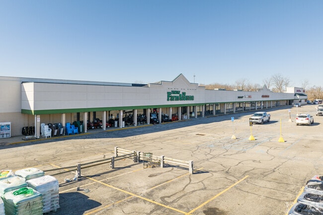
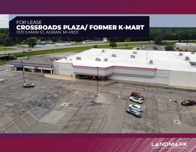
Property Record
1370 S Main St, Adrian, MI 49221
NEARBY LISTINGS FOR SALE OR LEASE
Property Detail
1370 S Main St
XA0-100-0344-12
Land Add
Commercialnec
BEG 1234.16 FT S & 50 FT W OF E 1/4 COR SEC 10 T7S R3E TH S 02^24' E 36.10 FT TH S 88^36' W 183 FT TH S 02^24' E 150 FT TH N
X
Lenawee
26091C0193D
Michigan
2024
14.27 AC
2025
Lenawee County
060600
Toledo
122,669 SF
Adrian, MI
DEMOGRAPHICS near 1370 S Main St
1 mile
3 mile
5 mile
2024 Total Population
6,426
28,918
36,056
2029 Population
6,343
28,676
35,696
Pop Growth 2024-2029
(1.29%)
(0.84%)
(1.00%)
Average Age
40
40
40
2024 Total Households
2,475
10,462
13,105
HH Growth 2024-2029
(1.45%)
(0.88%)
(1.06%)
Median Household Inc
$42,203
$40,504
$48,456
Avg Household Size
2.30
2.30
2.30
2024 Avg HH Vehicles
2.00
2.00
2.00
Median Home Value
$94,314
$111,412
$134,233
Median Year Built
1981
1965
1968
Nearby Places
Map Layers
Map Styles
 Street
 Aerial
Transit
 Traffic
 Biking
Places
Listings with unknown addresses are not visible on the map
- Restaurants
- Banks
- Shops
- Fitness
- Groceries
PUBLIC TRANSPORTATION
AIRPORT
Eugene F Kranz Toledo Express
Drive
Walk
Distance
Eugene F Kranz Toledo Express
59 min
33.2 mi
Freight Ports
Drive
Walk
Distance
61 min
41.6 mi
SALE & LEASE HISTORY
LISTING DATE
SALE/LEASE

Sep 25, 2016
For Lease
Oct 04, 2022
For Lease
Jun 21, 2023
For Sale
Nearby Properties
Address
Land Use
TOTAL SIZE
Lot Size
Zoning
Address
Land Use
TOTAL SIZE
Lot Size
Zoning
198,348 SF
28.50 AC
Address
Land Use
TOTAL SIZE
Lot Size
Zoning
297,470 SF
31.39 AC
I-2
Address
Land Use
TOTAL SIZE
Lot Size
Zoning
19,469 SF
27.08 AC
I-2
Address
Land Use
TOTAL SIZE
Lot Size
Zoning
21.68 AC
B-4
Address
Land Use
TOTAL SIZE
Lot Size
Zoning
Address
Land Use
TOTAL SIZE
Lot Size
Zoning
51,068 SF
7.07 AC
Address
Land Use
TOTAL SIZE
Lot Size
Zoning
83,180 SF
3.14 AC
ERO
Address
Land Use
TOTAL SIZE
Lot Size
Zoning
27,436 SF
79.87 AC
CI
Address
Land Use
TOTAL SIZE
Lot Size
Zoning
119,884 SF
9.37 AC
RM-1
Address
Land Use
TOTAL SIZE
Lot Size
Zoning
101,287 SF
16.98 AC
B-4
Address
Land Use
TOTAL SIZE
Lot Size
Zoning
805,326 SF
50.38 AC
Address
Land Use
TOTAL SIZE
Lot Size
Zoning
136,850 SF
10.37 AC
RM-1
Address
Land Use
TOTAL SIZE
Lot Size
Zoning
35,880 SF
2.45 AC
Address
Land Use
TOTAL SIZE
Lot Size
Zoning
77,162 SF
22.82 AC
CI
Address
Land Use
TOTAL SIZE
Lot Size
Zoning
512,408 SF
33.83 AC
I-2
Address
Land Use
TOTAL SIZE
Lot Size
Zoning
53,333 SF
6.70 AC
B-4
Address
Land Use
TOTAL SIZE
Lot Size
Zoning
86,479 SF
4.79 AC
Address
Land Use
TOTAL SIZE
Lot Size
Zoning
64,385 SF
11.08 AC
CI
Address
Land Use
TOTAL SIZE
Lot Size
Zoning
33,858 SF
14.53 AC
OS-1
Address
Land Use
TOTAL SIZE
Lot Size
Zoning
49,676 SF
0.94 AC
RM-2
Address
Land Use
TOTAL SIZE
Lot Size
Zoning
29.25 AC
B-4
Address
Land Use
TOTAL SIZE
Lot Size
Zoning
42,682 SF
6.41 AC
B-2
Address
Land Use
TOTAL SIZE
Lot Size
Zoning
191,777 SF
6.15 AC
E-1
Address
Land Use
TOTAL SIZE
Lot Size
Zoning
35,534 SF
4.48 AC
Address
Land Use
TOTAL SIZE
Lot Size
Zoning
73,636 SF
9.99 AC
RM-1
Address
Land Use
TOTAL SIZE
Lot Size
Zoning
86,971 SF
9.56 AC
RM-1
Address
Land Use
TOTAL SIZE
Lot Size
Zoning
17,751 SF
2.76 AC
B-2
Address
Land Use
TOTAL SIZE
Lot Size
Zoning
72,839 SF
7.05 AC
RM-1
Address
Land Use
TOTAL SIZE
Lot Size
Zoning
37.20 AC
The World's #1 Commercial Real Estate Marketplace
Connect with us
© 2026 CoStar Group
The information above has been obtained from sources believed reliable. While we do not doubt its accuracy we have not verified it and make no guarantee, warranty or representation about it. It is your responsibility to independently confirm its accuracy and completeness. Any projections, opinions, assumptions, or estimates used are for example only and do not represent the current or future performance of the property. The value of this transaction to you depends on tax and other factors which should be evaluated by your tax, financial, and legal advisors. You and your advisors should conduct a careful, independent investigation of the property to determine to your satisfaction the suitability of the property for your needs.