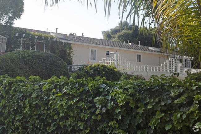
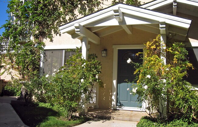
Property Record
1369 Danielson Rd, Santa Barbara, CA 93108

NEARBY LISTINGS FOR SALE OR LEASE
Property Detail
1369 Danielson Rd
Santa Maria-Santa Barbara, CA
Parcel Map 11587
009-320-012
Santa Barbara
Residentialnec
California
X
0.23 AC
06083C1392H
East Santa Barbara
2,736 SF
Santa Barbara/Sta Maria/Goleta
DEMOGRAPHICS near 1369 Danielson Rd
1 Mile
3 Mile
5 Mile
2024 Total Population
3,487
25,037
73,081
2029 Population
3,597
25,082
72,745
Pop Growth 2024-2029
+ 3.15%
+ 0.18%
(0.46%)
Average Age
49
43
41
2024 Total Households
1,573
9,096
29,098
HH Growth 2024-2029
+ 3.05%
+ 0.32%
(0.54%)
Median Household Inc
$183,107
$135,367
$98,085
Avg Household Size
2.20
2.50
2.40
2024 Avg HH Vehicles
2.00
2.00
2.00
Median Home Value
$1,136,205
$1,118,308
$1,102,389
Median Year Built
1967
1966
1963
Nearby Places
Map Layers
Map Styles
 Street
 Aerial
- Restaurants
- Banks
- Shops
- Fitness
- Groceries
PUBLIC TRANSPORTATION
COMMUTER RAIL
Santa Barbara (Coast Starlight - Amtrak, Pacific Surfliner - Amtrak)
DRIVE
WALK
Distance
Santa Barbara (Coast Starlight - Amtrak, Pacific Surfliner - Amtrak)
7 min
3.8 mi
Carpinteria Amtrak (Pacific Surfliner - Amtrak)
DRIVE
WALK
Distance
Carpinteria Amtrak (Pacific Surfliner - Amtrak)
12 min
7.4 mi
AIRPORT
Santa Barbara Municipal
DRIVE
WALK
Distance
Santa Barbara Municipal
33 min
15.9 mi
Freight Ports
The Port of Hueneme
DRIVE
WALK
Distance
The Port of Hueneme
50 min
36.1 mi
SALE & LEASE HISTORY
LISTING DATE
SALE/LEASE

Nov 01, 2018
For Sale
Jul 24, 2020
For Sale
Nearby Properties
Address
Land Use
TOTAL SIZE
Lot Size
Zoning
Address
Land Use
TOTAL SIZE
Lot Size
Zoning
12.32 AC
CV
Address
Land Use
TOTAL SIZE
Lot Size
Zoning
Address
Land Use
TOTAL SIZE
Lot Size
Zoning
21.85 AC
HRC1SP
Address
Land Use
TOTAL SIZE
Lot Size
Zoning
51,425 SF
28.35 AC
MRP
Address
Land Use
TOTAL SIZE
Lot Size
Zoning
Address
Land Use
TOTAL SIZE
Lot Size
Zoning
Address
Land Use
TOTAL SIZE
Lot Size
Zoning
77.82 AC
A2SD3
Address
Land Use
TOTAL SIZE
Lot Size
Zoning
183,552 SF
50.14 AC
SP5
Address
Land Use
TOTAL SIZE
Lot Size
Zoning
1.12 AC
HRC1SD
Address
Land Use
TOTAL SIZE
Lot Size
Zoning
16,816 SF
1.02 AC
CV
Address
Land Use
TOTAL SIZE
Lot Size
Zoning
7.44 AC
OM1SD3
Address
Land Use
TOTAL SIZE
Lot Size
Zoning
1 AC
HRC1SD
Address
Land Use
TOTAL SIZE
Lot Size
Zoning
1.29 AC
HRC1SD
Address
Land Use
TOTAL SIZE
Lot Size
Zoning
4,415 SF
6.56 AC
CV
Address
Land Use
TOTAL SIZE
Lot Size
Zoning
4.74 AC
M1
Address
Land Use
TOTAL SIZE
Lot Size
Zoning
3.17 AC
R2
Address
Land Use
TOTAL SIZE
Lot Size
Zoning
12,387 SF
3.26 AC
CV
Address
Land Use
TOTAL SIZE
Lot Size
Zoning
5,929 SF
6.70 AC
5E1
Address
Land Use
TOTAL SIZE
Lot Size
Zoning
1.95 AC
HRC2SD
Address
Land Use
TOTAL SIZE
Lot Size
Zoning
888 SF
0.60 AC
Address
Land Use
TOTAL SIZE
Lot Size
Zoning
630 SF
1.32 AC
CN
Address
Land Use
TOTAL SIZE
Lot Size
Zoning
1,280 SF
76.87 AC
2E1
Address
Land Use
TOTAL SIZE
Lot Size
Zoning
7,112 SF
3.92 AC
2E1
Address
Land Use
TOTAL SIZE
Lot Size
Zoning
0.74 AC
C1SD3
Address
Land Use
TOTAL SIZE
Lot Size
Zoning
24,223 SF
6.31 AC
1E1
Address
Land Use
TOTAL SIZE
Lot Size
Zoning
1.30 AC
C1SD3
Address
Land Use
TOTAL SIZE
Lot Size
Zoning
9.93 AC
2E1
Address
Land Use
TOTAL SIZE
Lot Size
Zoning
4.02 AC
3E1
Address
Land Use
TOTAL SIZE
Lot Size
Zoning
2.50 AC
CP
Address
Land Use
TOTAL SIZE
Lot Size
Zoning
0.79 AC
R4SD3
The World's #1 Commercial Real Estate Marketplace
Connect with us
© 2025 CoStar Group
The information above has been obtained from sources believed reliable. While we do not doubt its accuracy we have not verified it and make no guarantee, warranty or representation about it. It is your responsibility to independently confirm its accuracy and completeness. Any projections, opinions, assumptions, or estimates used are for example only and do not represent the current or future performance of the property. The value of this transaction to you depends on tax and other factors which should be evaluated by your tax, financial, and legal advisors. You and your advisors should conduct a careful, independent investigation of the property to determine to your satisfaction the suitability of the property for your needs.