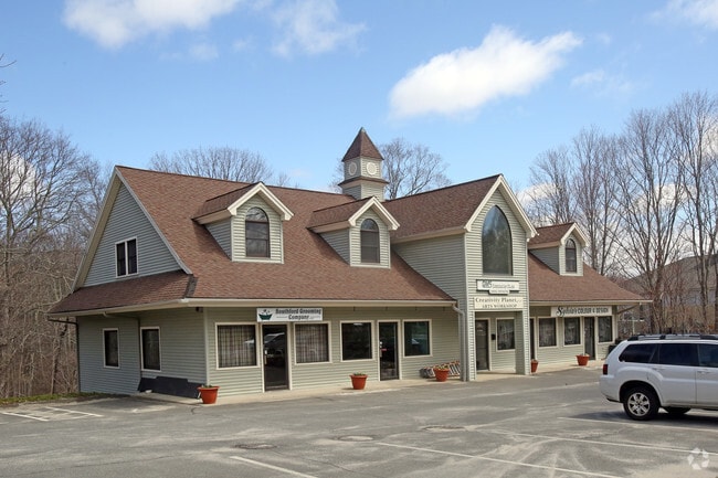
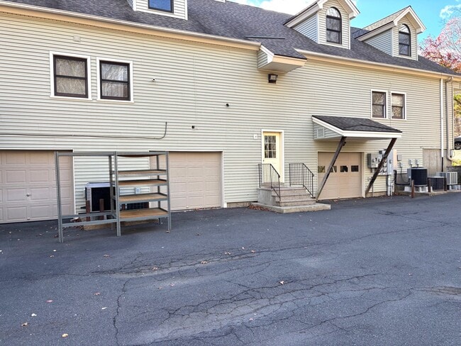
Property Record
1369 Southford Rd, Southbury, CT 06488

Current Lease Availabilities
NEARBY LISTINGS FOR SALE OR LEASE
Property Detail
1369 Southford Rd
SBUR-000054-000033-000008
New Haven
Commercialbuilding
Connecticut
X
8
09009C0233H
0.88 AC
2025
Southbury
2025
Westchester/So Connecticut
348122
New Haven-Milford, CT
4,572 SF
DEMOGRAPHICS near 1369 Southford Rd
1 Mile
3 Mile
5 Mile
2024 Total Population
1,498
12,240
36,352
2029 Population
1,499
12,220
36,273
Pop Growth 2024-2029
+ 0.07%
(0.16%)
(0.22%)
Average Age
42
43
46
2024 Total Households
523
4,393
14,748
HH Growth 2024-2029
0.00%
(0.39%)
(0.51%)
Median Household Inc
$139,843
$132,468
$111,046
Avg Household Size
2.80
2.70
2.40
2024 Avg HH Vehicles
2.00
2.00
2.00
Median Home Value
$382,954
$407,851
$385,176
Median Year Built
1977
1981
1978
Nearby Places
Map Layers
Map Styles
 Street
 Aerial
- Restaurants
- Banks
- Shops
- Fitness
- Groceries
PUBLIC TRANSPORTATION
COMMUTER RAIL
Seymour Station (New Haven Line - Metro-North Commuter Railroad Company (Metro-North))
DRIVE
WALK
Distance
Seymour Station (New Haven Line - Metro-North Commuter Railroad Company (Metro-North))
14 min
7.4 mi
Beacon Falls Station (New Haven Line - Metro-North Commuter Railroad Company (Metro-North))
DRIVE
WALK
Distance
Beacon Falls Station (New Haven Line - Metro-North Commuter Railroad Company (Metro-North))
15 min
8.1 mi
AIRPORT
Tweed/New Haven
DRIVE
WALK
Distance
Tweed/New Haven
43 min
23.7 mi
Nearby Properties
Address
Land Use
TOTAL SIZE
Lot Size
Zoning
Address
Land Use
TOTAL SIZE
Lot Size
Zoning
404.50 AC
IND
Address
Land Use
TOTAL SIZE
Lot Size
Zoning
102,919 SF
227.90 AC
R-60C
Address
Land Use
TOTAL SIZE
Lot Size
Zoning
18.85 AC
T5
Address
Land Use
TOTAL SIZE
Lot Size
Zoning
207,001 SF
60.66 AC
M-2
Address
Land Use
TOTAL SIZE
Lot Size
Zoning
67,200 SF
139.13 AC
RESA
Address
Land Use
TOTAL SIZE
Lot Size
Zoning
23.58 AC
B-3A
Address
Land Use
TOTAL SIZE
Lot Size
Zoning
17.80 AC
IND
Address
Land Use
TOTAL SIZE
Lot Size
Zoning
20.30 AC
IND
Address
Land Use
TOTAL SIZE
Lot Size
Zoning
64,356 SF
RESA
Address
Land Use
TOTAL SIZE
Lot Size
Zoning
40.53 AC
L200
Address
Land Use
TOTAL SIZE
Lot Size
Zoning
36.62 AC
L200
Address
Land Use
TOTAL SIZE
Lot Size
Zoning
137,519 SF
10.11 AC
IND
Address
Land Use
TOTAL SIZE
Lot Size
Zoning
1,832 SF
77.04 AC
L200
Address
Land Use
TOTAL SIZE
Lot Size
Zoning
48,796 SF
13.53 AC
PDD
Address
Land Use
TOTAL SIZE
Lot Size
Zoning
20 AC
IND
Address
Land Use
TOTAL SIZE
Lot Size
Zoning
62.31 AC
IND
Address
Land Use
TOTAL SIZE
Lot Size
Zoning
110,160 SF
24.13 AC
IND
Address
Land Use
TOTAL SIZE
Lot Size
Zoning
142,146 SF
6.63 AC
B-2
Address
Land Use
TOTAL SIZE
Lot Size
Zoning
60,528 SF
10 AC
IND
Address
Land Use
TOTAL SIZE
Lot Size
Zoning
32,264 SF
15.92 AC
R-60
Address
Land Use
TOTAL SIZE
Lot Size
Zoning
9.66 AC
IND
Address
Land Use
TOTAL SIZE
Lot Size
Zoning
3.59 AC
B-2D
Address
Land Use
TOTAL SIZE
Lot Size
Zoning
60,000 SF
12 AC
IND
Address
Land Use
TOTAL SIZE
Lot Size
Zoning
18,137 SF
33.54 AC
R-60
Address
Land Use
TOTAL SIZE
Lot Size
Zoning
43,250 SF
6.20 AC
IND
Address
Land Use
TOTAL SIZE
Lot Size
Zoning
45,000 SF
5.36 AC
IND
Address
Land Use
TOTAL SIZE
Lot Size
Zoning
51,345 SF
6.75 AC
IND
Address
Land Use
TOTAL SIZE
Lot Size
Zoning
67,910 SF
5.60 AC
IND
Address
Land Use
TOTAL SIZE
Lot Size
Zoning
14,110 SF
1.40 AC
B-2D
Address
Land Use
TOTAL SIZE
Lot Size
Zoning
13,120 SF
5.68 AC
RESA
The World's #1 Commercial Real Estate Marketplace
Connect with us
© 2025 CoStar Group
The information above has been obtained from sources believed reliable. While we do not doubt its accuracy we have not verified it and make no guarantee, warranty or representation about it. It is your responsibility to independently confirm its accuracy and completeness. Any projections, opinions, assumptions, or estimates used are for example only and do not represent the current or future performance of the property. The value of this transaction to you depends on tax and other factors which should be evaluated by your tax, financial, and legal advisors. You and your advisors should conduct a careful, independent investigation of the property to determine to your satisfaction the suitability of the property for your needs.