Property Record
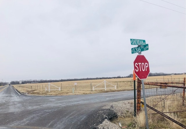
136Th St N, Collinsville, OK 74021


NEARBY LISTINGS FOR SALE OR LEASE
Property Detail
136Th St N
Tulsa, OK
Unplatted
92334-23-34-33670
E/2 NE NE LESS N16.5 & E16.5 THEREOF FOR RD SEC 34 22 13 19.256ACS
Residentialacreage
Tulsa
X
Oklahoma
40143C0110L
19.26 AC
2025
Northeast
2025
Tulsa
005401
DEMOGRAPHICS near 136Th St N
1 Mile
3 Mile
5 Mile
2024 Total Population
1,855
6,568
30,521
2029 Population
2,000
6,943
31,839
Pop Growth 2024-2029
+ 7.82%
+ 5.71%
+ 4.32%
Average Age
37
38
38
2024 Total Households
616
2,309
11,191
HH Growth 2024-2029
+ 7.95%
+ 5.63%
+ 4.35%
Median Household Inc
$109,267
$96,005
$76,754
Avg Household Size
3.00
2.80
2.70
2024 Avg HH Vehicles
3.00
2.00
2.00
Median Home Value
$249,832
$245,072
$210,445
Median Year Built
2010
2004
2001
Nearby Places
Map Layers
Map Styles
 Street
 Aerial
- Restaurants
- Banks
- Shops
- Fitness
- Groceries
PUBLIC TRANSPORTATION
AIRPORT
Tulsa International
DRIVE
WALK
Distance
Tulsa International
22 min
13.9 mi
Freight Ports
Tulsa Port Of Catoosa
DRIVE
WALK
Distance
Tulsa Port Of Catoosa
28 min
18.5 mi
SALE & LEASE HISTORY
LISTING DATE
SALE/LEASE

Feb 28, 2021
For Sale
Nearby Properties
Address
Land Use
TOTAL SIZE
Lot Size
Zoning
Address
Land Use
TOTAL SIZE
Lot Size
Zoning
27,314 SF
12.29 AC
AG
Address
Land Use
TOTAL SIZE
Lot Size
Zoning
41,764 SF
17.87 AC
AG
Address
Land Use
TOTAL SIZE
Lot Size
Zoning
113.74 AC
AG
Address
Land Use
TOTAL SIZE
Lot Size
Zoning
143,419 SF
29.73 AC
IM
Address
Land Use
TOTAL SIZE
Lot Size
Zoning
6,125 SF
17.83 AC
AG
Address
Land Use
TOTAL SIZE
Lot Size
Zoning
6,420 SF
1.93 AC
AG
Address
Land Use
TOTAL SIZE
Lot Size
Zoning
48,500 SF
9.74 AC
IM
Address
Land Use
TOTAL SIZE
Lot Size
Zoning
10,812 SF
8.56 AC
AG
Address
Land Use
TOTAL SIZE
Lot Size
Zoning
3,350 SF
0.86 AC
AGR
Address
Land Use
TOTAL SIZE
Lot Size
Zoning
64,400 SF
7.18 AC
IL
Address
Land Use
TOTAL SIZE
Lot Size
Zoning
15.89 AC
AG
Address
Land Use
TOTAL SIZE
Lot Size
Zoning
22,780 SF
4.62 AC
CS
Address
Land Use
TOTAL SIZE
Lot Size
Zoning
13,270 SF
8.54 AC
AG
Address
Land Use
TOTAL SIZE
Lot Size
Zoning
432 SF
18.65 AC
AG
Address
Land Use
TOTAL SIZE
Lot Size
Zoning
45,850 SF
4.55 AC
CG
Address
Land Use
TOTAL SIZE
Lot Size
Zoning
8.01 AC
IM
Address
Land Use
TOTAL SIZE
Lot Size
Zoning
2,560 SF
5.44 AC
CG
Address
Land Use
TOTAL SIZE
Lot Size
Zoning
2.70 AC
CG
Address
Land Use
TOTAL SIZE
Lot Size
Zoning
35,950 SF
2.46 AC
CS
Address
Land Use
TOTAL SIZE
Lot Size
Zoning
1,224 SF
0.91 AC
Address
Land Use
TOTAL SIZE
Lot Size
Zoning
4,514 SF
3.13 AC
CG
Address
Land Use
TOTAL SIZE
Lot Size
Zoning
1,690 SF
0.90 AC
AG
Address
Land Use
TOTAL SIZE
Lot Size
Zoning
15,000 SF
5.67 AC
IM
Address
Land Use
TOTAL SIZE
Lot Size
Zoning
43,228 SF
8.78 AC
IM
Address
Land Use
TOTAL SIZE
Lot Size
Zoning
8.89 AC
IL
Address
Land Use
TOTAL SIZE
Lot Size
Zoning
9,037 SF
1.10 AC
CG
Address
Land Use
TOTAL SIZE
Lot Size
Zoning
18,090 SF
1 AC
CS
Address
Land Use
TOTAL SIZE
Lot Size
Zoning
15,456 SF
4.16 AC
CH
Address
Land Use
TOTAL SIZE
Lot Size
Zoning
75,264 SF
10.18 AC
CG
The World's #1 Commercial Real Estate Marketplace
Connect with us
© 2026 CoStar Group
The information above has been obtained from sources believed reliable. While we do not doubt its accuracy we have not verified it and make no guarantee, warranty or representation about it. It is your responsibility to independently confirm its accuracy and completeness. Any projections, opinions, assumptions, or estimates used are for example only and do not represent the current or future performance of the property. The value of this transaction to you depends on tax and other factors which should be evaluated by your tax, financial, and legal advisors. You and your advisors should conduct a careful, independent investigation of the property to determine to your satisfaction the suitability of the property for your needs.