Property Record
136Th Ter E, Parrish, FL 34219
Property Detail
136Th Ter E
4915-0005-9
S 330 FT OF NE1/4 OF NE1/4 AS DESC IN ORB 794 P 64; SUBJ TO F P L EASMT DESC IN OR 985 P 239 PRMCF; LESS THE FOLLOWING DESC PARCEL: A PARCEL OF LAND LYING AND BEING IN THE NE 1/4
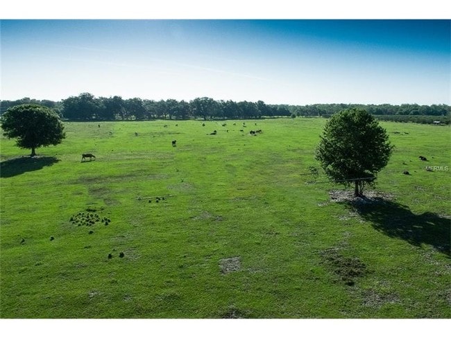
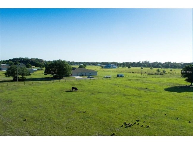
Agriculturalland
MANATEE
A GENERAL
Florida
AE The base floodplain where base flood elevations are provided. AE Zones are now used on new format FIRMs instead of A1-A30 Zones.
28.78 AC
2023
Manatee Outlying
2025
Tampa/St Petersburg
001913
North Port-Bradenton-Sarasota, FL
NEARBY LISTINGS FOR SALE OR LEASE
DEMOGRAPHICS near 136Th Ter E
1 mile
3 mile
5 mile
2025 Total Population
2,478
24,617
55,062
2030 Population
2,917
28,455
63,511
Pop Growth 2025-2030
+ 17.72%
+ 15.59%
+ 15.34%
Average Age
44
44
44
2025 Total Households
873
8,918
20,062
HH Growth 2025-2030
+ 17.75%
+ 15.40%
+ 15.00%
Median Household Inc
$115,423
$107,679
$114,674
Avg Household Size
2.70
2.70
2.70
2025 Avg HH Vehicles
2.00
2.00
2.00
Median Home Value
$496,454
$469,029
$477,640
Median Year Built
2010
2010
2010
Nearby Places
Map Layers
Map Styles
 Street
 Aerial
Layers
 Traffic
 Biking
Places
Listings with unknown addresses are not visible on the map
- Restaurants
- Banks
- Shops
- Fitness
- Groceries
PUBLIC TRANSPORTATION
AIRPORT
Sarasota/Bradenton International
Drive
Walk
Distance
Sarasota/Bradenton International
40 min
21.5 mi
St Pete-Clearwater International
Drive
Walk
Distance
St Pete-Clearwater International
62 min
42.2 mi
Tampa International
Drive
Walk
Distance
Tampa International
67 min
44.8 mi
Freight Ports
Port Manatee
Drive
Walk
Distance
Port Manatee
24 min
13.3 mi
SALE & LEASE HISTORY
LISTING DATE
SALE/LEASE

Feb 07, 2017
For Sale
Nearby Properties
Address
Land Use
TOTAL SIZE
Lot Size
Zoning
Address
Land Use
TOTAL SIZE
Lot Size
Zoning
66,063 SF
9.24 AC
PD-C
Address
Land Use
TOTAL SIZE
Lot Size
Zoning
43,464 SF
14.47 AC
VIL VILLAG
Address
Land Use
TOTAL SIZE
Lot Size
Zoning
50,580 SF
5.97 AC
Address
Land Use
TOTAL SIZE
Lot Size
Zoning
61.03 AC
Address
Land Use
TOTAL SIZE
Lot Size
Zoning
53,851 SF
6.32 AC
Address
Land Use
TOTAL SIZE
Lot Size
Zoning
30,101 SF
13.44 AC
PD-C
Address
Land Use
TOTAL SIZE
Lot Size
Zoning
36,700 SF
17 AC
A-1 SUBURB
Address
Land Use
TOTAL SIZE
Lot Size
Zoning
109.06 AC
Address
Land Use
TOTAL SIZE
Lot Size
Zoning
3.11 AC
Address
Land Use
TOTAL SIZE
Lot Size
Zoning
4.07 AC
Address
Land Use
TOTAL SIZE
Lot Size
Zoning
53,448 SF
3 AC
PD-C
Address
Land Use
TOTAL SIZE
Lot Size
Zoning
44.29 AC
Address
Land Use
TOTAL SIZE
Lot Size
Zoning
25,842 SF
3.92 AC
Address
Land Use
TOTAL SIZE
Lot Size
Zoning
9,806 SF
4.04 AC
VIL VILLAG
Address
Land Use
TOTAL SIZE
Lot Size
Zoning
14,910 SF
4.67 AC
Address
Land Use
TOTAL SIZE
Lot Size
Zoning
17,677 SF
9.52 AC
A-1 SUBURB
Address
Land Use
TOTAL SIZE
Lot Size
Zoning
3,749 SF
22.25 AC
A GENERAL
Address
Land Use
TOTAL SIZE
Lot Size
Zoning
113.80 AC
Address
Land Use
TOTAL SIZE
Lot Size
Zoning
3,604 SF
42.10 AC
A GENERAL
Address
Land Use
TOTAL SIZE
Lot Size
Zoning
293,048 SF
42.24 AC
A-1 SUBURB
Address
Land Use
TOTAL SIZE
Lot Size
Zoning
10,303 SF
1.26 AC
PD-MU
Address
Land Use
TOTAL SIZE
Lot Size
Zoning
0.15 AC
PDR
Address
Land Use
TOTAL SIZE
Lot Size
Zoning
1,412 SF
2.16 AC
PD-R
Address
Land Use
TOTAL SIZE
Lot Size
Zoning
34,824 SF
192.28 AC
PD-R
Address
Land Use
TOTAL SIZE
Lot Size
Zoning
1.96 AC
Address
Land Use
TOTAL SIZE
Lot Size
Zoning
50.40 AC
PD-MU
Address
Land Use
TOTAL SIZE
Lot Size
Zoning
191.62 AC
PD-MU
Address
Land Use
TOTAL SIZE
Lot Size
Zoning
12,669 SF
2.49 AC
VIL VILLAG
Address
Land Use
TOTAL SIZE
Lot Size
Zoning
21,657 SF
91.19 AC
A GENERAL
Address
Land Use
TOTAL SIZE
Lot Size
Zoning
6,554 SF
8.67 AC
VIL VILLAG
The World's #1 Commercial Real Estate Marketplace
Connect with us
© 2026 CoStar Group
The information above has been obtained from sources believed reliable. While we do not doubt its accuracy we have not verified it and make no guarantee, warranty or representation about it. It is your responsibility to independently confirm its accuracy and completeness. Any projections, opinions, assumptions, or estimates used are for example only and do not represent the current or future performance of the property. The value of this transaction to you depends on tax and other factors which should be evaluated by your tax, financial, and legal advisors. You and your advisors should conduct a careful, independent investigation of the property to determine to your satisfaction the suitability of the property for your needs.