Property Record
137 Cedar Rd, Lexington, SC 29073
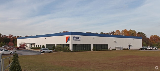


Property Detail
137 Cedar Rd
004498-02-011
PARCEL A
Warehouse
Lexington
ID
South Carolina
B and X Area of moderate flood hazard, usually the area between the limits of the 100-year and 500-year floods.
4.52 AC
0
Cayce/West Columbia
2024
Columbia
021019
Columbia, SC
56,023 SF
NEARBY LISTINGS FOR SALE OR LEASE
-
-
View all Lexington listings for lease on LoopNet.com
DEMOGRAPHICS near 137 Cedar Rd
1 mile
3 mile
5 mile
2025 Total Population
2,492
40,985
90,367
2030 Population
2,494
42,590
94,643
Pop Growth 2025-2030
+ 0.08%
+ 3.92%
+ 4.73%
Average Age
40
40
40
2025 Total Households
992
16,273
36,040
HH Growth 2025-2030
0.00%
+ 4.11%
+ 4.95%
Median Household Inc
$95,269
$88,075
$84,238
Avg Household Size
2.40
2.50
2.40
2025 Avg HH Vehicles
2.00
2.00
2.00
Median Home Value
$325,333
$245,184
$253,985
Median Year Built
2001
1996
1996
Nearby Places
Map Layers
Map Styles
 Street
 Aerial
Transit
 Traffic
 Biking
Places
Listings with unknown addresses are not visible on the map
- Restaurants
- Banks
- Shops
- Fitness
- Groceries
PUBLIC TRANSPORTATION
AIRPORT
Columbia Metro
Drive
Walk
Distance
Columbia Metro
31 min
12.8 mi
Freight Ports
North Charleston Terminal
Drive
Walk
Distance
North Charleston Terminal
138 min
114.7 mi
SALE & LEASE HISTORY
LISTING DATE
SALE/LEASE

Jun 12, 2020
For Lease
Nearby Properties
Address
Land Use
TOTAL SIZE
Lot Size
Zoning
Address
Land Use
TOTAL SIZE
Lot Size
Zoning
567,464 SF
44.62 AC
ID
Address
Land Use
TOTAL SIZE
Lot Size
Zoning
97,606 SF
15.92 AC
ID
Address
Land Use
TOTAL SIZE
Lot Size
Zoning
44,100 SF
67.47 AC
RD
Address
Land Use
TOTAL SIZE
Lot Size
Zoning
7,752 SF
28.48 AC
RD
Address
Land Use
TOTAL SIZE
Lot Size
Zoning
1,232 SF
0.42 AC
ID
Address
Land Use
TOTAL SIZE
Lot Size
Zoning
15,319 SF
12.72 AC
ID
Address
Land Use
TOTAL SIZE
Lot Size
Zoning
12,704 SF
3.60 AC
RD
Address
Land Use
TOTAL SIZE
Lot Size
Zoning
11,288 SF
3.08 AC
ID
Address
Land Use
TOTAL SIZE
Lot Size
Zoning
3,072 SF
1.53 AC
RD
Address
Land Use
TOTAL SIZE
Lot Size
Zoning
118.58 AC
RD
Address
Land Use
TOTAL SIZE
Lot Size
Zoning
181.17 AC
ID
Address
Land Use
TOTAL SIZE
Lot Size
Zoning
720 SF
31.37 AC
RD
Address
Land Use
TOTAL SIZE
Lot Size
Zoning
12,204 SF
1.63 AC
ID
Address
Land Use
TOTAL SIZE
Lot Size
Zoning
8,220 SF
5.35 AC
ID
Address
Land Use
TOTAL SIZE
Lot Size
Zoning
55.76 AC
ID
Address
Land Use
TOTAL SIZE
Lot Size
Zoning
15,000 SF
2.13 AC
Address
Land Use
TOTAL SIZE
Lot Size
Zoning
22.69 AC
ID
Address
Land Use
TOTAL SIZE
Lot Size
Zoning
5,108 SF
1.21 AC
RD
Address
Land Use
TOTAL SIZE
Lot Size
Zoning
3,220 SF
5.76 AC
RD
Address
Land Use
TOTAL SIZE
Lot Size
Zoning
12,000 SF
1.50 AC
Address
Land Use
TOTAL SIZE
Lot Size
Zoning
2,816 SF
25.45 AC
RD
Address
Land Use
TOTAL SIZE
Lot Size
Zoning
5,800 SF
5.86 AC
RD
Address
Land Use
TOTAL SIZE
Lot Size
Zoning
9,100 SF
0.92 AC
ID
Address
Land Use
TOTAL SIZE
Lot Size
Zoning
4,304 SF
8.44 AC
RD
Address
Land Use
TOTAL SIZE
Lot Size
Zoning
2,800 SF
4 AC
ID
Address
Land Use
TOTAL SIZE
Lot Size
Zoning
8,160 SF
5 AC
ID
Address
Land Use
TOTAL SIZE
Lot Size
Zoning
57.54 AC
RD
Address
Land Use
TOTAL SIZE
Lot Size
Zoning
4,644 SF
2.46 AC
Address
Land Use
TOTAL SIZE
Lot Size
Zoning
798 SF
105.90 AC
RD
The World's #1 Commercial Real Estate Marketplace
Connect with us
© 2026 CoStar Group
The information above has been obtained from sources believed reliable. While we do not doubt its accuracy we have not verified it and make no guarantee, warranty or representation about it. It is your responsibility to independently confirm its accuracy and completeness. Any projections, opinions, assumptions, or estimates used are for example only and do not represent the current or future performance of the property. The value of this transaction to you depends on tax and other factors which should be evaluated by your tax, financial, and legal advisors. You and your advisors should conduct a careful, independent investigation of the property to determine to your satisfaction the suitability of the property for your needs.