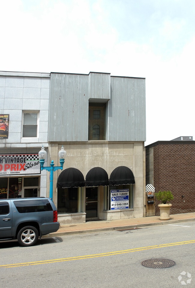
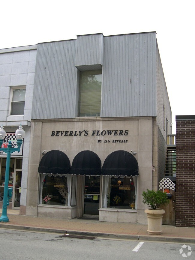
Property Record
137 E Main St, Carnegie, PA 15106
NEARBY LISTINGS FOR SALE OR LEASE
Property Detail
137 E Main St
Pittsburgh, PA
Brown Plan
0103-M-00242-0000-00
BROWN PLAN PTS 126-127 LOT 23.5X135 E MAIN ST 2 STY BRK HSE 137
Retailwithmorethanonenonretailuse
Allegheny
X
Pennsylvania
42003C0337H
242
2024
0.07 AC
2025
Parkway West Corridor
468700
Pittsburgh
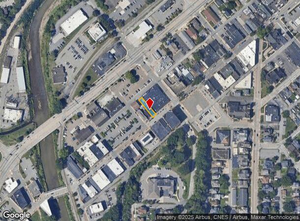
DEMOGRAPHICS near 137 E Main St
1 mile
3 mile
5 mile
2024 Total Population
11,840
81,474
215,218
2029 Population
11,489
79,259
210,645
Pop Growth 2024-2029
(2.96%)
(2.72%)
(2.12%)
Average Age
42
43
42
2024 Total Households
5,650
37,540
96,451
HH Growth 2024-2029
(3.04%)
(2.82%)
(2.20%)
Median Household Inc
$62,921
$79,435
$74,493
Avg Household Size
2.00
2.10
2.20
2024 Avg HH Vehicles
1.00
2.00
2.00
Median Home Value
$166,073
$209,528
$197,464
Median Year Built
1951
1955
1954
Nearby Places
Map Layers
Map Styles
 Street
 Aerial
Transit
 Traffic
 Biking
Places
Listings with unknown addresses are not visible on the map
- Restaurants
- Banks
- Shops
- Fitness
- Groceries
PUBLIC TRANSPORTATION
COMMUTER RAIL
Drive
Walk
Distance
11 min
6.5 mi
AIRPORT
Pittsburgh International
Drive
Walk
Distance
Pittsburgh International
22 min
12.7 mi
Nearby Properties
Address
Land Use
TOTAL SIZE
Lot Size
Zoning
Address
Land Use
TOTAL SIZE
Lot Size
Zoning
Address
Land Use
TOTAL SIZE
Lot Size
Zoning
62.76 AC
Address
Land Use
TOTAL SIZE
Lot Size
Zoning
28.59 AC
Address
Land Use
TOTAL SIZE
Lot Size
Zoning
15.88 AC
Address
Land Use
TOTAL SIZE
Lot Size
Zoning
14.32 AC
Address
Land Use
TOTAL SIZE
Lot Size
Zoning
16.54 AC
Address
Land Use
TOTAL SIZE
Lot Size
Zoning
21.38 AC
Address
Land Use
TOTAL SIZE
Lot Size
Zoning
Address
Land Use
TOTAL SIZE
Lot Size
Zoning
12.68 AC
Address
Land Use
TOTAL SIZE
Lot Size
Zoning
17.50 AC
Address
Land Use
TOTAL SIZE
Lot Size
Zoning
16.01 AC
Address
Land Use
TOTAL SIZE
Lot Size
Zoning
Address
Land Use
TOTAL SIZE
Lot Size
Zoning
6.31 AC
Address
Land Use
TOTAL SIZE
Lot Size
Zoning
24.04 AC
Address
Land Use
TOTAL SIZE
Lot Size
Zoning
39.74 AC
Address
Land Use
TOTAL SIZE
Lot Size
Zoning
Address
Land Use
TOTAL SIZE
Lot Size
Zoning
11.93 AC
Address
Land Use
TOTAL SIZE
Lot Size
Zoning
36.95 AC
Address
Land Use
TOTAL SIZE
Lot Size
Zoning
17.04 AC
Address
Land Use
TOTAL SIZE
Lot Size
Zoning
15.26 AC
Address
Land Use
TOTAL SIZE
Lot Size
Zoning
37.96 AC
Address
Land Use
TOTAL SIZE
Lot Size
Zoning
16.70 AC
Address
Land Use
TOTAL SIZE
Lot Size
Zoning
41.96 AC
Address
Land Use
TOTAL SIZE
Lot Size
Zoning
1,272 SF
40.99 AC
Address
Land Use
TOTAL SIZE
Lot Size
Zoning
32.24 AC
Address
Land Use
TOTAL SIZE
Lot Size
Zoning
Address
Land Use
TOTAL SIZE
Lot Size
Zoning
Address
Land Use
TOTAL SIZE
Lot Size
Zoning
5.95 AC
Address
Land Use
TOTAL SIZE
Lot Size
Zoning
20.31 AC
Address
Land Use
TOTAL SIZE
Lot Size
Zoning
19.18 AC
The World's #1 Commercial Real Estate Marketplace
Connect with us
© 2026 CoStar Group
The information above has been obtained from sources believed reliable. While we do not doubt its accuracy we have not verified it and make no guarantee, warranty or representation about it. It is your responsibility to independently confirm its accuracy and completeness. Any projections, opinions, assumptions, or estimates used are for example only and do not represent the current or future performance of the property. The value of this transaction to you depends on tax and other factors which should be evaluated by your tax, financial, and legal advisors. You and your advisors should conduct a careful, independent investigation of the property to determine to your satisfaction the suitability of the property for your needs.