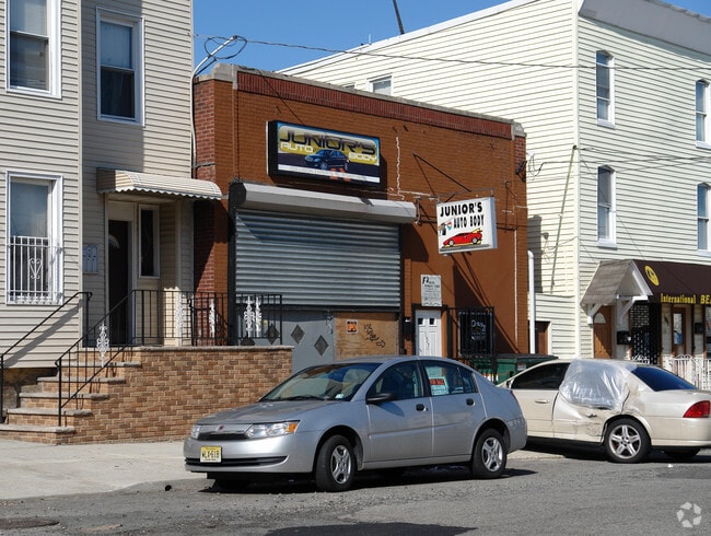
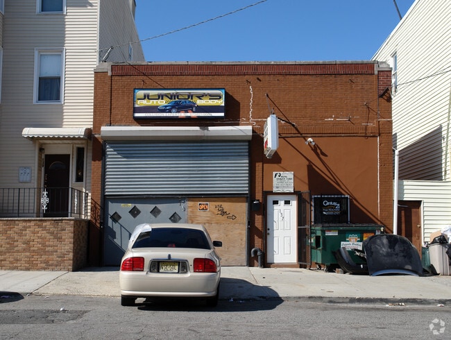
Property Record
137 Hudson St, Newark, NJ 07103
NEARBY LISTINGS FOR SALE OR LEASE
Property Detail
137 Hudson St
Newark, NJ-PA
30X110
14-00429-0000-00038
Essex
Apartment
New Jersey
X
38
34013C0156F
0.08 AC
2023
Newark
2025
Northern New Jersey
001100
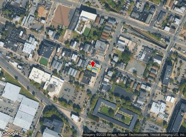
DEMOGRAPHICS near 137 Hudson St
1 Mile
3 Mile
5 Mile
2024 Total Population
53,842
441,776
748,102
2029 Population
52,494
427,591
726,303
Pop Growth 2024-2029
(2.50%)
(3.21%)
(2.91%)
Average Age
34
37
38
2024 Total Households
18,742
162,743
274,547
HH Growth 2024-2029
(2.19%)
(3.24%)
(3.00%)
Median Household Inc
$38,656
$47,826
$58,710
Avg Household Size
2.50
2.60
2.60
2024 Avg HH Vehicles
1.00
1.00
1.00
Median Home Value
$259,872
$298,771
$363,960
Median Year Built
1976
1963
1957
Nearby Places
Map Layers
Map Styles
 Street
 Aerial
- Restaurants
- Banks
- Shops
- Fitness
- Groceries
PUBLIC TRANSPORTATION
TRANSIT/SUBWAY
Norfolk Street (Grove Street - Newark Penn Station - Newark Light Rail (Newark Light Rail))
DRIVE
WALK
Distance
Norfolk Street (Grove Street - Newark Penn Station - Newark Light Rail (Newark Light Rail))
1 min
4 min
0.2 mi
Warren Street (Grove Street - Newark Penn Station - Newark Light Rail (Newark Light Rail))
DRIVE
WALK
Distance
Warren Street (Grove Street - Newark Penn Station - Newark Light Rail (Newark Light Rail))
1 min
7 min
0.4 mi
Orange Street (Grove Street - Newark Penn Station - Newark Light Rail (Newark Light Rail))
DRIVE
WALK
Distance
Orange Street (Grove Street - Newark Penn Station - Newark Light Rail (Newark Light Rail))
2 min
11 min
0.5 mi
Washington Street (Grove Street - Newark Penn Station - Newark Light Rail (Newark Light Rail))
DRIVE
WALK
Distance
Washington Street (Grove Street - Newark Penn Station - Newark Light Rail (Newark Light Rail))
2 min
17 min
0.9 mi
Newark-Broad Street (Broad Street Station - Newark Penn Station - Newark Light Rail (Newark Light Rail))
DRIVE
WALK
Distance
Newark-Broad Street (Broad Street Station - Newark Penn Station - Newark Light Rail (Newark Light Rail))
2 min
20 min
1.0 mi
COMMUTER RAIL
Newark Broad Street (Montclair-Boonton Line - NJ Transit Commuter Rail (NJ Transit), Morris & Essex Gladstone Branch - NJ Transit Commuter Rail (NJ Transit), Morris & Essex Morristown Line - NJ Transit Commuter Rail (NJ Transit))
DRIVE
WALK
Distance
Newark Broad Street (Montclair-Boonton Line - NJ Transit Commuter Rail (NJ Transit), Morris & Essex Gladstone Branch - NJ Transit Commuter Rail (NJ Transit), Morris & Essex Morristown Line - NJ Transit Commuter Rail (NJ Transit))
2 min
1.0 mi
Newark Penn Station (Newark Penn Station-World Trade Center - Port Authority Trans-Hudson (PATH))
DRIVE
WALK
Distance
Newark Penn Station (Newark Penn Station-World Trade Center - Port Authority Trans-Hudson (PATH))
4 min
1.7 mi
AIRPORT
Newark Liberty International
DRIVE
WALK
Distance
Newark Liberty International
12 min
6.3 mi
LaGuardia
DRIVE
WALK
Distance
LaGuardia
43 min
20.9 mi
John F Kennedy International
DRIVE
WALK
Distance
John F Kennedy International
54 min
30.4 mi
Freight Ports
Maher Terminal
DRIVE
WALK
Distance
Maher Terminal
16 min
7.4 mi
Nearby Properties
Address
Land Use
TOTAL SIZE
Lot Size
Zoning
Address
Land Use
TOTAL SIZE
Lot Size
Zoning
0.57 AC
Address
Land Use
TOTAL SIZE
Lot Size
Zoning
0.45 AC
Address
Land Use
TOTAL SIZE
Lot Size
Zoning
926,120 SF
11.46 AC
Address
Land Use
TOTAL SIZE
Lot Size
Zoning
0.61 AC
Address
Land Use
TOTAL SIZE
Lot Size
Zoning
31.86 AC
Address
Land Use
TOTAL SIZE
Lot Size
Zoning
Address
Land Use
TOTAL SIZE
Lot Size
Zoning
877 SF
7.25 AC
Address
Land Use
TOTAL SIZE
Lot Size
Zoning
1,136 SF
6.51 AC
Address
Land Use
TOTAL SIZE
Lot Size
Zoning
683 SF
9.59 AC
Address
Land Use
TOTAL SIZE
Lot Size
Zoning
2.01 AC
Address
Land Use
TOTAL SIZE
Lot Size
Zoning
3.42 AC
Address
Land Use
TOTAL SIZE
Lot Size
Zoning
320 SF
1.25 AC
Address
Land Use
TOTAL SIZE
Lot Size
Zoning
9.77 AC
Address
Land Use
TOTAL SIZE
Lot Size
Zoning
877 SF
0.91 AC
Address
Land Use
TOTAL SIZE
Lot Size
Zoning
1.64 AC
Address
Land Use
TOTAL SIZE
Lot Size
Zoning
Address
Land Use
TOTAL SIZE
Lot Size
Zoning
1.63 AC
Address
Land Use
TOTAL SIZE
Lot Size
Zoning
17.97 AC
Address
Land Use
TOTAL SIZE
Lot Size
Zoning
Address
Land Use
TOTAL SIZE
Lot Size
Zoning
2.79 AC
Address
Land Use
TOTAL SIZE
Lot Size
Zoning
4.82 AC
Address
Land Use
TOTAL SIZE
Lot Size
Zoning
0.13 AC
Address
Land Use
TOTAL SIZE
Lot Size
Zoning
1,264 SF
3.20 AC
Address
Land Use
TOTAL SIZE
Lot Size
Zoning
Address
Land Use
TOTAL SIZE
Lot Size
Zoning
0.06 AC
Address
Land Use
TOTAL SIZE
Lot Size
Zoning
0.09 AC
Address
Land Use
TOTAL SIZE
Lot Size
Zoning
877 SF
1.95 AC
Address
Land Use
TOTAL SIZE
Lot Size
Zoning
877 SF
1.35 AC
Address
Land Use
TOTAL SIZE
Lot Size
Zoning
16,084 SF
7.23 AC
Address
Land Use
TOTAL SIZE
Lot Size
Zoning
683 SF
0.79 AC
The World's #1 Commercial Real Estate Marketplace
Connect with us
© 2025 CoStar Group
The information above has been obtained from sources believed reliable. While we do not doubt its accuracy we have not verified it and make no guarantee, warranty or representation about it. It is your responsibility to independently confirm its accuracy and completeness. Any projections, opinions, assumptions, or estimates used are for example only and do not represent the current or future performance of the property. The value of this transaction to you depends on tax and other factors which should be evaluated by your tax, financial, and legal advisors. You and your advisors should conduct a careful, independent investigation of the property to determine to your satisfaction the suitability of the property for your needs.