Property Record
137 Oyler Ln, Hixson, TN 37343
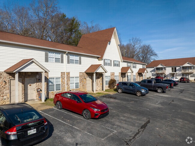

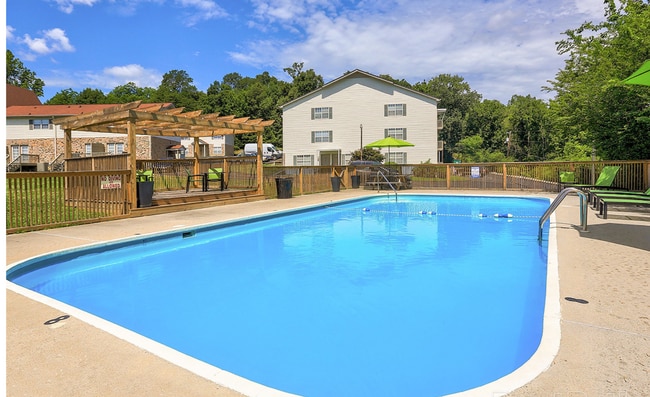
Property Detail
137 Oyler Ln
Chattanooga, TN-GA
LT 1 STRATFORD APTS SUB PB55 PG217 OUT OF 099E-B-011 FOR 2017 COUNTRY OAK APTS 38 UNITS
099E-B-011.01
HAMILTON
Multifamilydwelling
Tennessee
B and X Area of moderate flood hazard, usually the area between the limits of the 100-year and 500-year floods.
1
2025
2.17 AC
2025
Falling Water-Browntown
010435
Chattanooga
27,981 SF
NEARBY LISTINGS FOR SALE OR LEASE
-
-
View all Hixson listings for sale on LoopNet.com
DEMOGRAPHICS near 137 Oyler Ln
1 mile
3 mile
5 mile
2025 Total Population
5,876
33,543
73,643
2030 Population
6,177
35,219
77,211
Pop Growth 2025-2030
+ 5.12%
+ 5.00%
+ 4.84%
Average Age
40
42
42
2025 Total Households
2,477
14,130
31,038
HH Growth 2025-2030
+ 5.29%
+ 5.28%
+ 5.09%
Median Household Inc
$65,313
$71,594
$79,513
Avg Household Size
2.30
2.30
2.30
2025 Avg HH Vehicles
2.00
2.00
2.00
Median Home Value
$263,394
$288,904
$336,401
Median Year Built
1978
1977
1978
Nearby Places
Map Layers
Map Styles
 Street
 Aerial
Layers
 Traffic
 Biking
Places
Listings with unknown addresses are not visible on the map
- Restaurants
- Banks
- Shops
- Fitness
- Groceries
PUBLIC TRANSPORTATION
AIRPORT
Lovell Field
Drive
Walk
Distance
Lovell Field
21 min
12.6 mi
Nearby Properties
Address
Land Use
TOTAL SIZE
Lot Size
Zoning
Address
Land Use
TOTAL SIZE
Lot Size
Zoning
197,214 SF
19.39 AC
R4
Address
Land Use
TOTAL SIZE
Lot Size
Zoning
286,637 SF
20.40 AC
Address
Land Use
TOTAL SIZE
Lot Size
Zoning
292,937 SF
21.50 AC
R1
Address
Land Use
TOTAL SIZE
Lot Size
Zoning
7,693 SF
115.99 AC
R1
Address
Land Use
TOTAL SIZE
Lot Size
Zoning
68,635 SF
44.47 AC
Address
Land Use
TOTAL SIZE
Lot Size
Zoning
139,820 SF
12.67 AC
R3
Address
Land Use
TOTAL SIZE
Lot Size
Zoning
149,270 SF
9.25 AC
R4
Address
Land Use
TOTAL SIZE
Lot Size
Zoning
21,330 SF
15 AC
M1
Address
Land Use
TOTAL SIZE
Lot Size
Zoning
189,000 SF
10.39 AC
Address
Land Use
TOTAL SIZE
Lot Size
Zoning
182,466 SF
20.95 AC
R5
Address
Land Use
TOTAL SIZE
Lot Size
Zoning
341,649 SF
38.44 AC
C2
Address
Land Use
TOTAL SIZE
Lot Size
Zoning
186,480 SF
11.83 AC
Address
Land Use
TOTAL SIZE
Lot Size
Zoning
88,449 SF
4 AC
Address
Land Use
TOTAL SIZE
Lot Size
Zoning
20,880 SF
14.13 AC
R3
Address
Land Use
TOTAL SIZE
Lot Size
Zoning
91,520 SF
10.99 AC
C2
Address
Land Use
TOTAL SIZE
Lot Size
Zoning
125,681 SF
5.55 AC
M3
Address
Land Use
TOTAL SIZE
Lot Size
Zoning
215,672 SF
21.28 AC
Address
Land Use
TOTAL SIZE
Lot Size
Zoning
76,589 SF
9.71 AC
R4
Address
Land Use
TOTAL SIZE
Lot Size
Zoning
31,511 SF
5.48 AC
Address
Land Use
TOTAL SIZE
Lot Size
Zoning
160,149 SF
12.89 AC
C2
Address
Land Use
TOTAL SIZE
Lot Size
Zoning
56 AC
9999
Address
Land Use
TOTAL SIZE
Lot Size
Zoning
47,343 SF
4.06 AC
Address
Land Use
TOTAL SIZE
Lot Size
Zoning
79,260 SF
10.92 AC
C2
Address
Land Use
TOTAL SIZE
Lot Size
Zoning
87,930 SF
4 AC
Address
Land Use
TOTAL SIZE
Lot Size
Zoning
12,432 SF
6.41 AC
Address
Land Use
TOTAL SIZE
Lot Size
Zoning
137,151 SF
10.35 AC
M2
Address
Land Use
TOTAL SIZE
Lot Size
Zoning
141,549 SF
12.56 AC
C2
Address
Land Use
TOTAL SIZE
Lot Size
Zoning
19,940 SF
4.80 AC
R3
Address
Land Use
TOTAL SIZE
Lot Size
Zoning
25,617 SF
8 AC
R1
Address
Land Use
TOTAL SIZE
Lot Size
Zoning
41,872 SF
3.70 AC
The World's #1 Commercial Real Estate Marketplace
Connect with us
© 2026 CoStar Group
The information above has been obtained from sources believed reliable. While we do not doubt its accuracy we have not verified it and make no guarantee, warranty or representation about it. It is your responsibility to independently confirm its accuracy and completeness. Any projections, opinions, assumptions, or estimates used are for example only and do not represent the current or future performance of the property. The value of this transaction to you depends on tax and other factors which should be evaluated by your tax, financial, and legal advisors. You and your advisors should conduct a careful, independent investigation of the property to determine to your satisfaction the suitability of the property for your needs.