Property Record
137 Red Maple Ln, Burnsville, NC 28714
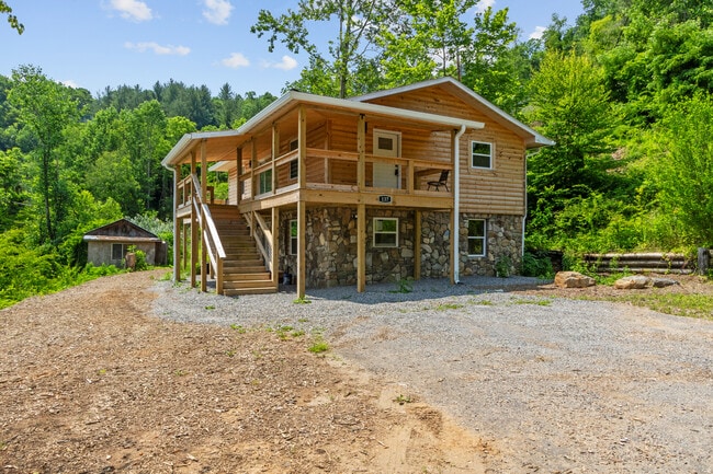
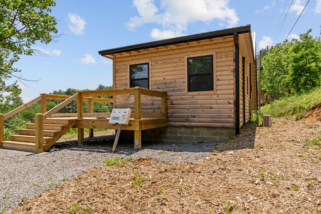
This Property Is For Sale
NEARBY LISTINGS FOR SALE OR LEASE
-
-
View all Burnsville listings for sale on LoopNet.com
Property Detail
137 Red Maple Ln
Sfr
Riverview Estates
X
Yancey
3710080000J
North Carolina
2025
1.06 AC
2025
North Carolina West/Cherokee Area
960300
Other Market Areas
936 SF
080004907331.000
DEMOGRAPHICS near 137 Red Maple Ln
1 Mile
3 Mile
5 Mile
2024 Total Population
437
4,284
8,639
2029 Population
479
4,627
9,332
Pop Growth 2024-2029
+ 9.61%
+ 8.01%
+ 8.02%
Average Age
47
47
46
2024 Total Households
197
1,956
3,885
HH Growth 2024-2029
+ 9.64%
+ 7.92%
+ 8.03%
Median Household Inc
$51,000
$52,892
$56,214
Avg Household Size
2.20
2.10
2.20
2024 Avg HH Vehicles
2.00
2.00
2.00
Median Home Value
$251,851
$252,156
$251,248
Median Year Built
1989
1985
1984
Nearby Places
Map Layers
Map Styles
 Street
 Aerial
- Restaurants
- Banks
- Shops
- Fitness
- Groceries
Nearby Properties
Address
Land Use
TOTAL SIZE
Lot Size
Zoning
Address
Land Use
TOTAL SIZE
Lot Size
Zoning
1,173.85 AC
Address
Land Use
TOTAL SIZE
Lot Size
Zoning
48.63 AC
Address
Land Use
TOTAL SIZE
Lot Size
Zoning
3,497.10 AC
Address
Land Use
TOTAL SIZE
Lot Size
Zoning
1,973.66 AC
Address
Land Use
TOTAL SIZE
Lot Size
Zoning
12,532 SF
4.25 AC
Address
Land Use
TOTAL SIZE
Lot Size
Zoning
80,677 SF
10.03 AC
C-2
Address
Land Use
TOTAL SIZE
Lot Size
Zoning
28,062 SF
4.54 AC
Address
Land Use
TOTAL SIZE
Lot Size
Zoning
Address
Land Use
TOTAL SIZE
Lot Size
Zoning
50,040 SF
7.10 AC
C-2
Address
Land Use
TOTAL SIZE
Lot Size
Zoning
751.91 AC
Address
Land Use
TOTAL SIZE
Lot Size
Zoning
13,138 SF
1.62 AC
C-2
Address
Land Use
TOTAL SIZE
Lot Size
Zoning
7,710 SF
0.48 AC
Address
Land Use
TOTAL SIZE
Lot Size
Zoning
4,762 SF
8.64 AC
C-2
Address
Land Use
TOTAL SIZE
Lot Size
Zoning
39,146 SF
4.46 AC
C-2
Address
Land Use
TOTAL SIZE
Lot Size
Zoning
10,113 SF
1.50 AC
C-2
Address
Land Use
TOTAL SIZE
Lot Size
Zoning
7,008 SF
0.67 AC
Address
Land Use
TOTAL SIZE
Lot Size
Zoning
20,650 SF
3.04 AC
Address
Land Use
TOTAL SIZE
Lot Size
Zoning
4,227 SF
1.03 AC
C-2
Address
Land Use
TOTAL SIZE
Lot Size
Zoning
496.95 AC
Address
Land Use
TOTAL SIZE
Lot Size
Zoning
8,960 SF
1.22 AC
C2&C3
Address
Land Use
TOTAL SIZE
Lot Size
Zoning
23,336 SF
0.71 AC
C-3
Address
Land Use
TOTAL SIZE
Lot Size
Zoning
3,423 SF
1.16 AC
C-2
Address
Land Use
TOTAL SIZE
Lot Size
Zoning
6,382 SF
3.76 AC
Address
Land Use
TOTAL SIZE
Lot Size
Zoning
8,400 SF
2.28 AC
C-3
Address
Land Use
TOTAL SIZE
Lot Size
Zoning
9,499 SF
2 AC
Address
Land Use
TOTAL SIZE
Lot Size
Zoning
3,402 SF
1.31 AC
C-2
Address
Land Use
TOTAL SIZE
Lot Size
Zoning
4,070 SF
2.68 AC
C-1
Address
Land Use
TOTAL SIZE
Lot Size
Zoning
2,325 SF
0.75 AC
C-2
Address
Land Use
TOTAL SIZE
Lot Size
Zoning
6,550 SF
1.69 AC
Address
Land Use
TOTAL SIZE
Lot Size
Zoning
2,864 SF
0.98 AC
C-2
The World's #1 Commercial Real Estate Marketplace
Connect with us
© 2025 CoStar Group
The information above has been obtained from sources believed reliable. While we do not doubt its accuracy we have not verified it and make no guarantee, warranty or representation about it. It is your responsibility to independently confirm its accuracy and completeness. Any projections, opinions, assumptions, or estimates used are for example only and do not represent the current or future performance of the property. The value of this transaction to you depends on tax and other factors which should be evaluated by your tax, financial, and legal advisors. You and your advisors should conduct a careful, independent investigation of the property to determine to your satisfaction the suitability of the property for your needs.