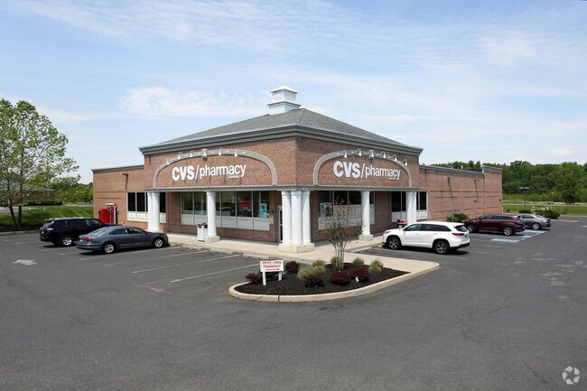
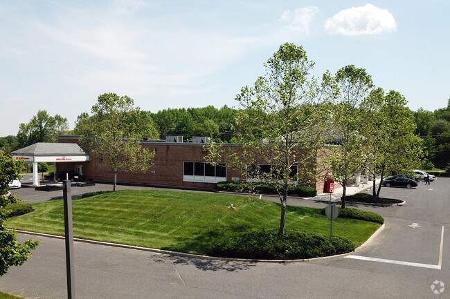
Property Record
137 Route 70, Medford, NJ 08055

Save to a Folder
{{folder.Name}}
{{folder.ListingIds.length}} Properties
{{folder.ListingIds.length}} Property
Create a New Folder
Property Detail
137 Route 70
20-00401-0000-00014-02
ADDITIONAL LOTS: HARTFORD SQUARE
Storebuilding
BURLINGTON
HM
New Jersey
B and X Area of moderate flood hazard, usually the area between the limits of the 100-year and 500-year floods.
14.2
0
2.02 AC
2026
South Burlington County
703802
Philadelphia
14,478 SF
Philadelphia-Camden-Wilmington, PA-NJ-DE-MD
NEARBY LISTINGS FOR SALE OR LEASE
DEMOGRAPHICS near 137 Route 70
1 mile
3 mile
5 mile
2025 Total Population
3,932
34,025
103,330
2030 Population
4,192
35,201
106,217
Pop Growth 2025-2030
+ 6.61%
+ 3.46%
+ 2.79%
Average Age
46
43
43
2025 Total Households
1,650
13,280
40,837
HH Growth 2025-2030
+ 5.88%
+ 3.53%
+ 2.84%
Median Household Inc
$117,812
$131,319
$126,765
Avg Household Size
2.30
2.50
2.50
2025 Avg HH Vehicles
2.00
2.00
2.00
Median Home Value
$560,522
$474,641
$446,312
Median Year Built
1999
1989
1985
Nearby Places
Map Layers
Map Styles
 Street
 Aerial
Layers
 Traffic
 Biking
Places
Listings with unknown addresses are not visible on the map
- Restaurants
- Banks
- Shops
- Fitness
- Groceries
PUBLIC TRANSPORTATION
AIRPORT
Philadelphia International
Drive
Walk
Distance
Philadelphia International
41 min
27.6 mi
Trenton Mercer
Drive
Walk
Distance
Trenton Mercer
53 min
34.9 mi
Atlantic City International
Drive
Walk
Distance
Atlantic City International
78 min
42.3 mi
Freight Ports
South Jersey Port
Drive
Walk
Distance
South Jersey Port
24 min
16.2 mi
Nearby Properties
Address
Land Use
TOTAL SIZE
Lot Size
Zoning
Address
Land Use
TOTAL SIZE
Lot Size
Zoning
50.60 AC
PPE
Address
Land Use
TOTAL SIZE
Lot Size
Zoning
58.48 AC
MD
Address
Land Use
TOTAL SIZE
Lot Size
Zoning
Address
Land Use
TOTAL SIZE
Lot Size
Zoning
2,600 SF
37.38 AC
AH-1
Address
Land Use
TOTAL SIZE
Lot Size
Zoning
9.38 AC
C-1
Address
Land Use
TOTAL SIZE
Lot Size
Zoning
3 AC
GMN
Address
Land Use
TOTAL SIZE
Lot Size
Zoning
62.20 AC
GMN
Address
Land Use
TOTAL SIZE
Lot Size
Zoning
13,636 SF
23 AC
HC1
Address
Land Use
TOTAL SIZE
Lot Size
Zoning
140.84 AC
MD
Address
Land Use
TOTAL SIZE
Lot Size
Zoning
16,243 SF
30.38 AC
I1
Address
Land Use
TOTAL SIZE
Lot Size
Zoning
49.38 AC
PPE
Address
Land Use
TOTAL SIZE
Lot Size
Zoning
10,000 SF
10.80 AC
RD-1
Address
Land Use
TOTAL SIZE
Lot Size
Zoning
32,390 SF
34.74 AC
PPE
Address
Land Use
TOTAL SIZE
Lot Size
Zoning
24.49 AC
Address
Land Use
TOTAL SIZE
Lot Size
Zoning
22.74 AC
HC1
Address
Land Use
TOTAL SIZE
Lot Size
Zoning
75,619 SF
57.38 AC
PPE
Address
Land Use
TOTAL SIZE
Lot Size
Zoning
67,096 SF
128.02 AC
PPE
Address
Land Use
TOTAL SIZE
Lot Size
Zoning
46.66 AC
AH3
Address
Land Use
TOTAL SIZE
Lot Size
Zoning
112,436 SF
9.88 AC
PPE
Address
Land Use
TOTAL SIZE
Lot Size
Zoning
23.70 AC
HM
Address
Land Use
TOTAL SIZE
Lot Size
Zoning
13.74 AC
C-1
Address
Land Use
TOTAL SIZE
Lot Size
Zoning
69,630 SF
10.69 AC
HC2
Address
Land Use
TOTAL SIZE
Lot Size
Zoning
48,439 SF
17.54 AC
PPE
Address
Land Use
TOTAL SIZE
Lot Size
Zoning
19.40 AC
PPE
Address
Land Use
TOTAL SIZE
Lot Size
Zoning
2,400 SF
127.18 AC
INS
Address
Land Use
TOTAL SIZE
Lot Size
Zoning
15.07 AC
INS
Address
Land Use
TOTAL SIZE
Lot Size
Zoning
10,000 SF
10 AC
INS
Address
Land Use
TOTAL SIZE
Lot Size
Zoning
23,402 SF
2.42 AC
RHO
Address
Land Use
TOTAL SIZE
Lot Size
Zoning
37.51 AC
CC
Address
Land Use
TOTAL SIZE
Lot Size
Zoning
118.26 AC
I3
The World's #1 Commercial Real Estate Marketplace
Connect with us
© 2026 CoStar Group
The information above has been obtained from sources believed reliable. While we do not doubt its accuracy we have not verified it and make no guarantee, warranty or representation about it. It is your responsibility to independently confirm its accuracy and completeness. Any projections, opinions, assumptions, or estimates used are for example only and do not represent the current or future performance of the property. The value of this transaction to you depends on tax and other factors which should be evaluated by your tax, financial, and legal advisors. You and your advisors should conduct a careful, independent investigation of the property to determine to your satisfaction the suitability of the property for your needs.