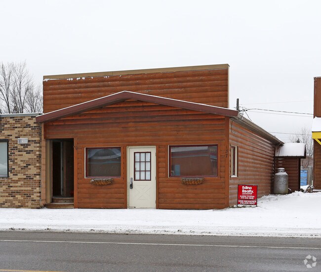
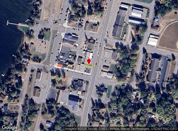
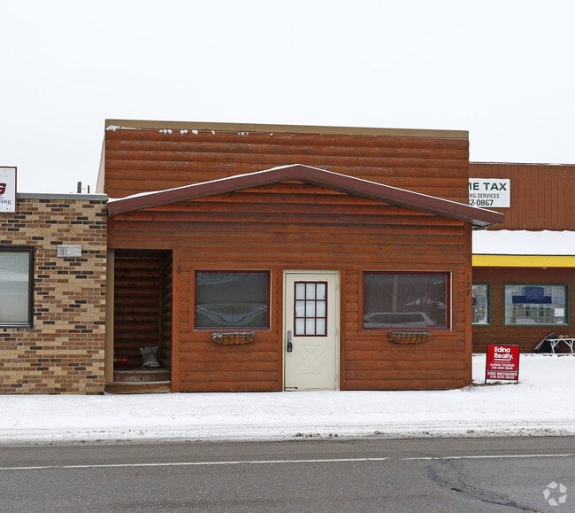
Property Record
137 Highway 371 S, Hackensack, MN 56452
NEARBY LISTINGS FOR SALE OR LEASE
-
-
View all Hackensack listings for sale on LoopNet.com
Property Detail
137 Highway 371 S
Brainerd, MN
Original Plat
89-337-0632
PART OF LOTS 10 & 11, BLK 6
Commercialnec
Cass
2025
Minnesota
2024
10-11
960301
131 SF
1,154 SF
Other Market Areas
DEMOGRAPHICS near 137 Highway 371 S
1 Mile
3 Mile
5 Mile
2024 Total Population
320
1,034
1,944
2029 Population
354
1,151
2,175
Pop Growth 2024-2029
+ 10.63%
+ 11.32%
+ 11.88%
Average Age
50
51
51
2024 Total Households
146
482
911
HH Growth 2024-2029
+ 10.27%
+ 11.00%
+ 11.64%
Median Household Inc
$52,857
$55,777
$58,408
Avg Household Size
2.10
2.00
2.00
2024 Avg HH Vehicles
2.00
2.00
2.00
Median Home Value
$235,000
$255,504
$270,326
Median Year Built
1989
1990
1991
Nearby Places
Map Layers
Map Styles
 Street
 Aerial
- Restaurants
- Banks
- Shops
- Fitness
- Groceries
SALE & LEASE HISTORY
LISTING DATE
SALE/LEASE

Jan 12, 2018
For Sale
Nearby Properties
Address
Land Use
TOTAL SIZE
Lot Size
Zoning
Address
Land Use
TOTAL SIZE
Lot Size
Zoning
1,042 SF
20.82 AC
Address
Land Use
TOTAL SIZE
Lot Size
Zoning
17,790 SF
1.28 AC
Address
Land Use
TOTAL SIZE
Lot Size
Zoning
3,100 SF
8.20 AC
Address
Land Use
TOTAL SIZE
Lot Size
Zoning
2.94 AC
Address
Land Use
TOTAL SIZE
Lot Size
Zoning
1.33 AC
Address
Land Use
TOTAL SIZE
Lot Size
Zoning
22.82 AC
Address
Land Use
TOTAL SIZE
Lot Size
Zoning
0.13 AC
Address
Land Use
TOTAL SIZE
Lot Size
Zoning
0.05 AC
Address
Land Use
TOTAL SIZE
Lot Size
Zoning
Address
Land Use
TOTAL SIZE
Lot Size
Zoning
0.05 AC
Address
Land Use
TOTAL SIZE
Lot Size
Zoning
0.05 AC
Address
Land Use
TOTAL SIZE
Lot Size
Zoning
6,250 SF
8 AC
Address
Land Use
TOTAL SIZE
Lot Size
Zoning
8,984 SF
2.82 AC
Address
Land Use
TOTAL SIZE
Lot Size
Zoning
2,560 SF
35.34 AC
Address
Land Use
TOTAL SIZE
Lot Size
Zoning
268.48 AC
Address
Land Use
TOTAL SIZE
Lot Size
Zoning
1,176 SF
80.09 AC
Address
Land Use
TOTAL SIZE
Lot Size
Zoning
3.90 AC
Address
Land Use
TOTAL SIZE
Lot Size
Zoning
1,176 SF
39.74 AC
Address
Land Use
TOTAL SIZE
Lot Size
Zoning
Address
Land Use
TOTAL SIZE
Lot Size
Zoning
6,400 SF
3.77 AC
Address
Land Use
TOTAL SIZE
Lot Size
Zoning
Address
Land Use
TOTAL SIZE
Lot Size
Zoning
5,292 SF
6.66 AC
Address
Land Use
TOTAL SIZE
Lot Size
Zoning
161.67 AC
Address
Land Use
TOTAL SIZE
Lot Size
Zoning
13.56 AC
Address
Land Use
TOTAL SIZE
Lot Size
Zoning
Address
Land Use
TOTAL SIZE
Lot Size
Zoning
1,646 SF
5.28 AC
Address
Land Use
TOTAL SIZE
Lot Size
Zoning
Address
Land Use
TOTAL SIZE
Lot Size
Zoning
0.06 AC
Address
Land Use
TOTAL SIZE
Lot Size
Zoning
0.31 AC
Address
Land Use
TOTAL SIZE
Lot Size
Zoning
10.07 AC
The World's #1 Commercial Real Estate Marketplace
Connect with us
© 2025 CoStar Group
The information above has been obtained from sources believed reliable. While we do not doubt its accuracy we have not verified it and make no guarantee, warranty or representation about it. It is your responsibility to independently confirm its accuracy and completeness. Any projections, opinions, assumptions, or estimates used are for example only and do not represent the current or future performance of the property. The value of this transaction to you depends on tax and other factors which should be evaluated by your tax, financial, and legal advisors. You and your advisors should conduct a careful, independent investigation of the property to determine to your satisfaction the suitability of the property for your needs.