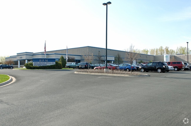
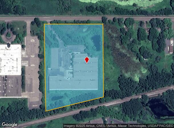
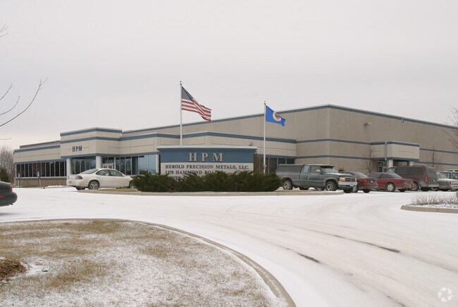
Property Record
1370 Hammond Rd, Saint Paul, MN 55110
NEARBY LISTINGS FOR SALE OR LEASE
Property Detail
1370 Hammond Rd
15-30-22-21-0015
Section 15 Town 30 Range 22
Lightindustrial
SECTION 15 TOWN 30 RANGE 22 EX E 980 FT; THAT PT OF NE 1/4 OF NW ...TO RD) ALL IN SEC 15 TN 30 RN 22
X
Ramsey
27003C0450E
Minnesota
2024
10.06 AC
2025
East
040101
Minneapolis/St Paul
105,322 SF
Minneapolis-St. Paul-Bloomington, MN-WI
DEMOGRAPHICS near 1370 Hammond Rd
1 Mile
3 Mile
5 Mile
2024 Total Population
5,275
34,281
102,583
2029 Population
5,115
33,494
102,341
Pop Growth 2024-2029
(3.03%)
(2.30%)
(0.24%)
Average Age
43
44
43
2024 Total Households
2,167
14,255
40,134
HH Growth 2024-2029
(3.28%)
(2.55%)
(0.55%)
Median Household Inc
$88,676
$95,769
$101,635
Avg Household Size
2.40
2.40
2.50
2024 Avg HH Vehicles
2.00
2.00
2.00
Median Home Value
$302,951
$343,342
$358,233
Median Year Built
1978
1980
1983
Nearby Places
Map Layers
Map Styles
 Street
 Aerial
- Restaurants
- Banks
- Shops
- Fitness
- Groceries
PUBLIC TRANSPORTATION
AIRPORT
Minneapolis-St Paul International/Wold-Chamberlain
DRIVE
WALK
Distance
Minneapolis-St Paul International/Wold-Chamberlain
32 min
21.3 mi
Freight Ports
Port Milwaukee
DRIVE
WALK
Distance
Port Milwaukee
374 min
337.7 mi
Nearby Properties
Address
Land Use
TOTAL SIZE
Lot Size
Zoning
Address
Land Use
TOTAL SIZE
Lot Size
Zoning
5.59 AC
Address
Land Use
TOTAL SIZE
Lot Size
Zoning
13.44 AC
Address
Land Use
TOTAL SIZE
Lot Size
Zoning
175,536 SF
7.60 AC
Address
Land Use
TOTAL SIZE
Lot Size
Zoning
250,050 SF
2.99 AC
Address
Land Use
TOTAL SIZE
Lot Size
Zoning
106,400 SF
18.29 AC
Address
Land Use
TOTAL SIZE
Lot Size
Zoning
78,163 SF
5.62 AC
Address
Land Use
TOTAL SIZE
Lot Size
Zoning
211,420 SF
5.22 AC
Address
Land Use
TOTAL SIZE
Lot Size
Zoning
126,852 SF
11.86 AC
Address
Land Use
TOTAL SIZE
Lot Size
Zoning
960 SF
17.11 AC
Address
Land Use
TOTAL SIZE
Lot Size
Zoning
138,655 SF
4.70 AC
Address
Land Use
TOTAL SIZE
Lot Size
Zoning
13,358 SF
311.47 AC
W8OPSP
Address
Land Use
TOTAL SIZE
Lot Size
Zoning
3,200 SF
14.31 AC
W7PUBLC
Address
Land Use
TOTAL SIZE
Lot Size
Zoning
26,109 SF
167.19 AC
Address
Land Use
TOTAL SIZE
Lot Size
Zoning
163,709 SF
1.22 AC
Address
Land Use
TOTAL SIZE
Lot Size
Zoning
295,860 SF
11.84 AC
Address
Land Use
TOTAL SIZE
Lot Size
Zoning
204,399 SF
12.82 AC
Address
Land Use
TOTAL SIZE
Lot Size
Zoning
202,460 SF
26.72 AC
Address
Land Use
TOTAL SIZE
Lot Size
Zoning
156,090 SF
4.27 AC
Address
Land Use
TOTAL SIZE
Lot Size
Zoning
1,357 SF
8.22 AC
Address
Land Use
TOTAL SIZE
Lot Size
Zoning
88,787 SF
5.16 AC
Address
Land Use
TOTAL SIZE
Lot Size
Zoning
234,156 SF
12.01 AC
Address
Land Use
TOTAL SIZE
Lot Size
Zoning
82,403 SF
41.35 AC
Address
Land Use
TOTAL SIZE
Lot Size
Zoning
128,462 SF
2.07 AC
Address
Land Use
TOTAL SIZE
Lot Size
Zoning
132,487 SF
2.19 AC
Address
Land Use
TOTAL SIZE
Lot Size
Zoning
103,400 SF
3.60 AC
Address
Land Use
TOTAL SIZE
Lot Size
Zoning
1,066 SF
8.04 AC
Address
Land Use
TOTAL SIZE
Lot Size
Zoning
60,017 SF
4.85 AC
Address
Land Use
TOTAL SIZE
Lot Size
Zoning
130,104 SF
3.35 AC
Address
Land Use
TOTAL SIZE
Lot Size
Zoning
113,858 SF
27.82 AC
Address
Land Use
TOTAL SIZE
Lot Size
Zoning
98,905 SF
11.34 AC
The World's #1 Commercial Real Estate Marketplace
Connect with us
© 2025 CoStar Group
The information above has been obtained from sources believed reliable. While we do not doubt its accuracy we have not verified it and make no guarantee, warranty or representation about it. It is your responsibility to independently confirm its accuracy and completeness. Any projections, opinions, assumptions, or estimates used are for example only and do not represent the current or future performance of the property. The value of this transaction to you depends on tax and other factors which should be evaluated by your tax, financial, and legal advisors. You and your advisors should conduct a careful, independent investigation of the property to determine to your satisfaction the suitability of the property for your needs.