Property Record
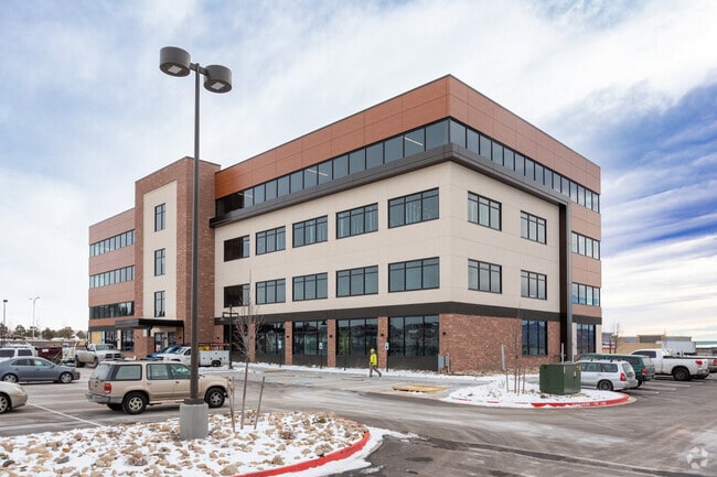
1370 Interquest Pkwy, Colorado Springs, CO 80921


Current Lease Availabilities
Property Detail
1370 Interquest Pkwy
62201-12-004
LOT 1 MARKETPLACE AT INTERQUEST FIL NO 22
Commercialnec
EL PASO
PDZ
Colorado
B and X Area of moderate flood hazard, usually the area between the limits of the 100-year and 500-year floods.
1
2025
4.26 AC
2026
Northeast
007205
Colorado Springs
65,044 SF
Colorado Springs, CO
NEARBY LISTINGS FOR SALE OR LEASE
DEMOGRAPHICS near 1370 Interquest Pkwy
1 mile
3 mile
5 mile
2025 Total Population
4,618
32,599
113,943
2030 Population
4,902
33,726
116,654
Pop Growth 2025-2030
+ 6.15%
+ 3.46%
+ 2.38%
Average Age
38
39
39
2025 Total Households
1,882
11,984
40,973
HH Growth 2025-2030
+ 6.16%
+ 3.76%
+ 2.66%
Median Household Inc
$135,563
$133,307
$123,054
Avg Household Size
2.50
2.70
2.70
2025 Avg HH Vehicles
2.00
2.00
2.00
Median Home Value
$733,766
$725,038
$631,140
Median Year Built
2010
2007
1998
Nearby Places
Map Layers
Map Styles
 Street
 Aerial
Layers
 Traffic
 Biking
Places
Listings with unknown addresses are not visible on the map
- Restaurants
- Banks
- Shops
- Fitness
- Groceries
PUBLIC TRANSPORTATION
AIRPORT
City of Colorado Springs Municipal
Drive
Walk
Distance
City of Colorado Springs Municipal
28 min
17.3 mi
Freight Ports
Tulsa Port Of Catoosa
Drive
Walk
Distance
Tulsa Port Of Catoosa
736 min
692.3 mi
Nearby Properties
Address
Land Use
TOTAL SIZE
Lot Size
Zoning
Address
Land Use
TOTAL SIZE
Lot Size
Zoning
361,165 SF
59.11 AC
PDZ
Address
Land Use
TOTAL SIZE
Lot Size
Zoning
177,966 SF
57.81 AC
PDZ HR
Address
Land Use
TOTAL SIZE
Lot Size
Zoning
261,339 SF
10.42 AC
MX-M CU
Address
Land Use
TOTAL SIZE
Lot Size
Zoning
278,951 SF
32.43 AC
BP/CR HR
Address
Land Use
TOTAL SIZE
Lot Size
Zoning
257,140 SF
30.17 AC
MX-N/CR MX
Address
Land Use
TOTAL SIZE
Lot Size
Zoning
121,820 SF
14.73 AC
BP
Address
Land Use
TOTAL SIZE
Lot Size
Zoning
154,703 SF
14.29 AC
BP HR
Address
Land Use
TOTAL SIZE
Lot Size
Zoning
187,841 SF
40.33 AC
A
Address
Land Use
TOTAL SIZE
Lot Size
Zoning
95,337 SF
49.29 AC
BP
Address
Land Use
TOTAL SIZE
Lot Size
Zoning
103,166 SF
8.88 AC
BP
Address
Land Use
TOTAL SIZE
Lot Size
Zoning
562,942 SF
27.13 AC
PDZ
Address
Land Use
TOTAL SIZE
Lot Size
Zoning
56,290 SF
6.55 AC
A/CR
Address
Land Use
TOTAL SIZE
Lot Size
Zoning
112,266 SF
0.24 AC
RR3
Address
Land Use
TOTAL SIZE
Lot Size
Zoning
114,474 SF
12.95 AC
BP
Address
Land Use
TOTAL SIZE
Lot Size
Zoning
480 SF
11 AC
A UV
Address
Land Use
TOTAL SIZE
Lot Size
Zoning
316,105 SF
19.73 AC
PDZ
Address
Land Use
TOTAL SIZE
Lot Size
Zoning
58,774 SF
5 AC
BP
Address
Land Use
TOTAL SIZE
Lot Size
Zoning
391,914 SF
3.13 AC
PDZ
Address
Land Use
TOTAL SIZE
Lot Size
Zoning
323,646 SF
31.30 AC
A BP/CR BP
Address
Land Use
TOTAL SIZE
Lot Size
Zoning
35,862 SF
5.95 AC
MX-N
Address
Land Use
TOTAL SIZE
Lot Size
Zoning
48,673 SF
5.51 AC
R-5 P
Address
Land Use
TOTAL SIZE
Lot Size
Zoning
68,829 SF
6 AC
BP/CR
Address
Land Use
TOTAL SIZE
Lot Size
Zoning
211,974 SF
25.15 AC
BP CU
Address
Land Use
TOTAL SIZE
Lot Size
Zoning
50,471 SF
7.28 AC
BP
Address
Land Use
TOTAL SIZE
Lot Size
Zoning
47,313 SF
11.15 AC
MX-N
Address
Land Use
TOTAL SIZE
Lot Size
Zoning
25,194 SF
4 AC
R-5 P
Address
Land Use
TOTAL SIZE
Lot Size
Zoning
188,626 SF
22.34 AC
BP/CR HR
Address
Land Use
TOTAL SIZE
Lot Size
Zoning
14,866 SF
12.71 AC
A
Address
Land Use
TOTAL SIZE
Lot Size
Zoning
49,391 SF
2.46 AC
PBC
Address
Land Use
TOTAL SIZE
Lot Size
Zoning
181,852 SF
20.99 AC
BP/CR HR
The World's #1 Commercial Real Estate Marketplace
Connect with us
© 2026 CoStar Group
The information above has been obtained from sources believed reliable. While we do not doubt its accuracy we have not verified it and make no guarantee, warranty or representation about it. It is your responsibility to independently confirm its accuracy and completeness. Any projections, opinions, assumptions, or estimates used are for example only and do not represent the current or future performance of the property. The value of this transaction to you depends on tax and other factors which should be evaluated by your tax, financial, and legal advisors. You and your advisors should conduct a careful, independent investigation of the property to determine to your satisfaction the suitability of the property for your needs.