Property Record
13700 Oak St, Kansas City, MO 64145

Save to a Folder
{{folder.Name}}
{{folder.ListingIds.length}} Properties
{{folder.ListingIds.length}} Property
Create a New Folder
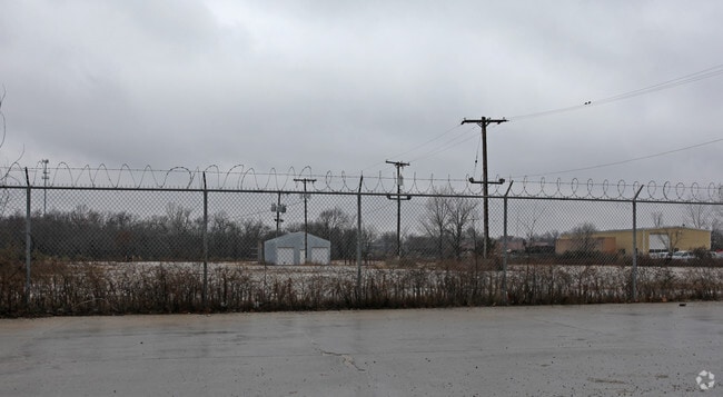
Property Detail
13700 Oak St
Kansas City, MO-KS
MARTIN CITY ACRES ALL OF OT 10 & PT SW 1/4 DAF: BEG SE COR O F SD LOT 10 TH W ALG S LI 620 TH S & PARA TO E LI OF SW 1/4 330 TH E & PARA TO S LI LOT 10, 262.66 TH N 215.66 TH E
66-200-03-35-01-0-00-000
JACKSON
Industrialgeneral
Missouri
AE The base floodplain where base flood elevations are provided. AE Zones are now used on new format FIRMs instead of A1-A30 Zones.
10
2024
4.93 AC
2025
South KC
013405
Kansas City
NEARBY LISTINGS FOR SALE OR LEASE
DEMOGRAPHICS near 13700 Oak St
1 mile
3 mile
5 mile
2025 Total Population
2,311
35,285
139,947
2030 Population
2,374
36,037
143,509
Pop Growth 2025-2030
+ 2.73%
+ 2.13%
+ 2.55%
Average Age
46
43
41
2025 Total Households
1,132
13,595
58,296
HH Growth 2025-2030
+ 2.65%
+ 2.00%
+ 2.59%
Median Household Inc
$74,482
$122,438
$92,527
Avg Household Size
2.00
2.50
2.30
2025 Avg HH Vehicles
2.00
2.00
2.00
Median Home Value
$321,030
$524,648
$405,293
Median Year Built
1988
1988
1988
Nearby Places
Map Layers
Map Styles
 Street
 Aerial
Layers
 Traffic
 Biking
Places
Listings with unknown addresses are not visible on the map
- Restaurants
- Banks
- Shops
- Fitness
- Groceries
PUBLIC TRANSPORTATION
AIRPORT
Kansas City International
Drive
Walk
Distance
Kansas City International
54 min
41.4 mi
Nearby Properties
Address
Land Use
TOTAL SIZE
Lot Size
Zoning
Address
Land Use
TOTAL SIZE
Lot Size
Zoning
1,314,506 SF
174 AC
Address
Land Use
TOTAL SIZE
Lot Size
Zoning
384,819 SF
67.59 AC
AG
Address
Land Use
TOTAL SIZE
Lot Size
Zoning
184,524 SF
33.20 AC
AG
Address
Land Use
TOTAL SIZE
Lot Size
Zoning
26,022 SF
109.48 AC
IP-2J
Address
Land Use
TOTAL SIZE
Lot Size
Zoning
166,097 SF
37.29 AC
R-1
Address
Land Use
TOTAL SIZE
Lot Size
Zoning
319,892 SF
Address
Land Use
TOTAL SIZE
Lot Size
Zoning
366,600 SF
9 AC
Address
Land Use
TOTAL SIZE
Lot Size
Zoning
72,184 SF
9.53 AC
AG
Address
Land Use
TOTAL SIZE
Lot Size
Zoning
45,775 SF
17.05 AC
BP
Address
Land Use
TOTAL SIZE
Lot Size
Zoning
68,493 SF
9.92 AC
R-1
Address
Land Use
TOTAL SIZE
Lot Size
Zoning
631,055 SF
71.76 AC
Address
Land Use
TOTAL SIZE
Lot Size
Zoning
36,012 SF
18.12 AC
AG
Address
Land Use
TOTAL SIZE
Lot Size
Zoning
227,676 SF
15.86 AC
Address
Land Use
TOTAL SIZE
Lot Size
Zoning
425,779 SF
23.23 AC
Address
Land Use
TOTAL SIZE
Lot Size
Zoning
43,021 SF
7.47 AC
SD-O
Address
Land Use
TOTAL SIZE
Lot Size
Zoning
60,960 SF
4.82 AC
SD-NCR
Address
Land Use
TOTAL SIZE
Lot Size
Zoning
64,785 SF
24.54 AC
RP-4 (CURR
Address
Land Use
TOTAL SIZE
Lot Size
Zoning
220,756 SF
19.65 AC
Address
Land Use
TOTAL SIZE
Lot Size
Zoning
355,091 SF
41.50 AC
Address
Land Use
TOTAL SIZE
Lot Size
Zoning
313,997 SF
20.57 AC
Address
Land Use
TOTAL SIZE
Lot Size
Zoning
504,100 SF
39.25 AC
Address
Land Use
TOTAL SIZE
Lot Size
Zoning
628,134 SF
37.62 AC
Address
Land Use
TOTAL SIZE
Lot Size
Zoning
303,625 SF
Address
Land Use
TOTAL SIZE
Lot Size
Zoning
94,080 SF
5.83 AC
Address
Land Use
TOTAL SIZE
Lot Size
Zoning
52,863 SF
20.80 AC
RP-4 (CURR
Address
Land Use
TOTAL SIZE
Lot Size
Zoning
253,575 SF
43.62 AC
Address
Land Use
TOTAL SIZE
Lot Size
Zoning
124,939 SF
8.93 AC
Address
Land Use
TOTAL SIZE
Lot Size
Zoning
166,384 SF
27.90 AC
Address
Land Use
TOTAL SIZE
Lot Size
Zoning
168,467 SF
13.37 AC
Address
Land Use
TOTAL SIZE
Lot Size
Zoning
7,783 SF
4.64 AC
REC
The World's #1 Commercial Real Estate Marketplace
Connect with us
© 2026 CoStar Group
The information above has been obtained from sources believed reliable. While we do not doubt its accuracy we have not verified it and make no guarantee, warranty or representation about it. It is your responsibility to independently confirm its accuracy and completeness. Any projections, opinions, assumptions, or estimates used are for example only and do not represent the current or future performance of the property. The value of this transaction to you depends on tax and other factors which should be evaluated by your tax, financial, and legal advisors. You and your advisors should conduct a careful, independent investigation of the property to determine to your satisfaction the suitability of the property for your needs.