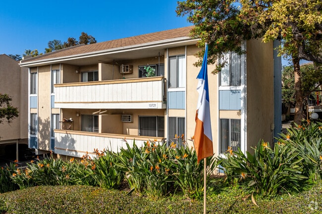
Property Record
13708 Via Del Palma Ave, Whittier, CA 90602

NEARBY LISTINGS FOR SALE OR LEASE
Property Detail
13708 Via Del Palma Ave
Los Angeles-Long Beach-Glendale, CA
Willard Tract
8142-005-043
2.39 MORE OR LESS ACS COM N 89 58'45 E 60 FT FROM SW COR OF LOT 30 TH WILLARD TRACT TH N 175 FT TH N 65 46'20 E 61.41FT TH N TO N LINE OF LOT 31 SD TR TH E SEE ASSESSOR MAPBOOK FOR MISSING PORTIONPART OF LOT 13 BLK B OCEAN VIEW TRACT
Multifamilydwelling
Los Angeles
X
California
06037C1835F
30
2024
2.35 AC
2025
Whittier City
501802
Los Angeles
83,364 SF
DEMOGRAPHICS near 13708 Via Del Palma Ave
1 Mile
3 Mile
5 Mile
2024 Total Population
26,943
133,841
394,428
2029 Population
26,104
129,136
380,221
Pop Growth 2024-2029
(3.11%)
(3.52%)
(3.60%)
Average Age
39
40
40
2024 Total Households
9,405
41,339
116,363
HH Growth 2024-2029
(3.37%)
(3.76%)
(3.85%)
Median Household Inc
$61,865
$85,980
$89,249
Avg Household Size
2.70
3.10
3.30
2024 Avg HH Vehicles
2.00
2.00
2.00
Median Home Value
$756,543
$726,550
$709,041
Median Year Built
1954
1955
1957
Nearby Places
Map Layers
Map Styles
 Street
 Aerial
- Restaurants
- Banks
- Shops
- Fitness
- Groceries
PUBLIC TRANSPORTATION
COMMUTER RAIL
Norwalk/Santa Fe Springs (91 Line - Southern California Regional Rail Authority (Metrolink), Orange County Line - Southern California Regional Rail Authority (Metrolink))
DRIVE
WALK
Distance
Norwalk/Santa Fe Springs (91 Line - Southern California Regional Rail Authority (Metrolink), Orange County Line - Southern California Regional Rail Authority (Metrolink))
11 min
5.3 mi
Montebello/Commerce (Riverside Line - Southern California Regional Rail Authority (Metrolink))
DRIVE
WALK
Distance
Montebello/Commerce (Riverside Line - Southern California Regional Rail Authority (Metrolink))
16 min
8.2 mi
AIRPORT
Long Beach (Daugherty Field)
DRIVE
WALK
Distance
Long Beach (Daugherty Field)
30 min
19.2 mi
John Wayne/Orange County
DRIVE
WALK
Distance
John Wayne/Orange County
38 min
27.2 mi
Los Angeles International
DRIVE
WALK
Distance
Los Angeles International
38 min
27.4 mi
Freight Ports
Port of Long Beach
DRIVE
WALK
Distance
Port of Long Beach
36 min
24.9 mi
Nearby Properties
Address
Land Use
TOTAL SIZE
Lot Size
Zoning
Address
Land Use
TOTAL SIZE
Lot Size
Zoning
519,516 SF
25.37 AC
WHR3*
Address
Land Use
TOTAL SIZE
Lot Size
Zoning
1,100,900 SF
22.36 AC
SSM2*
Address
Land Use
TOTAL SIZE
Lot Size
Zoning
304,549 SF
7.13 AC
SSM2*
Address
Land Use
TOTAL SIZE
Lot Size
Zoning
234,324 SF
10.05 AC
SSM2*
Address
Land Use
TOTAL SIZE
Lot Size
Zoning
300,148 SF
13.01 AC
SSM2*
Address
Land Use
TOTAL SIZE
Lot Size
Zoning
183,000 SF
7.76 AC
SSM2*
Address
Land Use
TOTAL SIZE
Lot Size
Zoning
657,978 SF
31.68 AC
SSM2*
Address
Land Use
TOTAL SIZE
Lot Size
Zoning
89,899 SF
SSM2*
Address
Land Use
TOTAL SIZE
Lot Size
Zoning
74,018 SF
14.92 AC
WHM1*
Address
Land Use
TOTAL SIZE
Lot Size
Zoning
89,514 SF
21.28 AC
WHC2*
Address
Land Use
TOTAL SIZE
Lot Size
Zoning
85,245 SF
7.44 AC
WHT*
Address
Land Use
TOTAL SIZE
Lot Size
Zoning
425,816 SF
30.02 AC
SSM2*
Address
Land Use
TOTAL SIZE
Lot Size
Zoning
320,030 SF
8.81 AC
WHM2*
Address
Land Use
TOTAL SIZE
Lot Size
Zoning
184,230 SF
4.55 AC
SSM2*
Address
Land Use
TOTAL SIZE
Lot Size
Zoning
312,052 SF
6.78 AC
SSM2
Address
Land Use
TOTAL SIZE
Lot Size
Zoning
161,861 SF
17.50 AC
SSC4PD*
Address
Land Use
TOTAL SIZE
Lot Size
Zoning
108,296 SF
8.81 AC
WHM2*
Address
Land Use
TOTAL SIZE
Lot Size
Zoning
216,952 SF
23.54 AC
WHR4*
Address
Land Use
TOTAL SIZE
Lot Size
Zoning
393,696 SF
12.73 AC
WHM2*
Address
Land Use
TOTAL SIZE
Lot Size
Zoning
112,619 SF
4.97 AC
SSC4-R3*
Address
Land Use
TOTAL SIZE
Lot Size
Zoning
67,692 SF
2.34 AC
WHC2*
Address
Land Use
TOTAL SIZE
Lot Size
Zoning
138,400 SF
3.49 AC
SSM2*
Address
Land Use
TOTAL SIZE
Lot Size
Zoning
151,618 SF
7.70 AC
WHM1*
Address
Land Use
TOTAL SIZE
Lot Size
Zoning
69,056 SF
2.25 AC
WHM1*
Address
Land Use
TOTAL SIZE
Lot Size
Zoning
117,159 SF
1.50 AC
WHC2UD*
Address
Land Use
TOTAL SIZE
Lot Size
Zoning
192,740 SF
10.18 AC
Address
Land Use
TOTAL SIZE
Lot Size
Zoning
172,423 SF
7.23 AC
SSM2*
Address
Land Use
TOTAL SIZE
Lot Size
Zoning
158,767 SF
6.21 AC
WHM2*
The World's #1 Commercial Real Estate Marketplace
Connect with us
© 2026 CoStar Group
The information above has been obtained from sources believed reliable. While we do not doubt its accuracy we have not verified it and make no guarantee, warranty or representation about it. It is your responsibility to independently confirm its accuracy and completeness. Any projections, opinions, assumptions, or estimates used are for example only and do not represent the current or future performance of the property. The value of this transaction to you depends on tax and other factors which should be evaluated by your tax, financial, and legal advisors. You and your advisors should conduct a careful, independent investigation of the property to determine to your satisfaction the suitability of the property for your needs.