Property Record
1371 E Bristol Rd, Burton, MI 48529
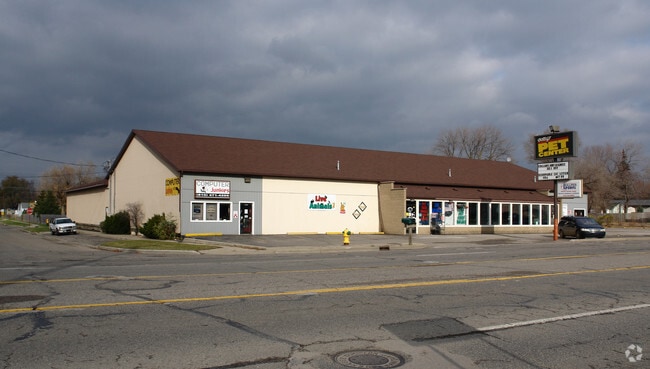


Property Detail
1371 E Bristol Rd
59-30-578-301
LOTS 1277 THRU 1281 & LOTS 1320 THRU 1323 & LOT 1324 EXCEPT S 12 FT OF E 10 FT BAKER PARK NO 1 (93) FR 5900049303
Commercialnec
Genesee
C-1
Michigan
B and X Area of moderate flood hazard, usually the area between the limits of the 100-year and 500-year floods.
1277,12
2025
1.15 AC
2025
Flint
011301
Detroit
15,935 SF
Flint, MI
NEARBY LISTINGS FOR SALE OR LEASE
DEMOGRAPHICS near 1371 E Bristol Rd
1 mile
3 mile
5 mile
2025 Total Population
10,684
58,485
135,936
2030 Population
10,625
58,425
136,113
Pop Growth 2025-2030
(0.55%)
(0.10%)
+ 0.13%
Average Age
38
39
40
2025 Total Households
4,445
24,558
57,129
HH Growth 2025-2030
(0.54%)
(0.11%)
+ 0.06%
Median Household Inc
$42,573
$46,200
$51,344
Avg Household Size
2.30
2.30
2.30
2025 Avg HH Vehicles
2.00
1.00
2.00
Median Home Value
$71,466
$109,421
$127,200
Median Year Built
1955
1961
1962
Nearby Places
Map Layers
Map Styles
 Street
 Aerial
Layers
 Traffic
 Biking
Places
Listings with unknown addresses are not visible on the map
- Restaurants
- Banks
- Shops
- Fitness
- Groceries
PUBLIC TRANSPORTATION
COMMUTER RAIL
Flint Amtrak Station (Blue Water - Amtrak)
Drive
Walk
Distance
Flint Amtrak Station (Blue Water - Amtrak)
8 min
4.3 mi
AIRPORT
Bishop International
Drive
Walk
Distance
Bishop International
20 min
7.7 mi
Freight Ports
Port of Toledo
Drive
Walk
Distance
Port of Toledo
133 min
112.4 mi
SALE & LEASE HISTORY
LISTING DATE
SALE/LEASE

Sep 25, 2016
For Lease
Nearby Properties
Address
Land Use
TOTAL SIZE
Lot Size
Zoning
Address
Land Use
TOTAL SIZE
Lot Size
Zoning
381,509 SF
371.45 AC
PC
Address
Land Use
TOTAL SIZE
Lot Size
Zoning
Address
Land Use
TOTAL SIZE
Lot Size
Zoning
51.26 AC
HDM
Address
Land Use
TOTAL SIZE
Lot Size
Zoning
155,220 SF
33.46 AC
GC
Address
Land Use
TOTAL SIZE
Lot Size
Zoning
33.65 AC
MDM
Address
Land Use
TOTAL SIZE
Lot Size
Zoning
911,140 SF
Address
Land Use
TOTAL SIZE
Lot Size
Zoning
210,684 SF
27.06 AC
GC
Address
Land Use
TOTAL SIZE
Lot Size
Zoning
120,487 SF
5.81 AC
PRC
Address
Land Use
TOTAL SIZE
Lot Size
Zoning
130,291 SF
Address
Land Use
TOTAL SIZE
Lot Size
Zoning
227,755 SF
32.27 AC
C-2
Address
Land Use
TOTAL SIZE
Lot Size
Zoning
144,896 SF
0.23 AC
DC
Address
Land Use
TOTAL SIZE
Lot Size
Zoning
115,556 SF
2.50 AC
DE
Address
Land Use
TOTAL SIZE
Lot Size
Zoning
75,536 SF
8.97 AC
PRC
Address
Land Use
TOTAL SIZE
Lot Size
Zoning
137,169 SF
18.50 AC
GC
Address
Land Use
TOTAL SIZE
Lot Size
Zoning
100,000 SF
Address
Land Use
TOTAL SIZE
Lot Size
Zoning
58,648 SF
5.80 AC
OS
Address
Land Use
TOTAL SIZE
Lot Size
Zoning
60,613 SF
12.91 AC
RO
Address
Land Use
TOTAL SIZE
Lot Size
Zoning
100,750 SF
Address
Land Use
TOTAL SIZE
Lot Size
Zoning
9.88 AC
HDM
Address
Land Use
TOTAL SIZE
Lot Size
Zoning
68,571 SF
0.81 AC
DC
Address
Land Use
TOTAL SIZE
Lot Size
Zoning
118,750 SF
21.26 AC
C-3A
Address
Land Use
TOTAL SIZE
Lot Size
Zoning
246,759 SF
19.03 AC
CC
Address
Land Use
TOTAL SIZE
Lot Size
Zoning
24.38 AC
RM
Address
Land Use
TOTAL SIZE
Lot Size
Zoning
91,726 SF
7.28 AC
HDM
Address
Land Use
TOTAL SIZE
Lot Size
Zoning
64,150 SF
3.64 AC
PRC
Address
Land Use
TOTAL SIZE
Lot Size
Zoning
24,670 SF
9.62 AC
GC
Address
Land Use
TOTAL SIZE
Lot Size
Zoning
49,582 SF
25.15 AC
HRM
Address
Land Use
TOTAL SIZE
Lot Size
Zoning
364,289 SF
24.80 AC
GN-1
Address
Land Use
TOTAL SIZE
Lot Size
Zoning
41,508 SF
5.27 AC
OS
Address
Land Use
TOTAL SIZE
Lot Size
Zoning
28,896 SF
7.47 AC
M-M
The World's #1 Commercial Real Estate Marketplace
Connect with us
© 2026 CoStar Group
The information above has been obtained from sources believed reliable. While we do not doubt its accuracy we have not verified it and make no guarantee, warranty or representation about it. It is your responsibility to independently confirm its accuracy and completeness. Any projections, opinions, assumptions, or estimates used are for example only and do not represent the current or future performance of the property. The value of this transaction to you depends on tax and other factors which should be evaluated by your tax, financial, and legal advisors. You and your advisors should conduct a careful, independent investigation of the property to determine to your satisfaction the suitability of the property for your needs.