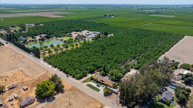
Property Record
13715 E Nebraska Ave, Kingsburg, CA 93631


NEARBY LISTINGS FOR SALE OR LEASE
Property Detail
13715 E Nebraska Ave
393-083-26
E1/2 OF NW1/4 OF NE1/4 & W1/2 OF W1/2 OF NE1/4 11
Farms
Fresno
X
California
06019C2675H
29.02 AC
2025
E Outlying Fresno County
2025
Fresno
007204
Fresno, CA
2,106 SF
DEMOGRAPHICS near 13715 E Nebraska Ave
1 mile
3 mile
5 mile
2024 Total Population
125
8,882
60,100
2029 Population
127
9,139
61,596
Pop Growth 2024-2029
+ 1.60%
+ 2.89%
+ 2.49%
Average Age
37
39
36
2024 Total Households
38
2,954
17,567
HH Growth 2024-2029
+ 2.63%
+ 3.05%
+ 2.60%
Median Household Inc
$104,687
$92,005
$63,910
Avg Household Size
3.40
3.00
3.40
2024 Avg HH Vehicles
2.00
2.00
2.00
Median Home Value
$499,999
$498,761
$349,120
Median Year Built
2001
1984
1984
Nearby Places
Map Layers
Map Styles
 Street
 Aerial
Transit
 Traffic
 Biking
Places
Listings with unknown addresses are not visible on the map
- Restaurants
- Banks
- Shops
- Fitness
- Groceries
PUBLIC TRANSPORTATION
AIRPORT
Fresno Yosemite International
Drive
Walk
Distance
Fresno Yosemite International
34 min
23.0 mi
Freight Ports
Port of Stockton
Drive
Walk
Distance
Port of Stockton
175 min
148.1 mi
Nearby Properties
Address
Land Use
TOTAL SIZE
Lot Size
Zoning
Address
Land Use
TOTAL SIZE
Lot Size
Zoning
644,619 SF
49.55 AC
M1
Address
Land Use
TOTAL SIZE
Lot Size
Zoning
606,174 SF
68.10 AC
M3
Address
Land Use
TOTAL SIZE
Lot Size
Zoning
93,446 SF
4.40 AC
RM3
Address
Land Use
TOTAL SIZE
Lot Size
Zoning
169,349 SF
75.52 AC
M3
Address
Land Use
TOTAL SIZE
Lot Size
Zoning
396,501 SF
26.40 AC
M1
Address
Land Use
TOTAL SIZE
Lot Size
Zoning
41,150 SF
7.99 AC
AE20
Address
Land Use
TOTAL SIZE
Lot Size
Zoning
314,498 SF
14.99 AC
IL
Address
Land Use
TOTAL SIZE
Lot Size
Zoning
121,390 SF
18.30 AC
Address
Land Use
TOTAL SIZE
Lot Size
Zoning
92,627 SF
12 AC
M1
Address
Land Use
TOTAL SIZE
Lot Size
Zoning
40,288 SF
3.51 AC
Address
Land Use
TOTAL SIZE
Lot Size
Zoning
41,517 SF
4.32 AC
CH
Address
Land Use
TOTAL SIZE
Lot Size
Zoning
99,923 SF
5.11 AC
M1
Address
Land Use
TOTAL SIZE
Lot Size
Zoning
162,379 SF
12.71 AC
CH
Address
Land Use
TOTAL SIZE
Lot Size
Zoning
24,793 SF
30.63 AC
M3
Address
Land Use
TOTAL SIZE
Lot Size
Zoning
14,474 SF
1.82 AC
CC
Address
Land Use
TOTAL SIZE
Lot Size
Zoning
33,658 SF
1.09 AC
M1
Address
Land Use
TOTAL SIZE
Lot Size
Zoning
61,470 SF
19.50 AC
M3
Address
Land Use
TOTAL SIZE
Lot Size
Zoning
24,687 SF
2.45 AC
RM3
Address
Land Use
TOTAL SIZE
Lot Size
Zoning
1,944 SF
316.28 AC
AE20
Address
Land Use
TOTAL SIZE
Lot Size
Zoning
21,122 SF
1.90 AC
CC
Address
Land Use
TOTAL SIZE
Lot Size
Zoning
798 SF
117.44 AC
AE20
Address
Land Use
TOTAL SIZE
Lot Size
Zoning
24,940 SF
2.90 AC
IL
Address
Land Use
TOTAL SIZE
Lot Size
Zoning
1,092 SF
79.39 AC
AE20
Address
Land Use
TOTAL SIZE
Lot Size
Zoning
15,680 SF
40 AC
AE20
Address
Land Use
TOTAL SIZE
Lot Size
Zoning
5,355 SF
0.72 AC
CC
Address
Land Use
TOTAL SIZE
Lot Size
Zoning
10,977 SF
27.72 AC
M1
Address
Land Use
TOTAL SIZE
Lot Size
Zoning
7,212 SF
22.75 AC
AE-20/F-1
Address
Land Use
TOTAL SIZE
Lot Size
Zoning
4,969 SF
10 AC
AE20
Address
Land Use
TOTAL SIZE
Lot Size
Zoning
4,443 SF
79.09 AC
AE20
The World's #1 Commercial Real Estate Marketplace
Connect with us
© 2026 CoStar Group
The information above has been obtained from sources believed reliable. While we do not doubt its accuracy we have not verified it and make no guarantee, warranty or representation about it. It is your responsibility to independently confirm its accuracy and completeness. Any projections, opinions, assumptions, or estimates used are for example only and do not represent the current or future performance of the property. The value of this transaction to you depends on tax and other factors which should be evaluated by your tax, financial, and legal advisors. You and your advisors should conduct a careful, independent investigation of the property to determine to your satisfaction the suitability of the property for your needs.