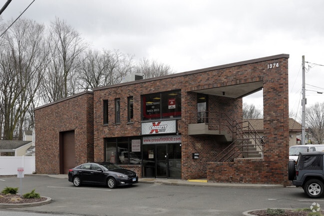
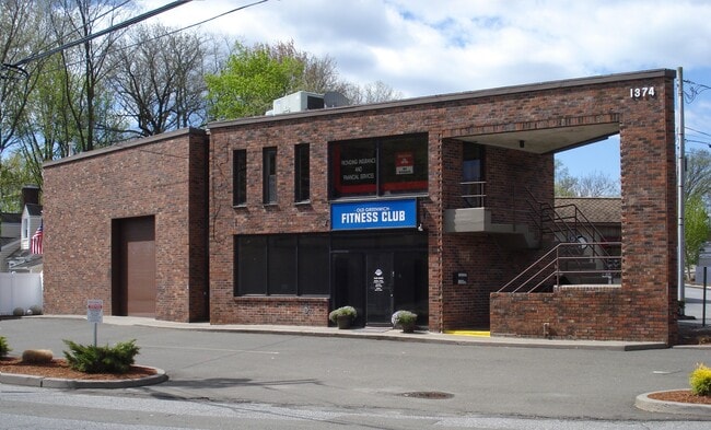
Property Record
1374 E Putnam Ave, Old Greenwich, CT 06870

Property Detail
1374 E Putnam Ave
Commercialofficeresidentialmixeduse
Western Ct
LB
Connecticut
B and X Area of moderate flood hazard, usually the area between the limits of the 100-year and 500-year floods.
0.15 AC
2025
Greenwich
2025
Westchester/So Connecticut
011000
Bridgeport-Stamford-Danbury, CT
4,315 SF
GREE-000006-000000-001045-S000000
NEARBY LISTINGS FOR SALE OR LEASE
DEMOGRAPHICS near 1374 E Putnam Ave
1 mile
3 mile
5 mile
2025 Total Population
15,988
119,143
193,474
2030 Population
16,286
122,253
198,031
Pop Growth 2025-2030
+ 1.86%
+ 2.61%
+ 2.36%
Average Age
40
39
40
2025 Total Households
5,466
47,644
74,843
HH Growth 2025-2030
+ 1.99%
+ 2.93%
+ 2.55%
Median Household Inc
$115,266
$111,137
$119,023
Avg Household Size
2.80
2.40
2.50
2025 Avg HH Vehicles
2.00
2.00
2.00
Median Home Value
$1,064,395
$877,546
$864,092
Median Year Built
1971
1975
1969
Nearby Places
Map Layers
Map Styles
 Street
 Aerial
Layers
 Traffic
 Biking
Places
Listings with unknown addresses are not visible on the map
- Restaurants
- Banks
- Shops
- Fitness
- Groceries
PUBLIC TRANSPORTATION
TRANSIT/SUBWAY
Old Greenwich Station (New Haven Line - Metro-North Commuter Railroad Company (Metro-North))
Drive
Walk
Distance
Old Greenwich Station (New Haven Line - Metro-North Commuter Railroad Company (Metro-North))
3 min
18 min
0.9 mi
COMMUTER RAIL
Old Greenwich Station (New Haven Line - Metro-North Commuter Railroad Company (Metro-North))
Drive
Walk
Distance
Old Greenwich Station (New Haven Line - Metro-North Commuter Railroad Company (Metro-North))
3 min
18 min
0.9 mi
Riverside Station (New Haven Line - Metro-North Commuter Railroad Company (Metro-North))
Drive
Walk
Distance
Riverside Station (New Haven Line - Metro-North Commuter Railroad Company (Metro-North))
4 min
1.6 mi
AIRPORT
Westchester County
Drive
Walk
Distance
Westchester County
20 min
10.6 mi
LaGuardia
Drive
Walk
Distance
LaGuardia
47 min
30.1 mi
John F Kennedy International
Drive
Walk
Distance
John F Kennedy International
53 min
37.7 mi
Freight Ports
NY - Red Hook Container Terminal
Drive
Walk
Distance
NY - Red Hook Container Terminal
61 min
40.6 mi
SALE & LEASE HISTORY
LISTING DATE
SALE/LEASE

Sep 12, 2022
For Lease
Mar 16, 2017
For Sale
Jul 23, 2019
For Sale
Jan 14, 2019
For Lease
Jan 13, 2020
For Lease
Apr 12, 2017
For Lease
Nearby Properties
Address
Land Use
TOTAL SIZE
Lot Size
Zoning
Address
Land Use
TOTAL SIZE
Lot Size
Zoning
13.21 AC
CSCD
Address
Land Use
TOTAL SIZE
Lot Size
Zoning
5.10 AC
MXD
Address
Land Use
TOTAL SIZE
Lot Size
Zoning
7,791 SF
33.47 AC
RA-1
Address
Land Use
TOTAL SIZE
Lot Size
Zoning
57,033 SF
33.04 AC
RA-1
Address
Land Use
TOTAL SIZE
Lot Size
Zoning
Address
Land Use
TOTAL SIZE
Lot Size
Zoning
397,378 SF
4.25 AC
CC
Address
Land Use
TOTAL SIZE
Lot Size
Zoning
543,005 SF
2.23 AC
RHD
Address
Land Use
TOTAL SIZE
Lot Size
Zoning
411,596 SF
3.30 AC
MZN
Address
Land Use
TOTAL SIZE
Lot Size
Zoning
4.13 AC
CC
Address
Land Use
TOTAL SIZE
Lot Size
Zoning
Address
Land Use
TOTAL SIZE
Lot Size
Zoning
46,302 SF
23.50 AC
MG
Address
Land Use
TOTAL SIZE
Lot Size
Zoning
9.62 AC
MZN
Address
Land Use
TOTAL SIZE
Lot Size
Zoning
17.54 AC
DWD
Address
Land Use
TOTAL SIZE
Lot Size
Zoning
359,686 SF
1.67 AC
CCN
Address
Land Use
TOTAL SIZE
Lot Size
Zoning
377,754 SF
2.06 AC
PD
Address
Land Use
TOTAL SIZE
Lot Size
Zoning
79.29 AC
P
Address
Land Use
TOTAL SIZE
Lot Size
Zoning
32.68 AC
MD
Address
Land Use
TOTAL SIZE
Lot Size
Zoning
8.21 AC
CWD
Address
Land Use
TOTAL SIZE
Lot Size
Zoning
9.56 AC
R-6
Address
Land Use
TOTAL SIZE
Lot Size
Zoning
98,106 SF
42.71 AC
RA-2
Address
Land Use
TOTAL SIZE
Lot Size
Zoning
304,617 SF
CI
Address
Land Use
TOTAL SIZE
Lot Size
Zoning
74,446 SF
10.39 AC
R-MF
Address
Land Use
TOTAL SIZE
Lot Size
Zoning
121,807 SF
16.08 AC
R-12
Address
Land Use
TOTAL SIZE
Lot Size
Zoning
377,918 SF
22.42 AC
MZN
Address
Land Use
TOTAL SIZE
Lot Size
Zoning
304,345 SF
1.15 AC
PD
Address
Land Use
TOTAL SIZE
Lot Size
Zoning
277,740 SF
2.82 AC
TCDD
Address
Land Use
TOTAL SIZE
Lot Size
Zoning
308,621 SF
CI
Address
Land Use
TOTAL SIZE
Lot Size
Zoning
235,186 SF
1.29 AC
CG
Address
Land Use
TOTAL SIZE
Lot Size
Zoning
3.14 AC
RH
Address
Land Use
TOTAL SIZE
Lot Size
Zoning
1.95 AC
SRDS
The World's #1 Commercial Real Estate Marketplace
Connect with us
© 2026 CoStar Group
The information above has been obtained from sources believed reliable. While we do not doubt its accuracy we have not verified it and make no guarantee, warranty or representation about it. It is your responsibility to independently confirm its accuracy and completeness. Any projections, opinions, assumptions, or estimates used are for example only and do not represent the current or future performance of the property. The value of this transaction to you depends on tax and other factors which should be evaluated by your tax, financial, and legal advisors. You and your advisors should conduct a careful, independent investigation of the property to determine to your satisfaction the suitability of the property for your needs.