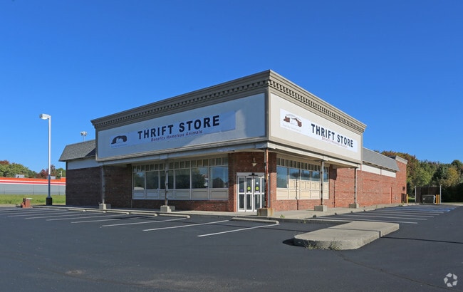
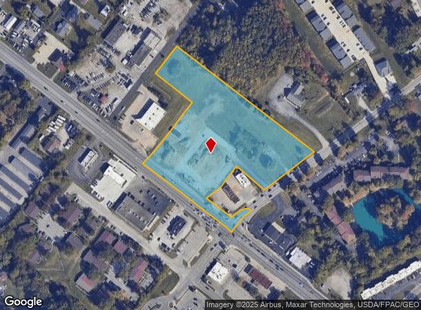
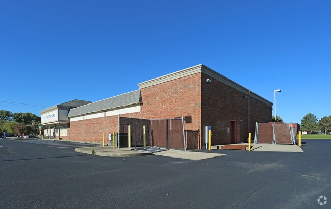
Property Record
1374 State Route 125, Amelia, OH 45102
NEARBY LISTINGS FOR SALE OR LEASE
Property Detail
1374 State Route 125
Cincinnati, OH-KY-IN
Edgar H Fiscus Farm
03-45-23C-044
EDGAR H FISCUS FARM; LOT 44
Commercialacreage
Clermont
X
Ohio
39025C0240G
44
2024
0.87 AC
2024
Eastgate/Anderson Twp
041105
Cincinnati/Dayton
10,112 SF
DEMOGRAPHICS near 1374 State Route 125
1 Mile
3 Mile
5 Mile
2024 Total Population
8,052
35,930
80,205
2029 Population
8,242
37,060
82,763
Pop Growth 2024-2029
+ 2.36%
+ 3.15%
+ 3.19%
Average Age
40
40
40
2024 Total Households
3,170
14,116
32,829
HH Growth 2024-2029
+ 2.43%
+ 3.17%
+ 3.27%
Median Household Inc
$68,113
$69,609
$66,430
Avg Household Size
2.50
2.50
2.40
2024 Avg HH Vehicles
2.00
2.00
2.00
Median Home Value
$221,102
$223,237
$217,374
Median Year Built
1989
1991
1989
Nearby Places
Map Layers
Map Styles
 Street
 Aerial
- Restaurants
- Banks
- Shops
- Fitness
- Groceries
PUBLIC TRANSPORTATION
AIRPORT
Cincinnati/Northern Kentucky International
DRIVE
WALK
Distance
Cincinnati/Northern Kentucky International
32 min
27.0 mi
Freight Ports
Virginia Port Authority - Richmond
DRIVE
WALK
Distance
Virginia Port Authority - Richmond
1 min
385.3 mi
SALE & LEASE HISTORY
LISTING DATE
SALE/LEASE

May 20, 2019
For Lease
Apr 15, 2020
For Sale
Nearby Properties
Address
Land Use
TOTAL SIZE
Lot Size
Zoning
Address
Land Use
TOTAL SIZE
Lot Size
Zoning
7,560 SF
79.10 AC
Address
Land Use
TOTAL SIZE
Lot Size
Zoning
104,856 SF
32.81 AC
Address
Land Use
TOTAL SIZE
Lot Size
Zoning
8,914 SF
37.70 AC
Address
Land Use
TOTAL SIZE
Lot Size
Zoning
49.15 AC
Address
Land Use
TOTAL SIZE
Lot Size
Zoning
16.02 AC
Address
Land Use
TOTAL SIZE
Lot Size
Zoning
1,380 SF
8.78 AC
Address
Land Use
TOTAL SIZE
Lot Size
Zoning
11,442 SF
9.70 AC
Address
Land Use
TOTAL SIZE
Lot Size
Zoning
168,266 SF
105.07 AC
Address
Land Use
TOTAL SIZE
Lot Size
Zoning
70,489 SF
8.57 AC
Address
Land Use
TOTAL SIZE
Lot Size
Zoning
65,720 SF
7.49 AC
Address
Land Use
TOTAL SIZE
Lot Size
Zoning
216,760 SF
26.34 AC
Address
Land Use
TOTAL SIZE
Lot Size
Zoning
275,706 SF
14.82 AC
Address
Land Use
TOTAL SIZE
Lot Size
Zoning
6,900 SF
37.76 AC
Address
Land Use
TOTAL SIZE
Lot Size
Zoning
4,920 SF
2.50 AC
Address
Land Use
TOTAL SIZE
Lot Size
Zoning
7,822 SF
8.47 AC
Address
Land Use
TOTAL SIZE
Lot Size
Zoning
67,894 SF
6.02 AC
Address
Land Use
TOTAL SIZE
Lot Size
Zoning
Address
Land Use
TOTAL SIZE
Lot Size
Zoning
4,680 SF
10 AC
Address
Land Use
TOTAL SIZE
Lot Size
Zoning
42,300 SF
10.72 AC
Address
Land Use
TOTAL SIZE
Lot Size
Zoning
29,856 SF
19.21 AC
Address
Land Use
TOTAL SIZE
Lot Size
Zoning
65,720 SF
7.49 AC
Address
Land Use
TOTAL SIZE
Lot Size
Zoning
20,482 SF
39.58 AC
Address
Land Use
TOTAL SIZE
Lot Size
Zoning
8,173 SF
4.03 AC
Address
Land Use
TOTAL SIZE
Lot Size
Zoning
6,304 SF
8.05 AC
Address
Land Use
TOTAL SIZE
Lot Size
Zoning
305,514 SF
9.04 AC
Address
Land Use
TOTAL SIZE
Lot Size
Zoning
19,654 SF
11.57 AC
Address
Land Use
TOTAL SIZE
Lot Size
Zoning
11,300 SF
5.70 AC
Address
Land Use
TOTAL SIZE
Lot Size
Zoning
32,200 SF
8.76 AC
Address
Land Use
TOTAL SIZE
Lot Size
Zoning
44.65 AC
Address
Land Use
TOTAL SIZE
Lot Size
Zoning
800 SF
39.98 AC
The World's #1 Commercial Real Estate Marketplace
Connect with us
© 2025 CoStar Group
The information above has been obtained from sources believed reliable. While we do not doubt its accuracy we have not verified it and make no guarantee, warranty or representation about it. It is your responsibility to independently confirm its accuracy and completeness. Any projections, opinions, assumptions, or estimates used are for example only and do not represent the current or future performance of the property. The value of this transaction to you depends on tax and other factors which should be evaluated by your tax, financial, and legal advisors. You and your advisors should conduct a careful, independent investigation of the property to determine to your satisfaction the suitability of the property for your needs.