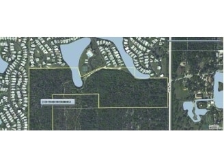
Property Record
1375 82Nd Ave, Vero Beach, FL 32966

NEARBY LISTINGS FOR SALE OR LEASE
Property Detail
1375 82Nd Ave
Sebastian-Vero Beach-West Vero Corridor, FL
Indian River Farms Company S/D
33-38-11-00001-0010-00001.0
INDIAN RIVER FARMS CO SUB IND RIV FARMS CO SUB PBS 2-25 THAT POR OF TRS 1, 2, 7 & 8, MORE PART DESC AS FOLL: COM AT SW COR OF SAID TR 7 & RUN N 00 DEG 12 MIN 55 SEC W ALONG W LINE OF TR 7 FOR 60.0 FT TO N R/W OF ROSEDALE RD (12TH ST), TO POB; TH CONT
Miscellaneous
Indian River
A
Florida
12061C0219J
1
2025
44.67 AC
2025
Fort Pierce/Port St Lucie
050709
Other Market Areas
DEMOGRAPHICS near 1375 82Nd Ave
1 Mile
3 Mile
5 Mile
2024 Total Population
5,803
16,637
37,015
2029 Population
6,514
18,694
41,232
Pop Growth 2024-2029
+ 12.25%
+ 12.36%
+ 11.39%
Average Age
57
56
51
2024 Total Households
2,997
8,611
16,902
HH Growth 2024-2029
+ 11.64%
+ 11.88%
+ 11.00%
Median Household Inc
$49,043
$54,110
$59,285
Avg Household Size
1.90
1.90
2.10
2024 Avg HH Vehicles
1.00
2.00
2.00
Median Home Value
$88,094
$209,753
$260,002
Median Year Built
1992
1991
1992
Nearby Places
Map Layers
Map Styles
 Street
 Aerial
- Restaurants
- Banks
- Shops
- Fitness
- Groceries
SALE & LEASE HISTORY
LISTING DATE
SALE/LEASE

Sep 24, 2016
For Sale
Nearby Properties
Address
Land Use
TOTAL SIZE
Lot Size
Zoning
Address
Land Use
TOTAL SIZE
Lot Size
Zoning
223,614 SF
38.25 AC
RM-8
Address
Land Use
TOTAL SIZE
Lot Size
Zoning
83,174 SF
49.75 AC
PD
Address
Land Use
TOTAL SIZE
Lot Size
Zoning
2,391 SF
44.51 AC
CG
Address
Land Use
TOTAL SIZE
Lot Size
Zoning
204,103 SF
33.89 AC
RM-8
Address
Land Use
TOTAL SIZE
Lot Size
Zoning
27.70 AC
RS-6
Address
Land Use
TOTAL SIZE
Lot Size
Zoning
6,532 SF
21.92 AC
RM-6
Address
Land Use
TOTAL SIZE
Lot Size
Zoning
1,944 SF
21.99 AC
RM-8
Address
Land Use
TOTAL SIZE
Lot Size
Zoning
408,898 SF
78.81 AC
CG
Address
Land Use
TOTAL SIZE
Lot Size
Zoning
241,529 SF
29.18 AC
RM-8
Address
Land Use
TOTAL SIZE
Lot Size
Zoning
83,300 SF
84.34 AC
A-1
Address
Land Use
TOTAL SIZE
Lot Size
Zoning
298,394 SF
14 AC
RM-6
Address
Land Use
TOTAL SIZE
Lot Size
Zoning
180,092 SF
14.66 AC
RM-8
Address
Land Use
TOTAL SIZE
Lot Size
Zoning
178,300 SF
5.69 AC
PDTND
Address
Land Use
TOTAL SIZE
Lot Size
Zoning
181,621 SF
28.49 AC
RM-6
Address
Land Use
TOTAL SIZE
Lot Size
Zoning
23,607 SF
39.05 AC
IL
Address
Land Use
TOTAL SIZE
Lot Size
Zoning
95,845 SF
10 AC
RM-8
Address
Land Use
TOTAL SIZE
Lot Size
Zoning
69,815 SF
3.28 AC
PDTND
Address
Land Use
TOTAL SIZE
Lot Size
Zoning
23,022 SF
59.40 AC
A-1
Address
Land Use
TOTAL SIZE
Lot Size
Zoning
75.77 AC
RM-6
Address
Land Use
TOTAL SIZE
Lot Size
Zoning
1,660 SF
203.81 AC
RS-3
Address
Land Use
TOTAL SIZE
Lot Size
Zoning
64,392 SF
6.02 AC
CG
Address
Land Use
TOTAL SIZE
Lot Size
Zoning
2,349 SF
8.04 AC
PD
Address
Land Use
TOTAL SIZE
Lot Size
Zoning
2,681 SF
33.93 AC
A-1
Address
Land Use
TOTAL SIZE
Lot Size
Zoning
48,800 SF
4.18 AC
CG
Address
Land Use
TOTAL SIZE
Lot Size
Zoning
83.54 AC
RM-6
Address
Land Use
TOTAL SIZE
Lot Size
Zoning
129,601 SF
10.15 AC
CG
Address
Land Use
TOTAL SIZE
Lot Size
Zoning
2,100 SF
3.92 AC
PD
Address
Land Use
TOTAL SIZE
Lot Size
Zoning
120,385 SF
8.76 AC
CG
Address
Land Use
TOTAL SIZE
Lot Size
Zoning
45,560 SF
3 AC
CG
Address
Land Use
TOTAL SIZE
Lot Size
Zoning
2,240 SF
78.82 AC
A-1
The World's #1 Commercial Real Estate Marketplace
Connect with us
© 2026 CoStar Group
The information above has been obtained from sources believed reliable. While we do not doubt its accuracy we have not verified it and make no guarantee, warranty or representation about it. It is your responsibility to independently confirm its accuracy and completeness. Any projections, opinions, assumptions, or estimates used are for example only and do not represent the current or future performance of the property. The value of this transaction to you depends on tax and other factors which should be evaluated by your tax, financial, and legal advisors. You and your advisors should conduct a careful, independent investigation of the property to determine to your satisfaction the suitability of the property for your needs.