Property Record
1375 Crossman Ave, Sunnyvale, CA 94089


Property Detail
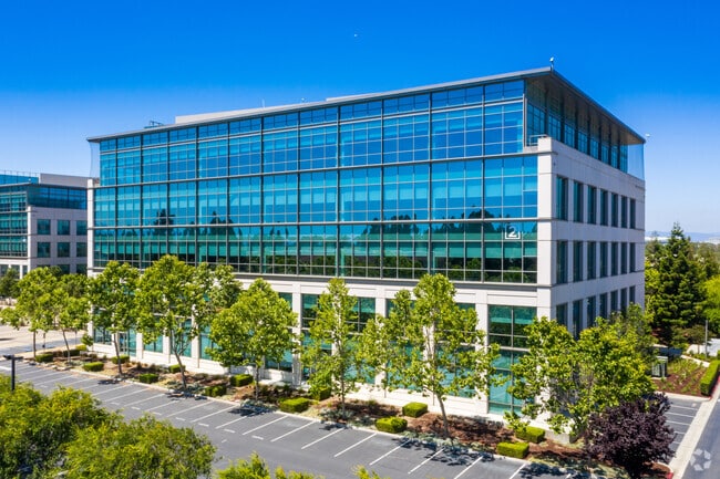
1375 Crossman Ave
Industrialgeneral
Santa Clara
MP-TO
California
AE The base floodplain where base flood elevations are provided. AE Zones are now used on new format FIRMs instead of A1-A30 Zones.
1.10 AC
2024
Moffett Park
2025
South Bay/San Jose
504602
San Jose-Sunnyvale-Santa Clara, CA
189,778 SF
110-32-027
NEARBY LISTINGS FOR SALE OR LEASE
DEMOGRAPHICS near 1375 Crossman Ave
1 mile
3 mile
5 mile
2025 Total Population
8,328
83,450
314,572
2030 Population
8,615
86,374
324,248
Pop Growth 2025-2030
+ 3.45%
+ 3.50%
+ 3.08%
Average Age
41
38
38
2025 Total Households
3,448
32,061
122,607
HH Growth 2025-2030
+ 3.22%
+ 3.60%
+ 3.15%
Median Household Inc
$159,135
$175,188
$184,604
Avg Household Size
2.40
2.50
2.50
2025 Avg HH Vehicles
2.00
2.00
2.00
Median Home Value
$291,631
$1,059,824
$1,103,855
Median Year Built
2001
1990
1979
Nearby Places
Map Layers
Map Styles
 Street
 Aerial
Layers
 Traffic
 Biking
Places
Listings with unknown addresses are not visible on the map
- Restaurants
- Banks
- Shops
- Fitness
- Groceries
PUBLIC TRANSPORTATION
TRANSIT/SUBWAY
Crossman Station (Mountain View - Winchester Line - Santa Clara VTA Light Rail)
Drive
Walk
Distance
Crossman Station (Mountain View - Winchester Line - Santa Clara VTA Light Rail)
1 min
8 min
0.4 mi
Borregas Station (Mountain View - Winchester Line - Santa Clara VTA Light Rail)
Drive
Walk
Distance
Borregas Station (Mountain View - Winchester Line - Santa Clara VTA Light Rail)
2 min
13 min
0.7 mi
Fair Oaks Station (Mountain View - Winchester Line - Santa Clara VTA Light Rail)
Drive
Walk
Distance
Fair Oaks Station (Mountain View - Winchester Line - Santa Clara VTA Light Rail)
3 min
17 min
0.9 mi
COMMUTER RAIL
Drive
Walk
Distance
8 min
3.5 mi
Drive
Walk
Distance
7 min
3.6 mi
AIRPORT
Norman Y Mineta San Jose International
Drive
Walk
Distance
Norman Y Mineta San Jose International
12 min
7.1 mi
San Francisco International
Drive
Walk
Distance
San Francisco International
36 min
28.1 mi
Metro Oakland International
Drive
Walk
Distance
Metro Oakland International
45 min
35.0 mi
Freight Ports
Port of Redwood City
Drive
Walk
Distance
Port of Redwood City
21 min
15.0 mi
SALE & LEASE HISTORY
LISTING DATE
SALE/LEASE

May 18, 2021
For Lease
Nearby Properties
Address
Land Use
TOTAL SIZE
Lot Size
Zoning
Address
Land Use
TOTAL SIZE
Lot Size
Zoning
777,000 SF
17.84 AC
MS
Address
Land Use
TOTAL SIZE
Lot Size
Zoning
424,316 SF
22.37 AC
SU
Address
Land Use
TOTAL SIZE
Lot Size
Zoning
1,640,399 SF
101.23 AC
MP-I
Address
Land Use
TOTAL SIZE
Lot Size
Zoning
318,172 SF
60.47 AC
MP-TO
Address
Land Use
TOTAL SIZE
Lot Size
Zoning
107,203 SF
21.74 AC
MXD2
Address
Land Use
TOTAL SIZE
Lot Size
Zoning
16.72 AC
MSLSP
Address
Land Use
TOTAL SIZE
Lot Size
Zoning
181,562 SF
16.51 AC
ML
Address
Land Use
TOTAL SIZE
Lot Size
Zoning
818,051 SF
13.81 AC
CP
Address
Land Use
TOTAL SIZE
Lot Size
Zoning
73,425 SF
14.20 AC
MS
Address
Land Use
TOTAL SIZE
Lot Size
Zoning
4 AC
DSP/1
Address
Land Use
TOTAL SIZE
Lot Size
Zoning
181,709 SF
24.01 AC
MPI
Address
Land Use
TOTAL SIZE
Lot Size
Zoning
81,250 SF
14.73 AC
MPT
Address
Land Use
TOTAL SIZE
Lot Size
Zoning
431,256 SF
12.43 AC
PPSP
Address
Land Use
TOTAL SIZE
Lot Size
Zoning
350,633 SF
1.08 AC
MPTOD
Address
Land Use
TOTAL SIZE
Lot Size
Zoning
350,633 SF
1.27 AC
MPTOD
Address
Land Use
TOTAL SIZE
Lot Size
Zoning
23.19 AC
MP-I
Address
Land Use
TOTAL SIZE
Lot Size
Zoning
350,633 SF
1.08 AC
MPTOD
Address
Land Use
TOTAL SIZE
Lot Size
Zoning
587,826 SF
2.54 AC
DSP/1
Address
Land Use
TOTAL SIZE
Lot Size
Zoning
353,745 SF
14.82 AC
PPSP
Address
Land Use
TOTAL SIZE
Lot Size
Zoning
17.25 AC
MPI
Address
Land Use
TOTAL SIZE
Lot Size
Zoning
530,457 SF
6.71 AC
A(PD)
Address
Land Use
TOTAL SIZE
Lot Size
Zoning
162,205 SF
18.69 AC
MS
Address
Land Use
TOTAL SIZE
Lot Size
Zoning
107.73 AC
CT
Address
Land Use
TOTAL SIZE
Lot Size
Zoning
23,709 SF
7.48 AC
PPSP
Address
Land Use
TOTAL SIZE
Lot Size
Zoning
22,400 SF
11.43 AC
MP-TO
Address
Land Use
TOTAL SIZE
Lot Size
Zoning
22.40 AC
PD
Address
Land Use
TOTAL SIZE
Lot Size
Zoning
22.40 AC
PD
Address
Land Use
TOTAL SIZE
Lot Size
Zoning
350,633 SF
1.27 AC
MPTOD
Address
Land Use
TOTAL SIZE
Lot Size
Zoning
350,633 SF
1.27 AC
MPTOD
Address
Land Use
TOTAL SIZE
Lot Size
Zoning
312,510 SF
23.46 AC
P41
The World's #1 Commercial Real Estate Marketplace
Connect with us
© 2026 CoStar Group
The information above has been obtained from sources believed reliable. While we do not doubt its accuracy we have not verified it and make no guarantee, warranty or representation about it. It is your responsibility to independently confirm its accuracy and completeness. Any projections, opinions, assumptions, or estimates used are for example only and do not represent the current or future performance of the property. The value of this transaction to you depends on tax and other factors which should be evaluated by your tax, financial, and legal advisors. You and your advisors should conduct a careful, independent investigation of the property to determine to your satisfaction the suitability of the property for your needs.