Property Record
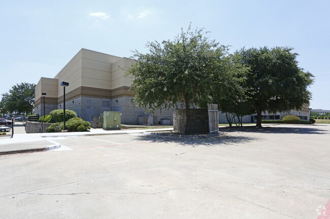
1375 E Campbell Rd, Richardson, TX 75081


Property Detail
1375 E Campbell Rd
420190500B0010000
CAMPBELL CREEK PLACE BLK B LT 1 ACS 5.8448 VOL98017/3630 DD012198 CO-DALLAS 0190500B00100 3420190500B
Gymhealthspa
DALLAS
Z109
Texas
B and X Area of moderate flood hazard, usually the area between the limits of the 100-year and 500-year floods.
1
2024
5.85 AC
2025
Richardson
019052
Dallas/Ft Worth
47,112 SF
Dallas-Fort Worth-Arlington, TX
NEARBY LISTINGS FOR SALE OR LEASE
DEMOGRAPHICS near 1375 E Campbell Rd
1 mile
3 mile
5 mile
2025 Total Population
6,985
108,004
378,497
2030 Population
7,208
115,076
403,673
Pop Growth 2025-2030
+ 3.19%
+ 6.55%
+ 6.65%
Average Age
40
39
38
2025 Total Households
3,209
45,455
142,860
HH Growth 2025-2030
+ 3.71%
+ 7.37%
+ 7.14%
Median Household Inc
$103,642
$92,409
$81,589
Avg Household Size
2.10
2.30
2.50
2025 Avg HH Vehicles
2.00
2.00
2.00
Median Home Value
$388,516
$382,396
$387,444
Median Year Built
1995
1985
1982
Nearby Places
Map Layers
Map Styles
 Street
 Aerial
Layers
 Traffic
 Biking
Places
Listings with unknown addresses are not visible on the map
- Restaurants
- Banks
- Shops
- Fitness
- Groceries
PUBLIC TRANSPORTATION
AIRPORT
Dallas Love Field
Drive
Walk
Distance
Dallas Love Field
27 min
17.9 mi
Dallas-Fort Worth International
Drive
Walk
Distance
Dallas-Fort Worth International
34 min
26.8 mi
Nearby Properties
Address
Land Use
TOTAL SIZE
Lot Size
Zoning
Address
Land Use
TOTAL SIZE
Lot Size
Zoning
1,049,441 SF
Address
Land Use
TOTAL SIZE
Lot Size
Zoning
1,283,376 SF
11.62 AC
Address
Land Use
TOTAL SIZE
Lot Size
Zoning
1,050,550 SF
18.24 AC
Address
Land Use
TOTAL SIZE
Lot Size
Zoning
479,209 SF
19.97 AC
Address
Land Use
TOTAL SIZE
Lot Size
Zoning
453,635 SF
19.04 AC
RT
Address
Land Use
TOTAL SIZE
Lot Size
Zoning
641,243 SF
20.67 AC
Z109
Address
Land Use
TOTAL SIZE
Lot Size
Zoning
630,247 SF
42 AC
Z239
Address
Land Use
TOTAL SIZE
Lot Size
Zoning
766,245 SF
49.94 AC
COMM
Address
Land Use
TOTAL SIZE
Lot Size
Zoning
567,715 SF
4.75 AC
LC/PD-A
Address
Land Use
TOTAL SIZE
Lot Size
Zoning
1,105,509 SF
92.46 AC
A
Address
Land Use
TOTAL SIZE
Lot Size
Zoning
242,201 SF
14.54 AC
RT
Address
Land Use
TOTAL SIZE
Lot Size
Zoning
384,538 SF
2.63 AC
LI-1
Address
Land Use
TOTAL SIZE
Lot Size
Zoning
490,285 SF
29.66 AC
LC/PD-A
Address
Land Use
TOTAL SIZE
Lot Size
Zoning
595,150 SF
17.20 AC
MF-H
Address
Land Use
TOTAL SIZE
Lot Size
Zoning
768,061 SF
42.03 AC
Z02
Address
Land Use
TOTAL SIZE
Lot Size
Zoning
487,093 SF
6.28 AC
MF-E
Address
Land Use
TOTAL SIZE
Lot Size
Zoning
394,287 SF
14.96 AC
Address
Land Use
TOTAL SIZE
Lot Size
Zoning
507,693 SF
32.50 AC
MFL
Address
Land Use
TOTAL SIZE
Lot Size
Zoning
377,152 SF
3.91 AC
O-S
Address
Land Use
TOTAL SIZE
Lot Size
Zoning
279,693 SF
19.86 AC
Z239
Address
Land Use
TOTAL SIZE
Lot Size
Zoning
548,300 SF
17.29 AC
Z239
Address
Land Use
TOTAL SIZE
Lot Size
Zoning
509,566 SF
34.05 AC
PD
Address
Land Use
TOTAL SIZE
Lot Size
Zoning
289,093 SF
8.87 AC
R/O-2
Address
Land Use
TOTAL SIZE
Lot Size
Zoning
284,830 SF
2.98 AC
Address
Land Use
TOTAL SIZE
Lot Size
Zoning
324,000 SF
6.67 AC
O-S
Address
Land Use
TOTAL SIZE
Lot Size
Zoning
129,810 SF
14.93 AC
Z236
Address
Land Use
TOTAL SIZE
Lot Size
Zoning
374,266 SF
19.42 AC
Z239
Address
Land Use
TOTAL SIZE
Lot Size
Zoning
421,532 SF
4.29 AC
Address
Land Use
TOTAL SIZE
Lot Size
Zoning
795,714 SF
5.36 AC
Z109
The World's #1 Commercial Real Estate Marketplace
Connect with us
© 2026 CoStar Group
The information above has been obtained from sources believed reliable. While we do not doubt its accuracy we have not verified it and make no guarantee, warranty or representation about it. It is your responsibility to independently confirm its accuracy and completeness. Any projections, opinions, assumptions, or estimates used are for example only and do not represent the current or future performance of the property. The value of this transaction to you depends on tax and other factors which should be evaluated by your tax, financial, and legal advisors. You and your advisors should conduct a careful, independent investigation of the property to determine to your satisfaction the suitability of the property for your needs.