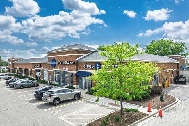
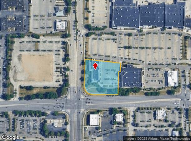
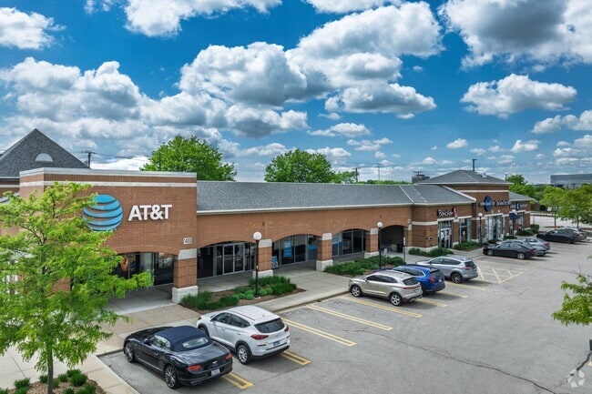
Property Record
1375 N Meacham Rd, Schaumburg, IL 60173
NEARBY LISTINGS FOR SALE OR LEASE
Property Detail
1375 N Meacham Rd
07-12-401-004-0000
Woodfield Village Green Subdivision Numb
Commercialbuilding
Cook
2023
Illinois
2024
Schaumburg Area
804603
Chicago
16,504 SF
Chicago-Naperville-Elgin, IL-IN-WI
DEMOGRAPHICS near 1375 N Meacham Rd
1 Mile
3 Mile
5 Mile
2024 Total Population
4,343
83,041
274,500
2029 Population
4,212
80,618
266,177
Pop Growth 2024-2029
(3.02%)
(2.92%)
(3.03%)
Average Age
37
41
42
2024 Total Households
2,068
32,628
107,035
HH Growth 2024-2029
(3.09%)
(3.22%)
(3.34%)
Median Household Inc
$77,697
$88,670
$92,788
Avg Household Size
2.10
2.40
2.50
2024 Avg HH Vehicles
1.00
2.00
2.00
Median Home Value
$214,204
$303,395
$327,973
Median Year Built
1976
1975
1974
Nearby Places
Map Layers
Map Styles
 Street
 Aerial
- Restaurants
- Banks
- Shops
- Fitness
- Groceries
PUBLIC TRANSPORTATION
COMMUTER RAIL
Palatine Station (Union Pacific Northwest Line - Northeast Illinois Regional Commuter Railroad (Metra))
DRIVE
WALK
Distance
Palatine Station (Union Pacific Northwest Line - Northeast Illinois Regional Commuter Railroad (Metra))
10 min
4.8 mi
Arlington Park Station (Union Pacific Northwest Line - Northeast Illinois Regional Commuter Railroad (Metra))
DRIVE
WALK
Distance
Arlington Park Station (Union Pacific Northwest Line - Northeast Illinois Regional Commuter Railroad (Metra))
11 min
5.2 mi
AIRPORT
Chicago O'Hare International
DRIVE
WALK
Distance
Chicago O'Hare International
22 min
13.8 mi
Chicago Midway International
DRIVE
WALK
Distance
Chicago Midway International
42 min
29.0 mi
SALE & LEASE HISTORY
LISTING DATE
SALE/LEASE

Sep 25, 2016
For Lease
Nearby Properties
Address
Land Use
TOTAL SIZE
Lot Size
Zoning
Address
Land Use
TOTAL SIZE
Lot Size
Zoning
42.14 AC
Address
Land Use
TOTAL SIZE
Lot Size
Zoning
800,552 SF
38.86 AC
Address
Land Use
TOTAL SIZE
Lot Size
Zoning
32.56 AC
Address
Land Use
TOTAL SIZE
Lot Size
Zoning
Address
Land Use
TOTAL SIZE
Lot Size
Zoning
Address
Land Use
TOTAL SIZE
Lot Size
Zoning
Address
Land Use
TOTAL SIZE
Lot Size
Zoning
782,746 SF
12.44 AC
Address
Land Use
TOTAL SIZE
Lot Size
Zoning
300,000 SF
9.29 AC
Address
Land Use
TOTAL SIZE
Lot Size
Zoning
961,890 SF
42.21 AC
Address
Land Use
TOTAL SIZE
Lot Size
Zoning
875,776 SF
8.73 AC
Address
Land Use
TOTAL SIZE
Lot Size
Zoning
369,303 SF
29.96 AC
Address
Land Use
TOTAL SIZE
Lot Size
Zoning
510,788 SF
39.93 AC
Address
Land Use
TOTAL SIZE
Lot Size
Zoning
12.66 AC
Address
Land Use
TOTAL SIZE
Lot Size
Zoning
748,059 SF
7.36 AC
Address
Land Use
TOTAL SIZE
Lot Size
Zoning
303,671 SF
10.94 AC
Address
Land Use
TOTAL SIZE
Lot Size
Zoning
427,761 SF
30.41 AC
Address
Land Use
TOTAL SIZE
Lot Size
Zoning
388,080 SF
12.64 AC
Address
Land Use
TOTAL SIZE
Lot Size
Zoning
Address
Land Use
TOTAL SIZE
Lot Size
Zoning
24.55 AC
Address
Land Use
TOTAL SIZE
Lot Size
Zoning
298,493 SF
9.76 AC
Address
Land Use
TOTAL SIZE
Lot Size
Zoning
239,700 SF
Address
Land Use
TOTAL SIZE
Lot Size
Zoning
490,458 SF
13.52 AC
Address
Land Use
TOTAL SIZE
Lot Size
Zoning
544,744 SF
14.87 AC
Address
Land Use
TOTAL SIZE
Lot Size
Zoning
290,000 SF
9.08 AC
Address
Land Use
TOTAL SIZE
Lot Size
Zoning
117,825 SF
4.49 AC
Address
Land Use
TOTAL SIZE
Lot Size
Zoning
375,417 SF
13.35 AC
Address
Land Use
TOTAL SIZE
Lot Size
Zoning
302,135 SF
19.28 AC
Address
Land Use
TOTAL SIZE
Lot Size
Zoning
Address
Land Use
TOTAL SIZE
Lot Size
Zoning
Address
Land Use
TOTAL SIZE
Lot Size
Zoning
303,701 SF
31.18 AC
The World's #1 Commercial Real Estate Marketplace
Connect with us
© 2025 CoStar Group
The information above has been obtained from sources believed reliable. While we do not doubt its accuracy we have not verified it and make no guarantee, warranty or representation about it. It is your responsibility to independently confirm its accuracy and completeness. Any projections, opinions, assumptions, or estimates used are for example only and do not represent the current or future performance of the property. The value of this transaction to you depends on tax and other factors which should be evaluated by your tax, financial, and legal advisors. You and your advisors should conduct a careful, independent investigation of the property to determine to your satisfaction the suitability of the property for your needs.