Property Record
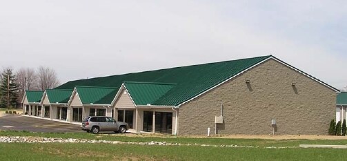
1375 State Route 131, Milford, OH 45150


NEARBY LISTINGS FOR SALE OR LEASE
Property Detail
1375 State Route 131
18-24-05E-298
Jonathan Clarks Military Survey No 972
Commercialnec
05TY .472 TO 307.
X
Clermont
39025C0140G
Ohio
2024
3.18 AC
2024
East
040600
Cincinnati/Dayton
15,600 SF
Cincinnati, OH-KY-IN
DEMOGRAPHICS near 1375 State Route 131
1 Mile
3 Mile
5 Mile
2024 Total Population
6,970
32,289
64,187
2029 Population
7,126
33,039
65,540
Pop Growth 2024-2029
+ 2.24%
+ 2.32%
+ 2.11%
Average Age
40
40
41
2024 Total Households
2,566
12,144
24,425
HH Growth 2024-2029
+ 2.22%
+ 2.26%
+ 2.14%
Median Household Inc
$82,710
$79,367
$83,000
Avg Household Size
2.70
2.60
2.60
2024 Avg HH Vehicles
2.00
2.00
2.00
Median Home Value
$221,170
$225,938
$238,658
Median Year Built
1976
1984
1983
Nearby Places
Map Layers
Map Styles
 Street
 Aerial
- Restaurants
- Banks
- Shops
- Fitness
- Groceries
PUBLIC TRANSPORTATION
AIRPORT
Cincinnati/Northern Kentucky International
DRIVE
WALK
Distance
Cincinnati/Northern Kentucky International
52 min
34.6 mi
Freight Ports
Port of Toledo
DRIVE
WALK
Distance
Port of Toledo
243 min
207.0 mi
SALE & LEASE HISTORY
LISTING DATE
SALE/LEASE

Sep 25, 2016
For Lease
Nearby Properties
Address
Land Use
TOTAL SIZE
Lot Size
Zoning
Address
Land Use
TOTAL SIZE
Lot Size
Zoning
145,346 SF
108.11 AC
Address
Land Use
TOTAL SIZE
Lot Size
Zoning
315,096 SF
9.48 AC
Address
Land Use
TOTAL SIZE
Lot Size
Zoning
43,511 SF
12.36 AC
Address
Land Use
TOTAL SIZE
Lot Size
Zoning
6,432 SF
16.37 AC
Address
Land Use
TOTAL SIZE
Lot Size
Zoning
10.89 AC
Address
Land Use
TOTAL SIZE
Lot Size
Zoning
6.76 AC
Address
Land Use
TOTAL SIZE
Lot Size
Zoning
20,432 SF
20.32 AC
Address
Land Use
TOTAL SIZE
Lot Size
Zoning
12.61 AC
Address
Land Use
TOTAL SIZE
Lot Size
Zoning
210,444 SF
29.04 AC
Address
Land Use
TOTAL SIZE
Lot Size
Zoning
3,042 SF
24.24 AC
Address
Land Use
TOTAL SIZE
Lot Size
Zoning
53,033 SF
17.48 AC
Address
Land Use
TOTAL SIZE
Lot Size
Zoning
200,000 SF
41.92 AC
Address
Land Use
TOTAL SIZE
Lot Size
Zoning
53,033 SF
32.99 AC
Address
Land Use
TOTAL SIZE
Lot Size
Zoning
31,200 SF
3.92 AC
Address
Land Use
TOTAL SIZE
Lot Size
Zoning
27.51 AC
Address
Land Use
TOTAL SIZE
Lot Size
Zoning
Address
Land Use
TOTAL SIZE
Lot Size
Zoning
26,878 SF
14.94 AC
Address
Land Use
TOTAL SIZE
Lot Size
Zoning
7,000 SF
0.18 AC
M1
Address
Land Use
TOTAL SIZE
Lot Size
Zoning
14,400 SF
41.92 AC
Address
Land Use
TOTAL SIZE
Lot Size
Zoning
50,720 SF
6.29 AC
Address
Land Use
TOTAL SIZE
Lot Size
Zoning
86,550 SF
7.13 AC
Address
Land Use
TOTAL SIZE
Lot Size
Zoning
1,748 SF
9.23 AC
Address
Land Use
TOTAL SIZE
Lot Size
Zoning
7,192 SF
19.87 AC
Address
Land Use
TOTAL SIZE
Lot Size
Zoning
3,932 SF
42.43 AC
Address
Land Use
TOTAL SIZE
Lot Size
Zoning
15,065 SF
1.62 AC
Address
Land Use
TOTAL SIZE
Lot Size
Zoning
71,980 SF
8.27 AC
Address
Land Use
TOTAL SIZE
Lot Size
Zoning
16,617 SF
1.54 AC
Address
Land Use
TOTAL SIZE
Lot Size
Zoning
132,622 SF
14.78 AC
Address
Land Use
TOTAL SIZE
Lot Size
Zoning
31,216 SF
5.05 AC
Address
Land Use
TOTAL SIZE
Lot Size
Zoning
43,944 SF
8.34 AC
The World's #1 Commercial Real Estate Marketplace
Connect with us
© 2026 CoStar Group
The information above has been obtained from sources believed reliable. While we do not doubt its accuracy we have not verified it and make no guarantee, warranty or representation about it. It is your responsibility to independently confirm its accuracy and completeness. Any projections, opinions, assumptions, or estimates used are for example only and do not represent the current or future performance of the property. The value of this transaction to you depends on tax and other factors which should be evaluated by your tax, financial, and legal advisors. You and your advisors should conduct a careful, independent investigation of the property to determine to your satisfaction the suitability of the property for your needs.