Property Record
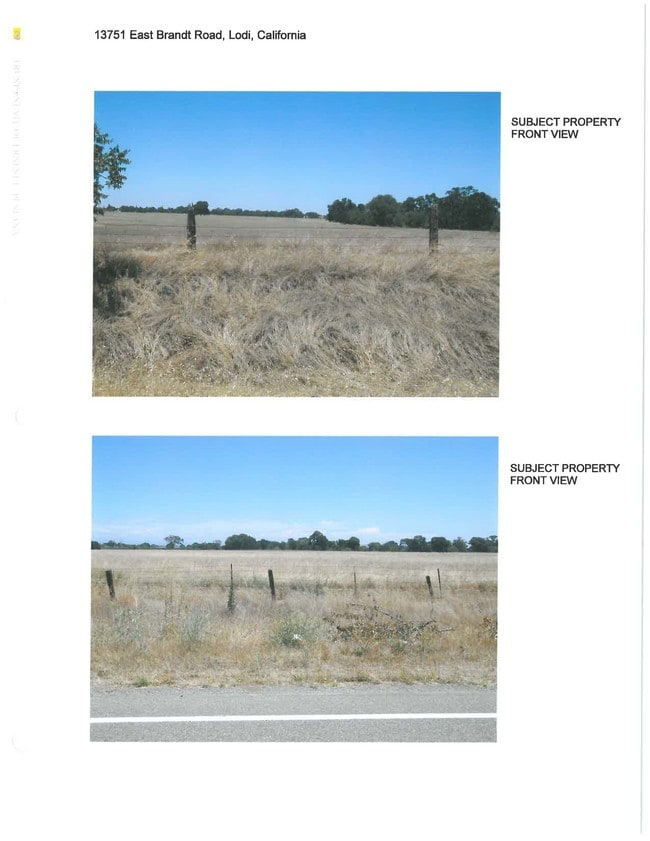
13751 E Brandt Rd, Lodi, CA 95240

Property Detail
13751 E Brandt Rd
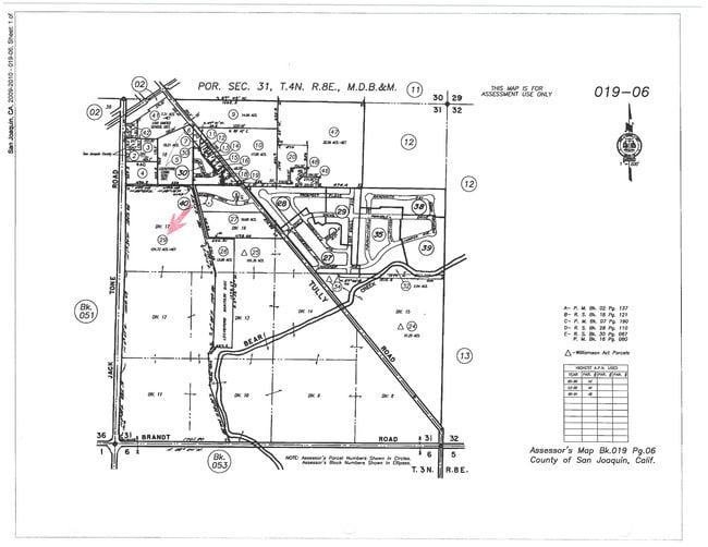
019-060-29
84 ACREAGE REVISION PER RS 28-110
Residentialacreage
SAN JOAQUIN
RL
California
AE The base floodplain where base flood elevations are provided. AE Zones are now used on new format FIRMs instead of A1-A30 Zones.
124.73 AC
2025
Lodi
2025
Stockton/Modesto
004701
Stockton-Lodi, CA
NEARBY LISTINGS FOR SALE OR LEASE
-
-
View all Lodi listings for sale on LoopNet.com
DEMOGRAPHICS near 13751 E Brandt Rd
1 mile
3 mile
5 mile
2025 Total Population
2,297
4,128
8,753
2030 Population
2,352
4,150
8,655
Pop Growth 2025-2030
+ 2.39%
+ 0.53%
(1.12%)
Average Age
43
43
43
2025 Total Households
846
1,477
3,070
HH Growth 2025-2030
+ 2.60%
+ 0.74%
(0.94%)
Median Household Inc
$99,878
$103,776
$106,398
Avg Household Size
2.70
2.70
2.80
2025 Avg HH Vehicles
2.00
2.00
3.00
Median Home Value
$441,573
$561,189
$675,947
Median Year Built
1982
1981
1978
Nearby Places
Map Layers
Map Styles
 Street
 Aerial
Transit
 Traffic
 Biking
Places
Listings with unknown addresses are not visible on the map
- Restaurants
- Banks
- Shops
- Fitness
- Groceries
PUBLIC TRANSPORTATION
COMMUTER RAIL
Lodi Amtrak Station (San Joaquins - Amtrak)
Drive
Walk
Distance
Lodi Amtrak Station (San Joaquins - Amtrak)
12 min
7.7 mi
AIRPORT
Stockton Metro
Drive
Walk
Distance
Stockton Metro
32 min
22.5 mi
Freight Ports
Port of Stockton
Drive
Walk
Distance
Port of Stockton
31 min
21.0 mi
SALE & LEASE HISTORY
LISTING DATE
SALE/LEASE

Sep 24, 2016
For Sale
Sep 13, 2017
For Sale
Nearby Properties
Address
Land Use
TOTAL SIZE
Lot Size
Zoning
Address
Land Use
TOTAL SIZE
Lot Size
Zoning
12.15 AC
IL
Address
Land Use
TOTAL SIZE
Lot Size
Zoning
13,832 SF
23.61 AC
IG
Address
Land Use
TOTAL SIZE
Lot Size
Zoning
49,680 SF
19.93 AC
IG
Address
Land Use
TOTAL SIZE
Lot Size
Zoning
58,032 SF
23.90 AC
IG
Address
Land Use
TOTAL SIZE
Lot Size
Zoning
4.85 AC
RL
Address
Land Use
TOTAL SIZE
Lot Size
Zoning
4.42 AC
CG
Address
Land Use
TOTAL SIZE
Lot Size
Zoning
179.07 AC
AG40
Address
Land Use
TOTAL SIZE
Lot Size
Zoning
1,115 SF
91.51 AC
AG40
Address
Land Use
TOTAL SIZE
Lot Size
Zoning
263.45 AC
AG40
Address
Land Use
TOTAL SIZE
Lot Size
Zoning
2,592 SF
104.01 AC
Address
Land Use
TOTAL SIZE
Lot Size
Zoning
1,975 SF
1.88 AC
CC
Address
Land Use
TOTAL SIZE
Lot Size
Zoning
824 SF
145.64 AC
AG40
Address
Land Use
TOTAL SIZE
Lot Size
Zoning
6,576 SF
0.71 AC
CC
Address
Land Use
TOTAL SIZE
Lot Size
Zoning
6,802 SF
45.42 AC
AG40
Address
Land Use
TOTAL SIZE
Lot Size
Zoning
37,326 SF
7 AC
CC
Address
Land Use
TOTAL SIZE
Lot Size
Zoning
3,354 SF
20.72 AC
AG40
Address
Land Use
TOTAL SIZE
Lot Size
Zoning
100,000 SF
20 AC
IG
Address
Land Use
TOTAL SIZE
Lot Size
Zoning
150.70 AC
AG40
Address
Land Use
TOTAL SIZE
Lot Size
Zoning
116.26 AC
AG40
Address
Land Use
TOTAL SIZE
Lot Size
Zoning
1.98 AC
CG
Address
Land Use
TOTAL SIZE
Lot Size
Zoning
3,493 SF
18.68 AC
AG40
Address
Land Use
TOTAL SIZE
Lot Size
Zoning
4,359 SF
44.92 AC
AG40
Address
Land Use
TOTAL SIZE
Lot Size
Zoning
108.72 AC
AG40
Address
Land Use
TOTAL SIZE
Lot Size
Zoning
1,576 SF
168 AC
AG40
Address
Land Use
TOTAL SIZE
Lot Size
Zoning
9,015 SF
0.91 AC
Address
Land Use
TOTAL SIZE
Lot Size
Zoning
13,832 SF
23.61 AC
IG
Address
Land Use
TOTAL SIZE
Lot Size
Zoning
154.65 AC
AG40
Address
Land Use
TOTAL SIZE
Lot Size
Zoning
9,683 SF
42.36 AC
AG40
Address
Land Use
TOTAL SIZE
Lot Size
Zoning
18,796 SF
5.20 AC
CG
The World's #1 Commercial Real Estate Marketplace
Connect with us
© 2026 CoStar Group
The information above has been obtained from sources believed reliable. While we do not doubt its accuracy we have not verified it and make no guarantee, warranty or representation about it. It is your responsibility to independently confirm its accuracy and completeness. Any projections, opinions, assumptions, or estimates used are for example only and do not represent the current or future performance of the property. The value of this transaction to you depends on tax and other factors which should be evaluated by your tax, financial, and legal advisors. You and your advisors should conduct a careful, independent investigation of the property to determine to your satisfaction the suitability of the property for your needs.