Property Record
13795 Sw 36Th Avenue Rd, Ocala, FL 34473
NEARBY LISTINGS FOR SALE OR LEASE
-
-
View all Ocala listings for lease on LoopNet.com
Property Detail
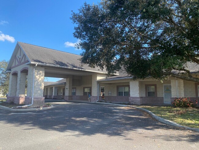
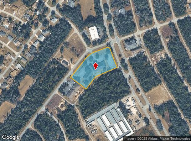
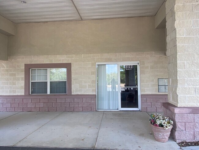
13795 Sw 36Th Avenue Rd
Ocala, FL
Marion Oaks
8002-0245-01
SEC 11 TWP 17 RGE 21 PLAT BOOK O PAGE 019 MARION OAKS UNIT 2 BLK 245 LOTS 1.2.3
Medicalbuilding
Marion
X
Florida
12083C0720D
1
2025
2.47 AC
2025
Outlying Marion County
001013
Ocala
17,300 SF
DEMOGRAPHICS near 13795 Sw 36Th Avenue Rd
1 Mile
3 Mile
5 Mile
2024 Total Population
5,604
22,376
47,410
2029 Population
6,385
25,835
54,409
Pop Growth 2024-2029
+ 13.94%
+ 15.46%
+ 14.76%
Average Age
39
41
45
2024 Total Households
2,044
8,183
18,712
HH Growth 2024-2029
+ 13.80%
+ 15.21%
+ 14.38%
Median Household Inc
$57,028
$64,875
$64,505
Avg Household Size
2.70
2.70
2.50
2024 Avg HH Vehicles
2.00
2.00
2.00
Median Home Value
$187,456
$186,879
$196,076
Median Year Built
1997
2003
2001
Nearby Places
Map Layers
Map Styles
 Street
 Aerial
- Restaurants
- Banks
- Shops
- Fitness
- Groceries
SALE & LEASE HISTORY
LISTING DATE
SALE/LEASE

Feb 02, 2023
For Lease
Nearby Properties
Address
Land Use
TOTAL SIZE
Lot Size
Zoning
Address
Land Use
TOTAL SIZE
Lot Size
Zoning
1,228,739 SF
200.13 AC
PUD
Address
Land Use
TOTAL SIZE
Lot Size
Zoning
944,472 SF
64.26 AC
PUD
Address
Land Use
TOTAL SIZE
Lot Size
Zoning
250,989 SF
13.26 AC
PUD
Address
Land Use
TOTAL SIZE
Lot Size
Zoning
115,843 SF
40.89 AC
GU
Address
Land Use
TOTAL SIZE
Lot Size
Zoning
132,132 SF
16.17 AC
PUD
Address
Land Use
TOTAL SIZE
Lot Size
Zoning
74,013 SF
22.81 AC
GU
Address
Land Use
TOTAL SIZE
Lot Size
Zoning
8,243 SF
33.70 AC
PRV
Address
Land Use
TOTAL SIZE
Lot Size
Zoning
80,705 SF
63.12 AC
PUD
Address
Land Use
TOTAL SIZE
Lot Size
Zoning
103,764 SF
14.50 AC
R1
Address
Land Use
TOTAL SIZE
Lot Size
Zoning
16,191 SF
2.84 AC
B4
Address
Land Use
TOTAL SIZE
Lot Size
Zoning
12,994 SF
1.98 AC
B2
Address
Land Use
TOTAL SIZE
Lot Size
Zoning
67,524 SF
12.52 AC
B5
Address
Land Use
TOTAL SIZE
Lot Size
Zoning
1,104 SF
46.26 AC
PUD
Address
Land Use
TOTAL SIZE
Lot Size
Zoning
59,024 SF
9.99 AC
B2
Address
Land Use
TOTAL SIZE
Lot Size
Zoning
61,453 SF
18.94 AC
B4
Address
Land Use
TOTAL SIZE
Lot Size
Zoning
9,580 SF
1.45 AC
B2
Address
Land Use
TOTAL SIZE
Lot Size
Zoning
26,223 SF
15.27 AC
B2
Address
Land Use
TOTAL SIZE
Lot Size
Zoning
15,289 SF
9.73 AC
A1
Address
Land Use
TOTAL SIZE
Lot Size
Zoning
60,080 SF
5.48 AC
B2
Address
Land Use
TOTAL SIZE
Lot Size
Zoning
46,723 SF
4.31 AC
B2
Address
Land Use
TOTAL SIZE
Lot Size
Zoning
10,270 SF
6.56 AC
B4
Address
Land Use
TOTAL SIZE
Lot Size
Zoning
36,450 SF
3 AC
B5
Address
Land Use
TOTAL SIZE
Lot Size
Zoning
12,219 SF
356.48 AC
A1
Address
Land Use
TOTAL SIZE
Lot Size
Zoning
8,410 SF
0.46 AC
B2
Address
Land Use
TOTAL SIZE
Lot Size
Zoning
10,179 SF
2.89 AC
B2
Address
Land Use
TOTAL SIZE
Lot Size
Zoning
16,054 SF
7.11 AC
B2
Address
Land Use
TOTAL SIZE
Lot Size
Zoning
6,093 SF
2.40 AC
PUD
Address
Land Use
TOTAL SIZE
Lot Size
Zoning
21,708 SF
2.76 AC
B2
Address
Land Use
TOTAL SIZE
Lot Size
Zoning
14,700 SF
2.06 AC
B2
Address
Land Use
TOTAL SIZE
Lot Size
Zoning
18,344 SF
5.35 AC
R1
The World's #1 Commercial Real Estate Marketplace
Connect with us
© 2026 CoStar Group
The information above has been obtained from sources believed reliable. While we do not doubt its accuracy we have not verified it and make no guarantee, warranty or representation about it. It is your responsibility to independently confirm its accuracy and completeness. Any projections, opinions, assumptions, or estimates used are for example only and do not represent the current or future performance of the property. The value of this transaction to you depends on tax and other factors which should be evaluated by your tax, financial, and legal advisors. You and your advisors should conduct a careful, independent investigation of the property to determine to your satisfaction the suitability of the property for your needs.