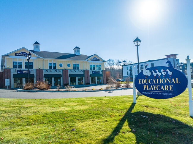
Property Record
138 E High St, East Hampton, CT 06424

Property Detail
138 E High St
EHAM-000010A-000085-000005A
Lower Ct River Vly
Commercialbuilding
Connecticut
DD
5a
B and X Area of moderate flood hazard, usually the area between the limits of the 100-year and 500-year floods.
5.28 AC
2025
East Hampton/East Haddam
2025
Hartford
550201
Hartford-West Hartford-East Hartford, CT
17,000 SF
NEARBY LISTINGS FOR SALE OR LEASE
DEMOGRAPHICS near 138 E High St
1 mile
3 mile
5 mile
2025 Total Population
2,338
12,062
21,538
2030 Population
2,408
12,235
21,791
Pop Growth 2025-2030
+ 2.99%
+ 1.43%
+ 1.17%
Average Age
45
44
44
2025 Total Households
1,016
4,954
8,529
HH Growth 2025-2030
+ 3.15%
+ 1.45%
+ 1.17%
Median Household Inc
$118,291
$113,234
$124,163
Avg Household Size
2.30
2.40
2.50
2025 Avg HH Vehicles
2.00
2.00
2.00
Median Home Value
$330,319
$343,388
$367,130
Median Year Built
1963
1975
1976
Nearby Places
Map Layers
Map Styles
 Street
 Aerial
Layers
 Traffic
 Biking
Places
Listings with unknown addresses are not visible on the map
- Restaurants
- Banks
- Shops
- Fitness
- Groceries
PUBLIC TRANSPORTATION
AIRPORT
Bradley International
Drive
Walk
Distance
Bradley International
57 min
35.9 mi
Freight Ports
Port of New Haven
Drive
Walk
Distance
Port of New Haven
53 min
38.1 mi
SALE & LEASE HISTORY
LISTING DATE
SALE/LEASE

Mar 09, 2017
For Lease
Dec 28, 2023
For Lease
Dec 27, 2022
For Sale
Nearby Properties
Address
Land Use
TOTAL SIZE
Lot Size
Zoning
Address
Land Use
TOTAL SIZE
Lot Size
Zoning
127,409 SF
46.70 AC
R-1S
Address
Land Use
TOTAL SIZE
Lot Size
Zoning
12.12 AC
DC
Address
Land Use
TOTAL SIZE
Lot Size
Zoning
75,272 SF
24.50 AC
R-2S
Address
Land Use
TOTAL SIZE
Lot Size
Zoning
81,933 SF
20.65 AC
R
Address
Land Use
TOTAL SIZE
Lot Size
Zoning
81,849 SF
15 AC
R-2
Address
Land Use
TOTAL SIZE
Lot Size
Zoning
11.13 AC
C
Address
Land Use
TOTAL SIZE
Lot Size
Zoning
2.98 AC
C
Address
Land Use
TOTAL SIZE
Lot Size
Zoning
36,865 SF
6.76 AC
R-1S
Address
Land Use
TOTAL SIZE
Lot Size
Zoning
17,000 SF
3.98 AC
R-2S
Address
Land Use
TOTAL SIZE
Lot Size
Zoning
10.53 AC
R-2S
Address
Land Use
TOTAL SIZE
Lot Size
Zoning
19,210 SF
1.85 AC
C
Address
Land Use
TOTAL SIZE
Lot Size
Zoning
39,482 SF
2.54 AC
I
Address
Land Use
TOTAL SIZE
Lot Size
Zoning
18,345 SF
5.40 AC
C
Address
Land Use
TOTAL SIZE
Lot Size
Zoning
16,270 SF
3.01 AC
VC
Address
Land Use
TOTAL SIZE
Lot Size
Zoning
2.96 AC
PO/R
Address
Land Use
TOTAL SIZE
Lot Size
Zoning
7,680 SF
8.63 AC
C
Address
Land Use
TOTAL SIZE
Lot Size
Zoning
Address
Land Use
TOTAL SIZE
Lot Size
Zoning
1.70 AC
C
Address
Land Use
TOTAL SIZE
Lot Size
Zoning
Address
Land Use
TOTAL SIZE
Lot Size
Zoning
483.45 AC
R-3
Address
Land Use
TOTAL SIZE
Lot Size
Zoning
4.96 AC
R-2S
Address
Land Use
TOTAL SIZE
Lot Size
Zoning
36.02 AC
R
Address
Land Use
TOTAL SIZE
Lot Size
Zoning
17,472 SF
0.66 AC
DD
Address
Land Use
TOTAL SIZE
Lot Size
Zoning
17,472 SF
0.65 AC
DD
Address
Land Use
TOTAL SIZE
Lot Size
Zoning
4,968 SF
0.72 AC
C
Address
Land Use
TOTAL SIZE
Lot Size
Zoning
14,580 SF
0.40 AC
R-1S
Address
Land Use
TOTAL SIZE
Lot Size
Zoning
10,593 SF
2.84 AC
C
Address
Land Use
TOTAL SIZE
Lot Size
Zoning
0.84 AC
C
Address
Land Use
TOTAL SIZE
Lot Size
Zoning
5 AC
R-1S
The World's #1 Commercial Real Estate Marketplace
Connect with us
© 2026 CoStar Group
The information above has been obtained from sources believed reliable. While we do not doubt its accuracy we have not verified it and make no guarantee, warranty or representation about it. It is your responsibility to independently confirm its accuracy and completeness. Any projections, opinions, assumptions, or estimates used are for example only and do not represent the current or future performance of the property. The value of this transaction to you depends on tax and other factors which should be evaluated by your tax, financial, and legal advisors. You and your advisors should conduct a careful, independent investigation of the property to determine to your satisfaction the suitability of the property for your needs.