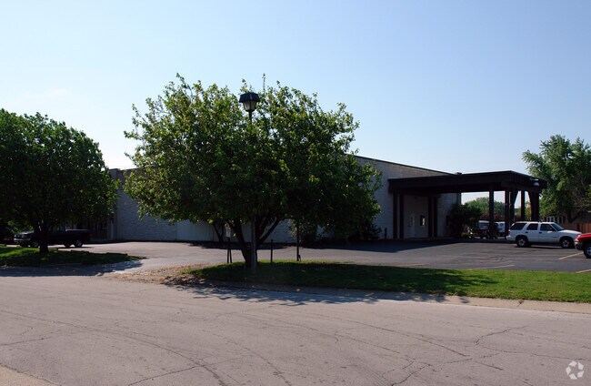
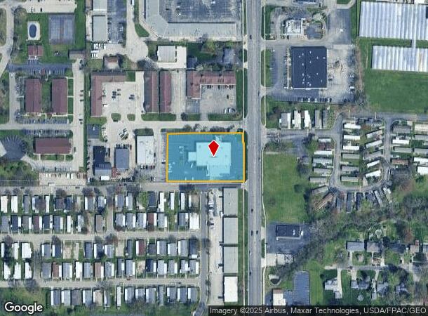
Property Record
138 S Reynolds Rd, Toledo, OH 43615
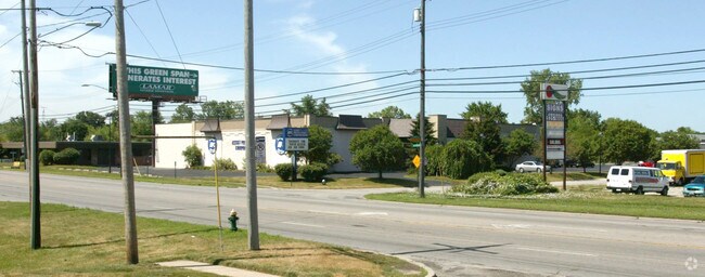
NEARBY LISTINGS FOR SALE OR LEASE
Property Detail
138 S Reynolds Rd
Toledo, OH
Renwyck Amended Plat
13-21837
RENWYCK AMENDED PLAT LOTS 12 & 13 EXC W 30 FT
Officebuilding
Lucas
X
Ohio
39095C0068F
12,13
2024
1 AC
2024
South/Southwest
008601
Toledo
17,217 SF
DEMOGRAPHICS near 138 S Reynolds Rd
1 Mile
3 Mile
5 Mile
2024 Total Population
6,126
74,981
187,536
2029 Population
6,021
74,150
184,501
Pop Growth 2024-2029
(1.71%)
(1.11%)
(1.62%)
Average Age
41
40
40
2024 Total Households
2,828
33,123
82,003
HH Growth 2024-2029
(1.87%)
(1.03%)
(1.62%)
Median Household Inc
$43,565
$49,389
$57,009
Avg Household Size
2.10
2.10
2.20
2024 Avg HH Vehicles
2.00
2.00
2.00
Median Home Value
$93,253
$140,188
$153,091
Median Year Built
1976
1975
1969
Nearby Places
Map Layers
Map Styles
 Street
 Aerial
- Restaurants
- Banks
- Shops
- Fitness
- Groceries
PUBLIC TRANSPORTATION
COMMUTER RAIL
DRIVE
WALK
Distance
13 min
7.1 mi
AIRPORT
Eugene F Kranz Toledo Express
DRIVE
WALK
Distance
Eugene F Kranz Toledo Express
27 min
13.6 mi
Freight Ports
DRIVE
WALK
Distance
26 min
13.2 mi
Nearby Properties
Address
Land Use
TOTAL SIZE
Lot Size
Zoning
Address
Land Use
TOTAL SIZE
Lot Size
Zoning
1,237,446 SF
193.94 AC
10-RS12
Address
Land Use
TOTAL SIZE
Lot Size
Zoning
513,157 SF
39.38 AC
10-MX
Address
Land Use
TOTAL SIZE
Lot Size
Zoning
436,094 SF
30.06 AC
10-RS6
Address
Land Use
TOTAL SIZE
Lot Size
Zoning
329,064 SF
69.74 AC
10-RS6
Address
Land Use
TOTAL SIZE
Lot Size
Zoning
173,943 SF
59.70 AC
10-IP
Address
Land Use
TOTAL SIZE
Lot Size
Zoning
186,190 SF
14 AC
19-C2
Address
Land Use
TOTAL SIZE
Lot Size
Zoning
123,064 SF
10 AC
10-RS6
Address
Land Use
TOTAL SIZE
Lot Size
Zoning
196,149 SF
18.69 AC
10-RD6
Address
Land Use
TOTAL SIZE
Lot Size
Zoning
170,960 SF
4 AC
10-RS6
Address
Land Use
TOTAL SIZE
Lot Size
Zoning
275,113 SF
21 AC
10-MX
Address
Land Use
TOTAL SIZE
Lot Size
Zoning
211,140 SF
28.92 AC
10-IC
Address
Land Use
TOTAL SIZE
Lot Size
Zoning
138,607 SF
21.30 AC
10-RS12
Address
Land Use
TOTAL SIZE
Lot Size
Zoning
141,643 SF
14.31 AC
10-RS9
Address
Land Use
TOTAL SIZE
Lot Size
Zoning
212,664 SF
21.43 AC
24-B3
Address
Land Use
TOTAL SIZE
Lot Size
Zoning
139,741 SF
30.48 AC
19-RA3
Address
Land Use
TOTAL SIZE
Lot Size
Zoning
200,639 SF
16.39 AC
24-SUP
Address
Land Use
TOTAL SIZE
Lot Size
Zoning
169,580 SF
8.98 AC
20-C2
Address
Land Use
TOTAL SIZE
Lot Size
Zoning
67,713 SF
10.24 AC
20-C2
Address
Land Use
TOTAL SIZE
Lot Size
Zoning
59 AC
10-IP
Address
Land Use
TOTAL SIZE
Lot Size
Zoning
203,129 SF
10 AC
10-RS9
Address
Land Use
TOTAL SIZE
Lot Size
Zoning
156,420 SF
12 AC
19-R3
Address
Land Use
TOTAL SIZE
Lot Size
Zoning
238,148 SF
18.20 AC
24-B3
Address
Land Use
TOTAL SIZE
Lot Size
Zoning
200,978 SF
13.15 AC
10-RD6
Address
Land Use
TOTAL SIZE
Lot Size
Zoning
214,986 SF
17.55 AC
19-R1
Address
Land Use
TOTAL SIZE
Lot Size
Zoning
81,672 SF
14.93 AC
10-RS9
Address
Land Use
TOTAL SIZE
Lot Size
Zoning
111,195 SF
13.64 AC
19-C2
Address
Land Use
TOTAL SIZE
Lot Size
Zoning
214,400 SF
13.07 AC
20-C2
Address
Land Use
TOTAL SIZE
Lot Size
Zoning
172,739 SF
10.93 AC
10-IL
Address
Land Use
TOTAL SIZE
Lot Size
Zoning
131,201 SF
10 AC
10-CUP
Address
Land Use
TOTAL SIZE
Lot Size
Zoning
90,782 SF
18.24 AC
20-RA
The World's #1 Commercial Real Estate Marketplace
Connect with us
© 2025 CoStar Group
The information above has been obtained from sources believed reliable. While we do not doubt its accuracy we have not verified it and make no guarantee, warranty or representation about it. It is your responsibility to independently confirm its accuracy and completeness. Any projections, opinions, assumptions, or estimates used are for example only and do not represent the current or future performance of the property. The value of this transaction to you depends on tax and other factors which should be evaluated by your tax, financial, and legal advisors. You and your advisors should conduct a careful, independent investigation of the property to determine to your satisfaction the suitability of the property for your needs.