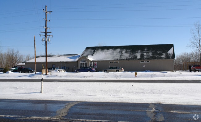
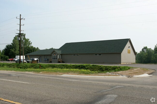
Property Record
1380 N Cedar Rd, Mason, MI 48854

Property Detail
1380 N Cedar Rd
25-05-25-102-011
COM AT NW COR OF SEC 25, TH S00?00'26W ALG W SEC LN 1326.03 FT TO INT W/ EXTND S LN OF SUP PLAT OF ROSE MILLS FARM
Storebuilding
Ingham
C-2
Michigan
A Areas with a 1% annual chance of flooding and a 26% chance of flooding over the life of a 30-year mortgage.
11
2025
1 AC
2025
Southern Lansing
005502
West Michigan
5,021 SF
Lansing-East Lansing, MI
NEARBY LISTINGS FOR SALE OR LEASE
DEMOGRAPHICS near 1380 N Cedar Rd
1 mile
3 mile
5 mile
2025 Total Population
1,641
22,152
56,567
2030 Population
1,647
22,295
57,036
Pop Growth 2025-2030
+ 0.37%
+ 0.65%
+ 0.83%
Average Age
39
41
39
2025 Total Households
630
9,291
23,961
HH Growth 2025-2030
+ 0.32%
+ 0.79%
+ 0.93%
Median Household Inc
$102,148
$82,792
$71,614
Avg Household Size
2.60
2.40
2.30
2025 Avg HH Vehicles
2.00
2.00
2.00
Median Home Value
$228,692
$207,788
$197,688
Median Year Built
1989
1979
1977
Nearby Places
Map Layers
Map Styles
 Street
 Aerial
Layers
 Traffic
 Biking
Places
Listings with unknown addresses are not visible on the map
- Restaurants
- Banks
- Shops
- Fitness
- Groceries
PUBLIC TRANSPORTATION
AIRPORT
Capital Region International
Drive
Walk
Distance
Capital Region International
23 min
12.8 mi
Freight Ports
Port of Toledo
Drive
Walk
Distance
Port of Toledo
136 min
105.2 mi
Nearby Properties
Address
Land Use
TOTAL SIZE
Lot Size
Zoning
Address
Land Use
TOTAL SIZE
Lot Size
Zoning
146,160 SF
88.98 AC
I-1
Address
Land Use
TOTAL SIZE
Lot Size
Zoning
15,000 SF
Address
Land Use
TOTAL SIZE
Lot Size
Zoning
107,580 SF
Address
Land Use
TOTAL SIZE
Lot Size
Zoning
178,096 SF
22.80 AC
IP
Address
Land Use
TOTAL SIZE
Lot Size
Zoning
269,915 SF
Address
Land Use
TOTAL SIZE
Lot Size
Zoning
912 SF
20.97 AC
RM
Address
Land Use
TOTAL SIZE
Lot Size
Zoning
7,868 SF
12.03 AC
RM
Address
Land Use
TOTAL SIZE
Lot Size
Zoning
8,341 SF
27.70 AC
RM
Address
Land Use
TOTAL SIZE
Lot Size
Zoning
616,146 SF
111.68 AC
IP
Address
Land Use
TOTAL SIZE
Lot Size
Zoning
10,112 SF
12.57 AC
RM-1
Address
Land Use
TOTAL SIZE
Lot Size
Zoning
47,352 SF
2.41 AC
TC
Address
Land Use
TOTAL SIZE
Lot Size
Zoning
14,981 SF
12.66 AC
R-1E
Address
Land Use
TOTAL SIZE
Lot Size
Zoning
Address
Land Use
TOTAL SIZE
Lot Size
Zoning
16,913 SF
11.25 AC
R-1E
Address
Land Use
TOTAL SIZE
Lot Size
Zoning
15,439 SF
13.13 AC
R-1E
Address
Land Use
TOTAL SIZE
Lot Size
Zoning
137,084 SF
6.86 AC
M1
Address
Land Use
TOTAL SIZE
Lot Size
Zoning
128,381 SF
11.61 AC
IP
Address
Land Use
TOTAL SIZE
Lot Size
Zoning
65,728 SF
18.32 AC
IP
Address
Land Use
TOTAL SIZE
Lot Size
Zoning
83,464 SF
7.85 AC
RM-1
Address
Land Use
TOTAL SIZE
Lot Size
Zoning
1,708 SF
20.73 AC
RM-1
Address
Land Use
TOTAL SIZE
Lot Size
Zoning
13,824 SF
15.39 AC
R-1E
Address
Land Use
TOTAL SIZE
Lot Size
Zoning
17,136 SF
5.38 AC
RM-1
Address
Land Use
TOTAL SIZE
Lot Size
Zoning
9,710 SF
5.19 AC
C-2
Address
Land Use
TOTAL SIZE
Lot Size
Zoning
7,760 SF
4.58 AC
RM-1
Address
Land Use
TOTAL SIZE
Lot Size
Zoning
7,341 SF
8.53 AC
RM-1
Address
Land Use
TOTAL SIZE
Lot Size
Zoning
Address
Land Use
TOTAL SIZE
Lot Size
Zoning
8,959 SF
2.44 AC
F COMM
Address
Land Use
TOTAL SIZE
Lot Size
Zoning
6,768 SF
228.81 AC
A-1
Address
Land Use
TOTAL SIZE
Lot Size
Zoning
40,000 SF
2.74 AC
IP
Address
Land Use
TOTAL SIZE
Lot Size
Zoning
5,922 SF
6.91 AC
RM-1
The World's #1 Commercial Real Estate Marketplace
Connect with us
© 2026 CoStar Group
The information above has been obtained from sources believed reliable. While we do not doubt its accuracy we have not verified it and make no guarantee, warranty or representation about it. It is your responsibility to independently confirm its accuracy and completeness. Any projections, opinions, assumptions, or estimates used are for example only and do not represent the current or future performance of the property. The value of this transaction to you depends on tax and other factors which should be evaluated by your tax, financial, and legal advisors. You and your advisors should conduct a careful, independent investigation of the property to determine to your satisfaction the suitability of the property for your needs.