Property Record
1380 Piney Green Rd, Jacksonville, NC 28546


NEARBY LISTINGS FOR SALE OR LEASE
Property Detail
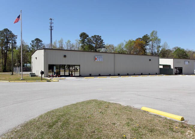
1380 Piney Green Rd
016598
TONI DR & PINEY GR RD
Officebuilding
Onslow
AE
North Carolina
3720439700J
2.32 AC
2025
North Carolina Southeast Area
2025
Other Market Areas
002300
Jacksonville, NC
2,150 SF
DEMOGRAPHICS near 1380 Piney Green Rd
1 Mile
3 Mile
5 Mile
2024 Total Population
4,942
33,014
58,040
2029 Population
5,209
35,047
61,610
Pop Growth 2024-2029
+ 5.40%
+ 6.16%
+ 6.15%
Average Age
33
32
31
2024 Total Households
1,846
12,634
21,498
HH Growth 2024-2029
+ 5.80%
+ 6.41%
+ 6.44%
Median Household Inc
$51,285
$49,516
$50,915
Avg Household Size
2.60
2.50
2.60
2024 Avg HH Vehicles
2.00
2.00
2.00
Median Home Value
$190,658
$169,006
$165,700
Median Year Built
1989
1992
1991
Nearby Places
Map Layers
Map Styles
 Street
 Aerial
- Restaurants
- Banks
- Shops
- Fitness
- Groceries
PUBLIC TRANSPORTATION
AIRPORT
Albert J Ellis
DRIVE
WALK
Distance
Albert J Ellis
40 min
21.5 mi
Coastal Carolina Regional
DRIVE
WALK
Distance
Coastal Carolina Regional
59 min
41.6 mi
Freight Ports
Port of Morehead City
DRIVE
WALK
Distance
Port of Morehead City
64 min
40.7 mi
SALE & LEASE HISTORY
LISTING DATE
SALE/LEASE

Jan 25, 2022
For Lease
Nearby Properties
Address
Land Use
TOTAL SIZE
Lot Size
Zoning
Address
Land Use
TOTAL SIZE
Lot Size
Zoning
244,010 SF
52.70 AC
CC
Address
Land Use
TOTAL SIZE
Lot Size
Zoning
11,192 SF
64.76 AC
OI
Address
Land Use
TOTAL SIZE
Lot Size
Zoning
164,207 SF
43.55 AC
OI
Address
Land Use
TOTAL SIZE
Lot Size
Zoning
40,838 SF
48.30 AC
O-I
Address
Land Use
TOTAL SIZE
Lot Size
Zoning
10,631 SF
8.77 AC
RMF-HD
Address
Land Use
TOTAL SIZE
Lot Size
Zoning
41,676 SF
16.53 AC
CC
Address
Land Use
TOTAL SIZE
Lot Size
Zoning
3,369 SF
79.40 AC
RMF-LD
Address
Land Use
TOTAL SIZE
Lot Size
Zoning
78,855 SF
40.49 AC
R-5
Address
Land Use
TOTAL SIZE
Lot Size
Zoning
7,740 SF
16.50 AC
RMF-LD
Address
Land Use
TOTAL SIZE
Lot Size
Zoning
12,745 SF
30 AC
R-5
Address
Land Use
TOTAL SIZE
Lot Size
Zoning
828 SF
8.56 AC
RMF-HD
Address
Land Use
TOTAL SIZE
Lot Size
Zoning
7,008 SF
9.72 AC
RMF-HD
Address
Land Use
TOTAL SIZE
Lot Size
Zoning
18,312 SF
16.25 AC
IND
Address
Land Use
TOTAL SIZE
Lot Size
Zoning
1,584 SF
61.32 AC
PDR
Address
Land Use
TOTAL SIZE
Lot Size
Zoning
30,942 SF
9.15 AC
RMF-HD
Address
Land Use
TOTAL SIZE
Lot Size
Zoning
42,180 SF
4.23 AC
CC
Address
Land Use
TOTAL SIZE
Lot Size
Zoning
46,502 SF
11.03 AC
CC
Address
Land Use
TOTAL SIZE
Lot Size
Zoning
85,530 SF
4.43 AC
CC
Address
Land Use
TOTAL SIZE
Lot Size
Zoning
4,200 SF
19.96 AC
R-10
Address
Land Use
TOTAL SIZE
Lot Size
Zoning
35,312 SF
3.13 AC
OI
Address
Land Use
TOTAL SIZE
Lot Size
Zoning
75,961 SF
5.96 AC
IND
Address
Land Use
TOTAL SIZE
Lot Size
Zoning
7,432 SF
7.95 AC
RMF-HD
Address
Land Use
TOTAL SIZE
Lot Size
Zoning
958 SF
8.73 AC
RMF-HD
Address
Land Use
TOTAL SIZE
Lot Size
Zoning
24,232 SF
8.06 AC
CC
Address
Land Use
TOTAL SIZE
Lot Size
Zoning
12,348 SF
3.57 AC
OI
Address
Land Use
TOTAL SIZE
Lot Size
Zoning
102,544 SF
11.60 AC
IND
Address
Land Use
TOTAL SIZE
Lot Size
Zoning
51,105 SF
7.86 AC
OI
Address
Land Use
TOTAL SIZE
Lot Size
Zoning
3,262 SF
8.52 AC
OI
Address
Land Use
TOTAL SIZE
Lot Size
Zoning
4,040 SF
13.48 AC
HB
Address
Land Use
TOTAL SIZE
Lot Size
Zoning
5,598 SF
4 AC
RMF-HD
The World's #1 Commercial Real Estate Marketplace
Connect with us
© 2025 CoStar Group
The information above has been obtained from sources believed reliable. While we do not doubt its accuracy we have not verified it and make no guarantee, warranty or representation about it. It is your responsibility to independently confirm its accuracy and completeness. Any projections, opinions, assumptions, or estimates used are for example only and do not represent the current or future performance of the property. The value of this transaction to you depends on tax and other factors which should be evaluated by your tax, financial, and legal advisors. You and your advisors should conduct a careful, independent investigation of the property to determine to your satisfaction the suitability of the property for your needs.