Property Record
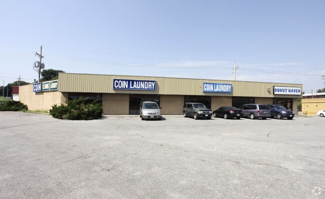
13807 P St, Omaha, NE 68137


NEARBY LISTINGS FOR SALE OR LEASE
Property Detail
13807 P St
Omaha-Council Bluffs, NE-IA
Westchester Of Millard
3456-3047-24
WESTCHESTER OF MILLARD LOT 431 BLOCK 0 NWSTLY TRIA 119.3 FT LT 500 -EX PT HWY RWY & N121 W120.7 FT- LT 501 & WSTLY 3140 SQ FT LT 502 & -EX ST- E15 W30 S297.05 FT LT 431
Regionalshoppingcenterormallwithanchorstore
Douglas
X
Nebraska
31153C0035H
431
2024
0.81 AC
2025
Southwest Omaha
007455
Omaha/Council Bluffs
5,159 SF
DEMOGRAPHICS near 13807 P St
1 Mile
3 Mile
5 Mile
2024 Total Population
10,048
85,266
206,263
2029 Population
10,106
87,023
212,150
Pop Growth 2024-2029
+ 0.58%
+ 2.06%
+ 2.85%
Average Age
39
39
39
2024 Total Households
4,075
33,445
80,264
HH Growth 2024-2029
+ 0.64%
+ 2.19%
+ 2.85%
Median Household Inc
$73,935
$85,460
$91,570
Avg Household Size
2.40
2.50
2.50
2024 Avg HH Vehicles
2.00
2.00
2.00
Median Home Value
$181,363
$229,402
$266,990
Median Year Built
1976
1983
1987
Nearby Places
Map Layers
Map Styles
 Street
 Aerial
- Restaurants
- Banks
- Shops
- Fitness
- Groceries
PUBLIC TRANSPORTATION
AIRPORT
Eppley Airfield
DRIVE
WALK
Distance
Eppley Airfield
28 min
17.1 mi
Freight Ports
Tulsa Port Of Catoosa
DRIVE
WALK
Distance
Tulsa Port Of Catoosa
474 min
426.2 mi
SALE & LEASE HISTORY
LISTING DATE
SALE/LEASE

Feb 01, 2023
For Sale
Nearby Properties
Address
Land Use
TOTAL SIZE
Lot Size
Zoning
Address
Land Use
TOTAL SIZE
Lot Size
Zoning
3,654 SF
39.62 AC
Address
Land Use
TOTAL SIZE
Lot Size
Zoning
209,917 SF
9.52 AC
Address
Land Use
TOTAL SIZE
Lot Size
Zoning
370,890 SF
11.20 AC
CC
Address
Land Use
TOTAL SIZE
Lot Size
Zoning
315,685 SF
21.57 AC
RG10
Address
Land Use
TOTAL SIZE
Lot Size
Zoning
56,174 SF
8.65 AC
Address
Land Use
TOTAL SIZE
Lot Size
Zoning
252,985 SF
6.53 AC
Address
Land Use
TOTAL SIZE
Lot Size
Zoning
8.10 AC
Address
Land Use
TOTAL SIZE
Lot Size
Zoning
369,614 SF
18.03 AC
CC
Address
Land Use
TOTAL SIZE
Lot Size
Zoning
23.99 AC
Address
Land Use
TOTAL SIZE
Lot Size
Zoning
294,334 SF
19.14 AC
R6
Address
Land Use
TOTAL SIZE
Lot Size
Zoning
22.05 AC
Address
Land Use
TOTAL SIZE
Lot Size
Zoning
85,632 SF
5.69 AC
Address
Land Use
TOTAL SIZE
Lot Size
Zoning
282,180 SF
13.96 AC
Address
Land Use
TOTAL SIZE
Lot Size
Zoning
23,890 SF
14.34 AC
I2
Address
Land Use
TOTAL SIZE
Lot Size
Zoning
423,905 SF
21.96 AC
GI
Address
Land Use
TOTAL SIZE
Lot Size
Zoning
281,964 SF
18.15 AC
R6
Address
Land Use
TOTAL SIZE
Lot Size
Zoning
210,585 SF
142.28 AC
I2
Address
Land Use
TOTAL SIZE
Lot Size
Zoning
274,072 SF
12.06 AC
Address
Land Use
TOTAL SIZE
Lot Size
Zoning
258,637 SF
24.30 AC
Address
Land Use
TOTAL SIZE
Lot Size
Zoning
268,545 SF
7.53 AC
Address
Land Use
TOTAL SIZE
Lot Size
Zoning
124,820 SF
9.69 AC
MU
Address
Land Use
TOTAL SIZE
Lot Size
Zoning
144,271 SF
4.75 AC
Address
Land Use
TOTAL SIZE
Lot Size
Zoning
238,428 SF
18.64 AC
R5
Address
Land Use
TOTAL SIZE
Lot Size
Zoning
154,164 SF
13.33 AC
Address
Land Use
TOTAL SIZE
Lot Size
Zoning
211,228 SF
4.79 AC
Address
Land Use
TOTAL SIZE
Lot Size
Zoning
201,293 SF
4.71 AC
Address
Land Use
TOTAL SIZE
Lot Size
Zoning
128,497 SF
13.49 AC
Address
Land Use
TOTAL SIZE
Lot Size
Zoning
12,998 SF
15.63 AC
Address
Land Use
TOTAL SIZE
Lot Size
Zoning
20.66 AC
The World's #1 Commercial Real Estate Marketplace
Connect with us
© 2026 CoStar Group
The information above has been obtained from sources believed reliable. While we do not doubt its accuracy we have not verified it and make no guarantee, warranty or representation about it. It is your responsibility to independently confirm its accuracy and completeness. Any projections, opinions, assumptions, or estimates used are for example only and do not represent the current or future performance of the property. The value of this transaction to you depends on tax and other factors which should be evaluated by your tax, financial, and legal advisors. You and your advisors should conduct a careful, independent investigation of the property to determine to your satisfaction the suitability of the property for your needs.