Property Record
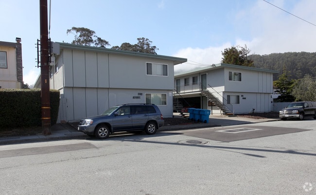
1383 Adobe Dr, Pacifica, CA 94044


Property Detail
1383 Adobe Dr
San Francisco-San Mateo-Redwood City, CA
LOT 36 ADOBE RANCHO MAP NO 1 RSM 30/29 30
023-222-050
San Mateo
Multifamilydwelling
California
A Areas with a 1% annual chance of flooding and a 26% chance of flooding over the life of a 30-year mortgage.
36
2024
0.52 AC
2025
Linda Mar
603300
San Francisco
15,246 SF
NEARBY LISTINGS FOR SALE OR LEASE
-
-
View all Pacifica listings for sale on LoopNet.com
DEMOGRAPHICS near 1383 Adobe Dr
1 mile
3 mile
5 mile
2025 Total Population
9,755
18,943
93,024
2030 Population
9,766
18,974
92,885
Pop Growth 2025-2030
+ 0.11%
+ 0.16%
(0.15%)
Average Age
45
46
44
2025 Total Households
3,551
7,040
33,106
HH Growth 2025-2030
+ 0.03%
+ 0.10%
(0.27%)
Median Household Inc
$146,206
$149,246
$151,915
Avg Household Size
2.70
2.70
2.70
2025 Avg HH Vehicles
2.00
2.00
2.00
Median Home Value
$1,112,635
$1,101,037
$1,087,556
Median Year Built
1958
1964
1966
Nearby Places
Map Layers
Map Styles
 Street
 Aerial
Transit
 Traffic
 Biking
Places
Listings with unknown addresses are not visible on the map
- Restaurants
- Banks
- Shops
- Fitness
- Groceries
PUBLIC TRANSPORTATION
COMMUTER RAIL
San Bruno Caltrain Station Southbound (Local Weekday - Caltrain (Caltrain), Local Weekend - Caltrain (Caltrain))
Drive
Walk
Distance
San Bruno Caltrain Station Southbound (Local Weekday - Caltrain (Caltrain), Local Weekend - Caltrain (Caltrain))
17 min
9.3 mi
AIRPORT
San Francisco International
Drive
Walk
Distance
San Francisco International
23 min
12.0 mi
Metro Oakland International
Drive
Walk
Distance
Metro Oakland International
53 min
36.7 mi
Freight Ports
Port of San Francisco
Drive
Walk
Distance
Port of San Francisco
28 min
19.3 mi
Nearby Properties
Address
Land Use
TOTAL SIZE
Lot Size
Zoning
Address
Land Use
TOTAL SIZE
Lot Size
Zoning
144,294 SF
12.12 AC
CL00C1
Address
Land Use
TOTAL SIZE
Lot Size
Zoning
73,485 SF
3.94 AC
R30000
Address
Land Use
TOTAL SIZE
Lot Size
Zoning
83,760 SF
1.49 AC
R30000
Address
Land Use
TOTAL SIZE
Lot Size
Zoning
0.75 AC
Address
Land Use
TOTAL SIZE
Lot Size
Zoning
74,279 SF
2.28 AC
R30000
Address
Land Use
TOTAL SIZE
Lot Size
Zoning
74,815 SF
1.70 AC
Address
Land Use
TOTAL SIZE
Lot Size
Zoning
23,940 SF
0.55 AC
CL00C1
Address
Land Use
TOTAL SIZE
Lot Size
Zoning
20,408 SF
1.57 AC
CL00C2
Address
Land Use
TOTAL SIZE
Lot Size
Zoning
9.10 AC
PF0000
Address
Land Use
TOTAL SIZE
Lot Size
Zoning
6.70 AC
Address
Land Use
TOTAL SIZE
Lot Size
Zoning
34,207 SF
1.72 AC
Address
Land Use
TOTAL SIZE
Lot Size
Zoning
2.63 AC
CL00C2
Address
Land Use
TOTAL SIZE
Lot Size
Zoning
8,239 SF
0.28 AC
Address
Land Use
TOTAL SIZE
Lot Size
Zoning
7.56 AC
00099X
Address
Land Use
TOTAL SIZE
Lot Size
Zoning
9,944 SF
0.34 AC
Address
Land Use
TOTAL SIZE
Lot Size
Zoning
8,312 SF
0.22 AC
Address
Land Use
TOTAL SIZE
Lot Size
Zoning
1,257 SF
171.30 AC
AB0005
Address
Land Use
TOTAL SIZE
Lot Size
Zoning
1.23 AC
Address
Land Use
TOTAL SIZE
Lot Size
Zoning
31,732 SF
0.68 AC
C10000
Address
Land Use
TOTAL SIZE
Lot Size
Zoning
8,524 SF
0.21 AC
Address
Land Use
TOTAL SIZE
Lot Size
Zoning
16,230 SF
0.36 AC
C10000
Address
Land Use
TOTAL SIZE
Lot Size
Zoning
8,680 SF
0.18 AC
Address
Land Use
TOTAL SIZE
Lot Size
Zoning
2.08 AC
Address
Land Use
TOTAL SIZE
Lot Size
Zoning
14,467 SF
1.47 AC
CL00C1
Address
Land Use
TOTAL SIZE
Lot Size
Zoning
9,462 SF
0.46 AC
Address
Land Use
TOTAL SIZE
Lot Size
Zoning
10,124 SF
0.34 AC
Address
Land Use
TOTAL SIZE
Lot Size
Zoning
4,861 SF
0.12 AC
The World's #1 Commercial Real Estate Marketplace
Connect with us
© 2026 CoStar Group
The information above has been obtained from sources believed reliable. While we do not doubt its accuracy we have not verified it and make no guarantee, warranty or representation about it. It is your responsibility to independently confirm its accuracy and completeness. Any projections, opinions, assumptions, or estimates used are for example only and do not represent the current or future performance of the property. The value of this transaction to you depends on tax and other factors which should be evaluated by your tax, financial, and legal advisors. You and your advisors should conduct a careful, independent investigation of the property to determine to your satisfaction the suitability of the property for your needs.