Property Record
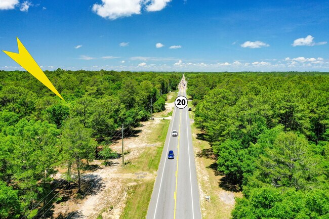
E State Highway 20 E, Freeport, FL 32439

Save to a Folder
{{folder.Name}}
{{folder.ListingIds.length}} Properties
{{folder.ListingIds.length}} Property
Create a New Folder
Property Detail
E State Highway 20 E
14-1S-19-23000-012-0071
EAST 108 FT OF WEST 408 FT OF N 400 FT SOUTH OF ST RD 20 IN SW4 OF SE4 SEC 14-1S-19W OR 2698-3518 OR 2818-1974 OR 3199-3844 OR 3313-4266
Miscellaneous
WALTON
MUNI
Florida
B and X Area of moderate flood hazard, usually the area between the limits of the 100-year and 500-year floods.
71
2025
0.99 AC
2025
Florida Panhandle Area
950502
Other Market Areas
637 SF
Crestview-Fort Walton Beach-Destin, FL
NEARBY LISTINGS FOR SALE OR LEASE
DEMOGRAPHICS near E State Highway 20 E
1 mile
3 mile
5 mile
2025 Total Population
687
5,335
10,728
2030 Population
758
5,926
11,900
Pop Growth 2025-2030
+ 10.33%
+ 11.08%
+ 10.92%
Average Age
38
37
38
2025 Total Households
253
1,945
3,926
HH Growth 2025-2030
+ 9.49%
+ 10.33%
+ 10.21%
Median Household Inc
$57,856
$68,951
$63,181
Avg Household Size
2.60
2.70
2.70
2025 Avg HH Vehicles
2.00
2.00
2.00
Median Home Value
$371,052
$339,313
$311,425
Median Year Built
2001
2008
2007
Nearby Places
Map Layers
Map Styles
 Street
 Aerial
Layers
 Traffic
 Biking
Places
Listings with unknown addresses are not visible on the map
- Restaurants
- Banks
- Shops
- Fitness
- Groceries
PUBLIC TRANSPORTATION
AIRPORT
Northwest Florida Beaches International
Drive
Walk
Distance
Northwest Florida Beaches International
41 min
30.1 mi
Eglin AFB/Destin-Ft Walton Beach
Drive
Walk
Distance
Eglin AFB/Destin-Ft Walton Beach
62 min
30.2 mi
Freight Ports
Port of Panama City
Drive
Walk
Distance
Port of Panama City
58 min
40.7 mi
Nearby Properties
Address
Land Use
TOTAL SIZE
Lot Size
Zoning
Address
Land Use
TOTAL SIZE
Lot Size
Zoning
176,047 SF
29.75 AC
Address
Land Use
TOTAL SIZE
Lot Size
Zoning
469,205 SF
21.39 AC
BYLAGR
Address
Land Use
TOTAL SIZE
Lot Size
Zoning
334,804 SF
13.94 AC
MUNI
Address
Land Use
TOTAL SIZE
Lot Size
Zoning
311,974 SF
7.28 AC
Address
Land Use
TOTAL SIZE
Lot Size
Zoning
161,667 SF
26.97 AC
3310
Address
Land Use
TOTAL SIZE
Lot Size
Zoning
63,166 SF
9.06 AC
3310
Address
Land Use
TOTAL SIZE
Lot Size
Zoning
306.09 AC
3310
Address
Land Use
TOTAL SIZE
Lot Size
Zoning
87,549 SF
11 AC
Address
Land Use
TOTAL SIZE
Lot Size
Zoning
Address
Land Use
TOTAL SIZE
Lot Size
Zoning
333.09 AC
3310
Address
Land Use
TOTAL SIZE
Lot Size
Zoning
1,759 SF
0.63 AC
Address
Land Use
TOTAL SIZE
Lot Size
Zoning
88.24 AC
3310
Address
Land Use
TOTAL SIZE
Lot Size
Zoning
81,765 SF
5.51 AC
BYLAGR
Address
Land Use
TOTAL SIZE
Lot Size
Zoning
46,904 SF
93.38 AC
BYLAGR
Address
Land Use
TOTAL SIZE
Lot Size
Zoning
2,072 SF
23.08 AC
MUNI
Address
Land Use
TOTAL SIZE
Lot Size
Zoning
5,624 SF
1.35 AC
3310
Address
Land Use
TOTAL SIZE
Lot Size
Zoning
31,217 SF
5.45 AC
3310
Address
Land Use
TOTAL SIZE
Lot Size
Zoning
12,472 SF
10.63 AC
Address
Land Use
TOTAL SIZE
Lot Size
Zoning
51,885 SF
8.65 AC
3310
Address
Land Use
TOTAL SIZE
Lot Size
Zoning
16,297 SF
13.93 AC
Address
Land Use
TOTAL SIZE
Lot Size
Zoning
4,400 SF
6.04 AC
3310
Address
Land Use
TOTAL SIZE
Lot Size
Zoning
16,804 SF
2.07 AC
Address
Land Use
TOTAL SIZE
Lot Size
Zoning
12,290 SF
1.45 AC
Address
Land Use
TOTAL SIZE
Lot Size
Zoning
30,164 SF
2.23 AC
3310
Address
Land Use
TOTAL SIZE
Lot Size
Zoning
10.84 AC
MUNI
Address
Land Use
TOTAL SIZE
Lot Size
Zoning
12,080 SF
3.50 AC
3310
Address
Land Use
TOTAL SIZE
Lot Size
Zoning
924 SF
11.89 AC
3310
Address
Land Use
TOTAL SIZE
Lot Size
Zoning
17,730 SF
2.68 AC
Address
Land Use
TOTAL SIZE
Lot Size
Zoning
9,475 SF
8.45 AC
3310
Address
Land Use
TOTAL SIZE
Lot Size
Zoning
5,040 SF
36.94 AC
The World's #1 Commercial Real Estate Marketplace
Connect with us
© 2026 CoStar Group
The information above has been obtained from sources believed reliable. While we do not doubt its accuracy we have not verified it and make no guarantee, warranty or representation about it. It is your responsibility to independently confirm its accuracy and completeness. Any projections, opinions, assumptions, or estimates used are for example only and do not represent the current or future performance of the property. The value of this transaction to you depends on tax and other factors which should be evaluated by your tax, financial, and legal advisors. You and your advisors should conduct a careful, independent investigation of the property to determine to your satisfaction the suitability of the property for your needs.