Property Record
1385 N Mcdowell Blvd, Petaluma, CA 94954


Current Lease Availabilities
Property Detail
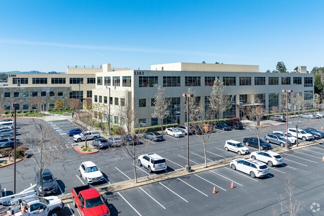
1385 N Mcdowell Blvd
Santa Rosa-Petaluma, CA
2023 TRA CONSOLIDATION 22-23
007-411-049
SONOMA
Officebuilding
California
2025
0.66 AC
2025
Petaluma/Cotati/Rohnert
150607
North Bay/Santa Rosa
54,637 SF
NEARBY LISTINGS FOR SALE OR LEASE
DEMOGRAPHICS near 1385 N Mcdowell Blvd
1 mile
3 mile
5 mile
2025 Total Population
1,806
31,121
99,524
2030 Population
1,728
30,607
99,118
Pop Growth 2025-2030
(4.32%)
(1.65%)
(0.41%)
Average Age
46
44
42
2025 Total Households
759
12,298
37,249
HH Growth 2025-2030
(4.35%)
(1.64%)
(0.44%)
Median Household Inc
$105,032
$109,970
$107,667
Avg Household Size
2.40
2.50
2.50
2025 Avg HH Vehicles
2.00
2.00
2.00
Median Home Value
$873,397
$852,381
$818,922
Median Year Built
1981
1983
1980
Nearby Places
Map Layers
Map Styles
 Street
 Aerial
Layers
 Traffic
 Biking
Places
Listings with unknown addresses are not visible on the map
- Restaurants
- Banks
- Shops
- Fitness
- Groceries
PUBLIC TRANSPORTATION
COMMUTER RAIL
Smart Petaluma North (Main Line - Sonoma Marin Area Rail Transit)
Drive
Walk
Distance
Smart Petaluma North (Main Line - Sonoma Marin Area Rail Transit)
3 min
20 min
1.0 mi
Smart Petaluma Downtown (Main Line - Sonoma Marin Area Rail Transit)
Drive
Walk
Distance
Smart Petaluma Downtown (Main Line - Sonoma Marin Area Rail Transit)
7 min
4.4 mi
AIRPORT
Charles M Schulz - Sonoma County
Drive
Walk
Distance
Charles M Schulz - Sonoma County
28 min
20.9 mi
Freight Ports
Port of Richmond
Drive
Walk
Distance
Port of Richmond
49 min
36.4 mi
Nearby Properties
Address
Land Use
TOTAL SIZE
Lot Size
Zoning
Address
Land Use
TOTAL SIZE
Lot Size
Zoning
226,772 SF
8.05 AC
Address
Land Use
TOTAL SIZE
Lot Size
Zoning
38,083 SF
16.14 AC
Address
Land Use
TOTAL SIZE
Lot Size
Zoning
150,025 SF
1.48 AC
Address
Land Use
TOTAL SIZE
Lot Size
Zoning
63,000 SF
5.40 AC
CITYPE
Address
Land Use
TOTAL SIZE
Lot Size
Zoning
82,704 SF
14.63 AC
CITYPE
Address
Land Use
TOTAL SIZE
Lot Size
Zoning
59,351 SF
14.53 AC
Address
Land Use
TOTAL SIZE
Lot Size
Zoning
83,653 SF
1.18 AC
Address
Land Use
TOTAL SIZE
Lot Size
Zoning
63,959 SF
7.13 AC
Address
Land Use
TOTAL SIZE
Lot Size
Zoning
195,837 SF
16.32 AC
PCD
Address
Land Use
TOTAL SIZE
Lot Size
Zoning
85,582 SF
2.61 AC
CITYPE
Address
Land Use
TOTAL SIZE
Lot Size
Zoning
83,109 SF
9.56 AC
Address
Land Use
TOTAL SIZE
Lot Size
Zoning
20,728 SF
10.36 AC
ML
Address
Land Use
TOTAL SIZE
Lot Size
Zoning
93,700 SF
6.02 AC
ML
Address
Land Use
TOTAL SIZE
Lot Size
Zoning
81,975 SF
5 AC
Address
Land Use
TOTAL SIZE
Lot Size
Zoning
88,482 SF
7.29 AC
Address
Land Use
TOTAL SIZE
Lot Size
Zoning
83,880 SF
5 AC
ML
Address
Land Use
TOTAL SIZE
Lot Size
Zoning
112,240 SF
6.30 AC
PUD
Address
Land Use
TOTAL SIZE
Lot Size
Zoning
5,500 SF
4.70 AC
Address
Land Use
TOTAL SIZE
Lot Size
Zoning
1,614 SF
5.21 AC
RM4
Address
Land Use
TOTAL SIZE
Lot Size
Zoning
78.31 AC
Address
Land Use
TOTAL SIZE
Lot Size
Zoning
32,288 SF
2.59 AC
CITYPE
Address
Land Use
TOTAL SIZE
Lot Size
Zoning
71,884 SF
0.65 AC
Address
Land Use
TOTAL SIZE
Lot Size
Zoning
141,168 SF
9.44 AC
18
Address
Land Use
TOTAL SIZE
Lot Size
Zoning
51,462 SF
0.90 AC
CITYPE
Address
Land Use
TOTAL SIZE
Lot Size
Zoning
35,864 SF
1.67 AC
PUD
Address
Land Use
TOTAL SIZE
Lot Size
Zoning
90,530 SF
2.61 AC
Address
Land Use
TOTAL SIZE
Lot Size
Zoning
58,299 SF
0.72 AC
Address
Land Use
TOTAL SIZE
Lot Size
Zoning
1,726 SF
1.66 AC
The World's #1 Commercial Real Estate Marketplace
Connect with us
© 2026 CoStar Group
The information above has been obtained from sources believed reliable. While we do not doubt its accuracy we have not verified it and make no guarantee, warranty or representation about it. It is your responsibility to independently confirm its accuracy and completeness. Any projections, opinions, assumptions, or estimates used are for example only and do not represent the current or future performance of the property. The value of this transaction to you depends on tax and other factors which should be evaluated by your tax, financial, and legal advisors. You and your advisors should conduct a careful, independent investigation of the property to determine to your satisfaction the suitability of the property for your needs.