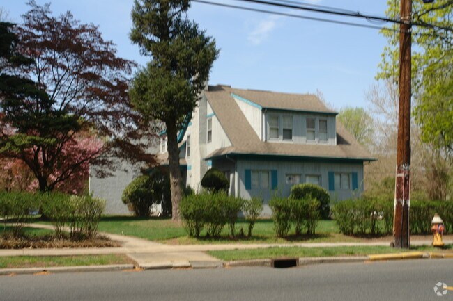
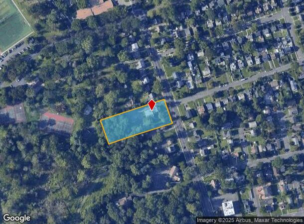
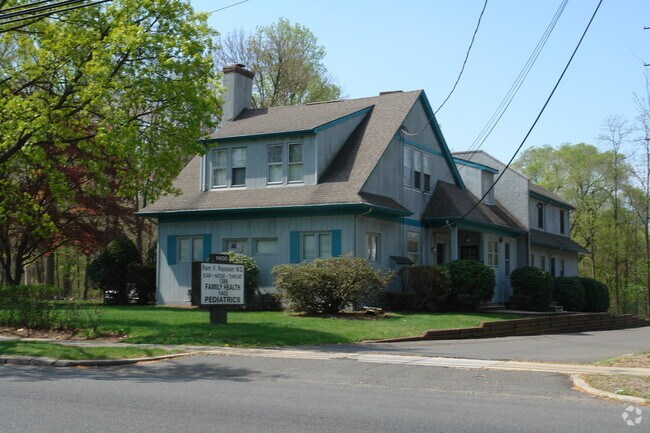
Property Record
1386 Park Ave, Plainfield, NJ 07060
NEARBY LISTINGS FOR SALE OR LEASE
Property Detail
1386 Park Ave
12-00731-0000-00010
ADDITIONAL LOTS: 5537 SF FT BLDG
Commercialnec
Union
X
New Jersey
34023C0032F
10
2024
1.38 AC
2025
Route 22 East
039700
Northern New Jersey
5,537 SF
Newark, NJ
DEMOGRAPHICS near 1386 Park Ave
1 Mile
3 Mile
5 Mile
2024 Total Population
13,443
135,444
318,833
2029 Population
13,416
133,856
316,228
Pop Growth 2024-2029
(0.20%)
(1.17%)
(0.82%)
Average Age
42
39
40
2024 Total Households
4,469
43,270
105,293
HH Growth 2024-2029
(0.29%)
(1.18%)
(0.85%)
Median Household Inc
$102,541
$93,170
$116,779
Avg Household Size
2.90
3.00
2.90
2024 Avg HH Vehicles
2.00
2.00
2.00
Median Home Value
$392,414
$409,437
$474,319
Median Year Built
1955
1959
1963
Nearby Places
Map Layers
Map Styles
 Street
 Aerial
- Restaurants
- Banks
- Shops
- Fitness
- Groceries
PUBLIC TRANSPORTATION
COMMUTER RAIL
Plainfield (Raritan Valley Line - NJ Transit Commuter Rail (NJ Transit))
DRIVE
WALK
Distance
Plainfield (Raritan Valley Line - NJ Transit Commuter Rail (NJ Transit))
4 min
1.6 mi
Netherwood (Raritan Valley Line - NJ Transit Commuter Rail (NJ Transit))
DRIVE
WALK
Distance
Netherwood (Raritan Valley Line - NJ Transit Commuter Rail (NJ Transit))
6 min
2.7 mi
AIRPORT
Newark Liberty International
DRIVE
WALK
Distance
Newark Liberty International
34 min
20.3 mi
LaGuardia
DRIVE
WALK
Distance
LaGuardia
69 min
39.6 mi
Trenton Mercer
DRIVE
WALK
Distance
Trenton Mercer
61 min
40.5 mi
Freight Ports
New York Container Terminal
DRIVE
WALK
Distance
New York Container Terminal
31 min
15.9 mi
Nearby Properties
Address
Land Use
TOTAL SIZE
Lot Size
Zoning
Address
Land Use
TOTAL SIZE
Lot Size
Zoning
17.01 AC
RM
Address
Land Use
TOTAL SIZE
Lot Size
Zoning
20.08 AC
RML1
Address
Land Use
TOTAL SIZE
Lot Size
Zoning
17.64 AC
R10A
Address
Land Use
TOTAL SIZE
Lot Size
Zoning
26.87 AC
H-D
Address
Land Use
TOTAL SIZE
Lot Size
Zoning
233,217 SF
36.91 AC
LI5
Address
Land Use
TOTAL SIZE
Lot Size
Zoning
96.22 AC
RA
Address
Land Use
TOTAL SIZE
Lot Size
Zoning
15.79 AC
H-D
Address
Land Use
TOTAL SIZE
Lot Size
Zoning
12.47 AC
H-D
Address
Land Use
TOTAL SIZE
Lot Size
Zoning
9.38 AC
RM
Address
Land Use
TOTAL SIZE
Lot Size
Zoning
19.84 AC
Address
Land Use
TOTAL SIZE
Lot Size
Zoning
9.85 AC
10A
Address
Land Use
TOTAL SIZE
Lot Size
Zoning
30.80 AC
R10
Address
Land Use
TOTAL SIZE
Lot Size
Zoning
4.74 AC
NC
Address
Land Use
TOTAL SIZE
Lot Size
Zoning
19.84 AC
H-D
Address
Land Use
TOTAL SIZE
Lot Size
Zoning
19.19 AC
R-3
Address
Land Use
TOTAL SIZE
Lot Size
Zoning
21.53 AC
H-D
Address
Land Use
TOTAL SIZE
Lot Size
Zoning
122,820 SF
14.65 AC
H-D
Address
Land Use
TOTAL SIZE
Lot Size
Zoning
12.52 AC
H-D
Address
Land Use
TOTAL SIZE
Lot Size
Zoning
21.60 AC
M3
Address
Land Use
TOTAL SIZE
Lot Size
Zoning
11.20 AC
Address
Land Use
TOTAL SIZE
Lot Size
Zoning
0.39 AC
R5
Address
Land Use
TOTAL SIZE
Lot Size
Zoning
Address
Land Use
TOTAL SIZE
Lot Size
Zoning
5.30 AC
RM
Address
Land Use
TOTAL SIZE
Lot Size
Zoning
87,778 SF
1.88 AC
Address
Land Use
TOTAL SIZE
Lot Size
Zoning
Address
Land Use
TOTAL SIZE
Lot Size
Zoning
43.03 AC
R-1
Address
Land Use
TOTAL SIZE
Lot Size
Zoning
4,900 SF
Address
Land Use
TOTAL SIZE
Lot Size
Zoning
50.50 AC
O
Address
Land Use
TOTAL SIZE
Lot Size
Zoning
11.50 AC
UR
Address
Land Use
TOTAL SIZE
Lot Size
Zoning
39,840 SF
10.97 AC
LI1
The World's #1 Commercial Real Estate Marketplace
Connect with us
© 2026 CoStar Group
The information above has been obtained from sources believed reliable. While we do not doubt its accuracy we have not verified it and make no guarantee, warranty or representation about it. It is your responsibility to independently confirm its accuracy and completeness. Any projections, opinions, assumptions, or estimates used are for example only and do not represent the current or future performance of the property. The value of this transaction to you depends on tax and other factors which should be evaluated by your tax, financial, and legal advisors. You and your advisors should conduct a careful, independent investigation of the property to determine to your satisfaction the suitability of the property for your needs.