Property Record
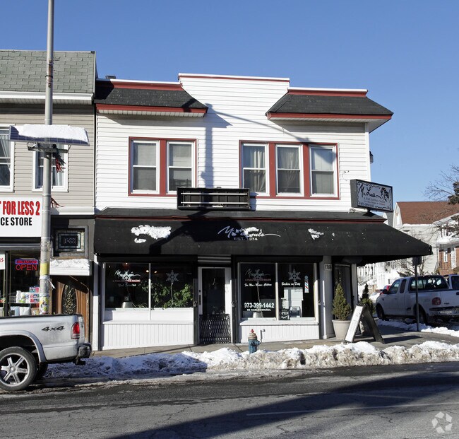
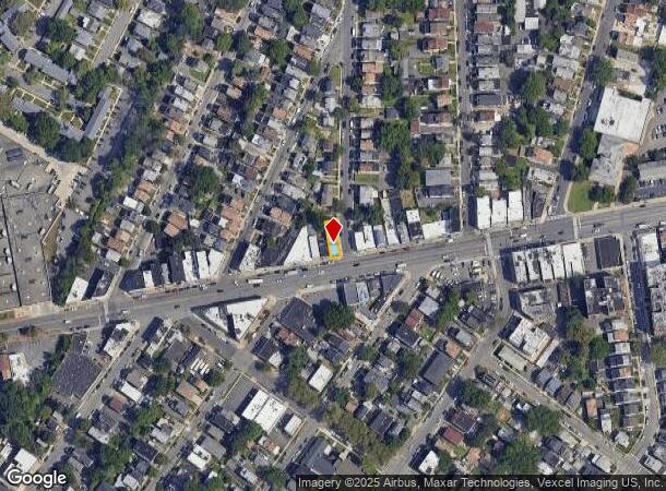
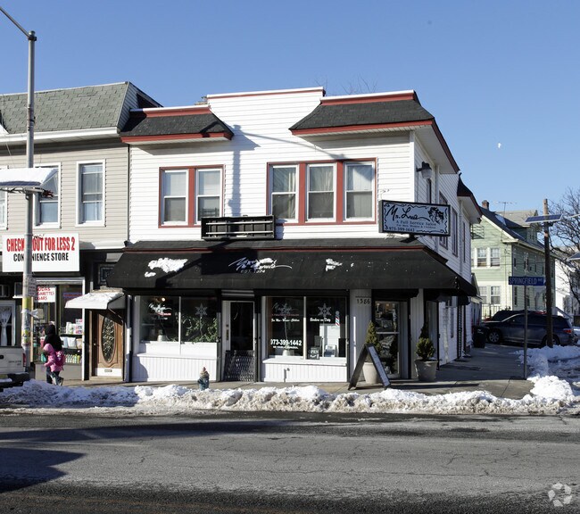
1386 Springfield Ave, Irvington, NJ 07111
NEARBY LISTINGS FOR SALE OR LEASE
Property Detail
1386 Springfield Ave
09-00372-0000-00008
25.55 X IRR.
Retailwithmorethanonenonretailuse
Essex
X
New Jersey
34013C0151F
8
2023
0.09 AC
2025
Urban Essex
012200
Northern New Jersey
2,984 SF
Newark, NJ
DEMOGRAPHICS near 1386 Springfield Ave
1 mile
3 mile
5 mile
2024 Total Population
53,937
319,985
746,597
2029 Population
52,426
311,556
729,224
Pop Growth 2024-2029
(2.80%)
(2.63%)
(2.33%)
Average Age
38
38
38
2024 Total Households
19,326
112,967
269,277
HH Growth 2024-2029
(3.00%)
(2.78%)
(2.38%)
Median Household Inc
$64,847
$63,194
$61,878
Avg Household Size
2.70
2.70
2.60
2024 Avg HH Vehicles
1.00
1.00
1.00
Median Home Value
$317,727
$371,482
$391,554
Median Year Built
1953
1954
1958
Nearby Places
Map Layers
Map Styles
 Street
 Aerial
Transit
 Traffic
 Biking
Places
Listings with unknown addresses are not visible on the map
- Restaurants
- Banks
- Shops
- Fitness
- Groceries
PUBLIC TRANSPORTATION
COMMUTER RAIL
South Orange (Morris & Essex Gladstone Branch - NJ Transit Commuter Rail (NJ Transit), Morris & Essex Morristown Line - NJ Transit Commuter Rail (NJ Transit))
Drive
Walk
Distance
South Orange (Morris & Essex Gladstone Branch - NJ Transit Commuter Rail (NJ Transit), Morris & Essex Morristown Line - NJ Transit Commuter Rail (NJ Transit))
7 min
2.2 mi
Maplewood (Morris & Essex Gladstone Branch - NJ Transit Commuter Rail (NJ Transit), Morris & Essex Morristown Line - NJ Transit Commuter Rail (NJ Transit))
Drive
Walk
Distance
Maplewood (Morris & Essex Gladstone Branch - NJ Transit Commuter Rail (NJ Transit), Morris & Essex Morristown Line - NJ Transit Commuter Rail (NJ Transit))
7 min
2.4 mi
AIRPORT
Newark Liberty International
Drive
Walk
Distance
Newark Liberty International
12 min
7.0 mi
LaGuardia
Drive
Walk
Distance
LaGuardia
48 min
26.2 mi
John F Kennedy International
Drive
Walk
Distance
John F Kennedy International
59 min
34.5 mi
Freight Ports
Maher Terminal
Drive
Walk
Distance
Maher Terminal
17 min
8.1 mi
Nearby Properties
Address
Land Use
TOTAL SIZE
Lot Size
Zoning
Address
Land Use
TOTAL SIZE
Lot Size
Zoning
57.23 AC
U
Address
Land Use
TOTAL SIZE
Lot Size
Zoning
926,120 SF
11.46 AC
Address
Land Use
TOTAL SIZE
Lot Size
Zoning
0.61 AC
Address
Land Use
TOTAL SIZE
Lot Size
Zoning
231 AC
R1-7
Address
Land Use
TOTAL SIZE
Lot Size
Zoning
219 AC
R1-7
Address
Land Use
TOTAL SIZE
Lot Size
Zoning
1,136 SF
6.51 AC
Address
Land Use
TOTAL SIZE
Lot Size
Zoning
32.27 AC
CCRC
Address
Land Use
TOTAL SIZE
Lot Size
Zoning
Address
Land Use
TOTAL SIZE
Lot Size
Zoning
0.23 AC
REDV
Address
Land Use
TOTAL SIZE
Lot Size
Zoning
4.60 AC
PRD
Address
Land Use
TOTAL SIZE
Lot Size
Zoning
13.80 AC
R1-5
Address
Land Use
TOTAL SIZE
Lot Size
Zoning
Address
Land Use
TOTAL SIZE
Lot Size
Zoning
16.14 AC
Address
Land Use
TOTAL SIZE
Lot Size
Zoning
310.45 AC
Address
Land Use
TOTAL SIZE
Lot Size
Zoning
Address
Land Use
TOTAL SIZE
Lot Size
Zoning
3.28 AC
Address
Land Use
TOTAL SIZE
Lot Size
Zoning
19,498 SF
0.67 AC
FVRZ
Address
Land Use
TOTAL SIZE
Lot Size
Zoning
Address
Land Use
TOTAL SIZE
Lot Size
Zoning
295,160 SF
3.72 AC
Address
Land Use
TOTAL SIZE
Lot Size
Zoning
Address
Land Use
TOTAL SIZE
Lot Size
Zoning
6.05 AC
RO
Address
Land Use
TOTAL SIZE
Lot Size
Zoning
3.64 AC
Address
Land Use
TOTAL SIZE
Lot Size
Zoning
6.57 AC
Address
Land Use
TOTAL SIZE
Lot Size
Zoning
Address
Land Use
TOTAL SIZE
Lot Size
Zoning
5.65 AC
R100
Address
Land Use
TOTAL SIZE
Lot Size
Zoning
395,080 SF
2.87 AC
Address
Land Use
TOTAL SIZE
Lot Size
Zoning
4.08 AC
Address
Land Use
TOTAL SIZE
Lot Size
Zoning
16.10 AC
R1-5
Address
Land Use
TOTAL SIZE
Lot Size
Zoning
4 AC
R1-5
Address
Land Use
TOTAL SIZE
Lot Size
Zoning
1.25 AC
CBR1
The World's #1 Commercial Real Estate Marketplace
Connect with us
© 2026 CoStar Group
The information above has been obtained from sources believed reliable. While we do not doubt its accuracy we have not verified it and make no guarantee, warranty or representation about it. It is your responsibility to independently confirm its accuracy and completeness. Any projections, opinions, assumptions, or estimates used are for example only and do not represent the current or future performance of the property. The value of this transaction to you depends on tax and other factors which should be evaluated by your tax, financial, and legal advisors. You and your advisors should conduct a careful, independent investigation of the property to determine to your satisfaction the suitability of the property for your needs.