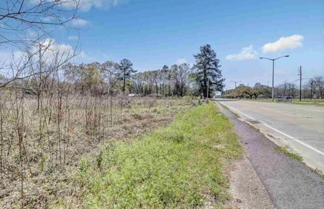
Property Record
13861 Plank Rd, Baker, LA 70714

Property Detail
13861 Plank Rd
01308459
WARD: 2-2, SUBDIVISION: WEILAND TRACT. .33 ACRES, AS TRACT A, TAKEN FROM THAT TRACT CONT 14.00 ACRES KNOWN AS THE WEILAND TRA
Storesoffices
E BATON ROUGE
AE The base floodplain where base flood elevations are provided. AE Zones are now used on new format FIRMs instead of A1-A30 Zones.
Louisiana
0
0.33 AC
2025
Greater Baton Rouge N
004201
Baton Rouge
2,188 SF
Baton Rouge, LA
NEARBY LISTINGS FOR SALE OR LEASE
-
-
View all Baker listings for sale on LoopNet.com
DEMOGRAPHICS near 13861 Plank Rd
1 mile
3 mile
5 mile
2025 Total Population
2,461
22,540
64,815
2030 Population
2,462
22,339
64,607
Pop Growth 2025-2030
+ 0.04%
(0.89%)
(0.32%)
Average Age
40
40
39
2025 Total Households
972
8,415
23,296
HH Growth 2025-2030
0.00%
(0.96%)
(0.38%)
Median Household Inc
$50,066
$47,180
$41,930
Avg Household Size
2.50
2.50
2.60
2025 Avg HH Vehicles
2.00
2.00
2.00
Median Home Value
$149,184
$154,560
$158,611
Median Year Built
1983
1977
1976
Nearby Places
Map Layers
Map Styles
 Street
 Aerial
Transit
 Traffic
 Biking
Places
Listings with unknown addresses are not visible on the map
- Restaurants
- Banks
- Shops
- Fitness
- Groceries
PUBLIC TRANSPORTATION
AIRPORT
Baton Rouge Metro Ryan Field
Drive
Walk
Distance
Baton Rouge Metro Ryan Field
6 min
3.4 mi
Freight Ports
Port of Greater Baton Rouge
Drive
Walk
Distance
Port of Greater Baton Rouge
25 min
14.3 mi
SALE & LEASE HISTORY
LISTING DATE
SALE/LEASE

Apr 22, 2020
For Sale
Nearby Properties
Address
Land Use
TOTAL SIZE
Lot Size
Zoning
Address
Land Use
TOTAL SIZE
Lot Size
Zoning
369.80 AC
Address
Land Use
TOTAL SIZE
Lot Size
Zoning
186,000 SF
23.51 AC
Address
Land Use
TOTAL SIZE
Lot Size
Zoning
45,480 SF
2.19 AC
Address
Land Use
TOTAL SIZE
Lot Size
Zoning
Address
Land Use
TOTAL SIZE
Lot Size
Zoning
34,310 SF
7.74 AC
Address
Land Use
TOTAL SIZE
Lot Size
Zoning
Address
Land Use
TOTAL SIZE
Lot Size
Zoning
36.32 AC
Address
Land Use
TOTAL SIZE
Lot Size
Zoning
72,300 SF
24.63 AC
Address
Land Use
TOTAL SIZE
Lot Size
Zoning
12.59 AC
Address
Land Use
TOTAL SIZE
Lot Size
Zoning
1.42 AC
Address
Land Use
TOTAL SIZE
Lot Size
Zoning
14.99 AC
Address
Land Use
TOTAL SIZE
Lot Size
Zoning
100,000 SF
7.48 AC
Address
Land Use
TOTAL SIZE
Lot Size
Zoning
Address
Land Use
TOTAL SIZE
Lot Size
Zoning
44,200 SF
6.53 AC
Address
Land Use
TOTAL SIZE
Lot Size
Zoning
36,750 SF
17.27 AC
Address
Land Use
TOTAL SIZE
Lot Size
Zoning
16,583 SF
5.61 AC
Address
Land Use
TOTAL SIZE
Lot Size
Zoning
8,500 SF
3.18 AC
Address
Land Use
TOTAL SIZE
Lot Size
Zoning
4,884 SF
10.65 AC
Address
Land Use
TOTAL SIZE
Lot Size
Zoning
2.70 AC
Address
Land Use
TOTAL SIZE
Lot Size
Zoning
Address
Land Use
TOTAL SIZE
Lot Size
Zoning
2.48 AC
Address
Land Use
TOTAL SIZE
Lot Size
Zoning
9,800 SF
3.60 AC
Address
Land Use
TOTAL SIZE
Lot Size
Zoning
16,102 SF
1.26 AC
Address
Land Use
TOTAL SIZE
Lot Size
Zoning
6,489 SF
0.74 AC
Address
Land Use
TOTAL SIZE
Lot Size
Zoning
13,225 SF
1.34 AC
Address
Land Use
TOTAL SIZE
Lot Size
Zoning
1.08 AC
Address
Land Use
TOTAL SIZE
Lot Size
Zoning
29,609 SF
17.39 AC
Address
Land Use
TOTAL SIZE
Lot Size
Zoning
4.77 AC
Address
Land Use
TOTAL SIZE
Lot Size
Zoning
53,200 SF
5.41 AC
The World's #1 Commercial Real Estate Marketplace
Connect with us
© 2026 CoStar Group
The information above has been obtained from sources believed reliable. While we do not doubt its accuracy we have not verified it and make no guarantee, warranty or representation about it. It is your responsibility to independently confirm its accuracy and completeness. Any projections, opinions, assumptions, or estimates used are for example only and do not represent the current or future performance of the property. The value of this transaction to you depends on tax and other factors which should be evaluated by your tax, financial, and legal advisors. You and your advisors should conduct a careful, independent investigation of the property to determine to your satisfaction the suitability of the property for your needs.