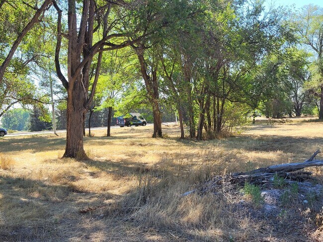
Property Record
139 Hover St, Longmont, CO 80501


Property Detail
139 Hover St
Boulder, CO
173 X 501 FT IN NE COR LOT 3 CUSHMANS REC 807365 11/24/86 LESS PT TO COUNTY FOR ROAD PER REC 682904 BCR
1315050-06-001
BOULDER
Residentialacreage
Colorado
A
3
AO River or stream flood hazard areas, and areas with a 1% or greater chance of shallow flooding each year. These areas have a 26% chance of flooding over the life of a 30-year mortgage.
1.60 AC
2024
Longmont
2025
Denver
013212
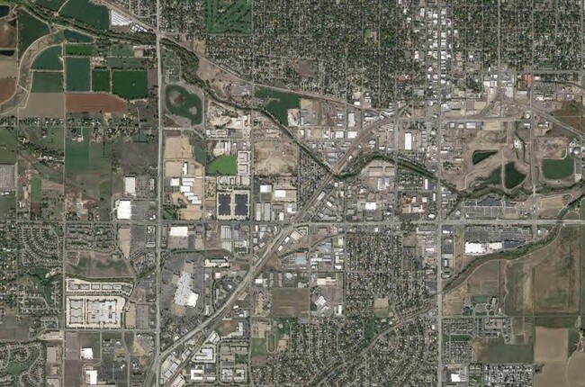
NEARBY LISTINGS FOR SALE OR LEASE
DEMOGRAPHICS near 139 Hover St
1 mile
3 mile
5 mile
2024 Total Population
6,829
78,849
106,460
2029 Population
6,892
78,517
106,474
Pop Growth 2024-2029
+ 0.92%
(0.42%)
+ 0.01%
Average Age
44
41
42
2024 Total Households
3,006
31,577
42,449
HH Growth 2024-2029
+ 0.96%
(0.44%)
0.00%
Median Household Inc
$87,189
$84,005
$90,639
Avg Household Size
2.20
2.40
2.40
2024 Avg HH Vehicles
2.00
2.00
2.00
Median Home Value
$688,981
$622,941
$660,024
Median Year Built
1977
1984
1989
Nearby Places
Map Layers
Map Styles
 Street
 Aerial
Transit
 Traffic
 Biking
Places
Listings with unknown addresses are not visible on the map
- Restaurants
- Banks
- Shops
- Fitness
- Groceries
PUBLIC TRANSPORTATION
AIRPORT
Denver International
Drive
Walk
Distance
Denver International
54 min
46.0 mi
SALE & LEASE HISTORY
LISTING DATE
SALE/LEASE

Sep 24, 2016
For Sale
Aug 16, 2024
For Sale
Nearby Properties
Address
Land Use
TOTAL SIZE
Lot Size
Zoning
Address
Land Use
TOTAL SIZE
Lot Size
Zoning
750,908 SF
64.12 AC
Address
Land Use
TOTAL SIZE
Lot Size
Zoning
1,152 SF
17.20 AC
Address
Land Use
TOTAL SIZE
Lot Size
Zoning
540,109 SF
40.51 AC
Address
Land Use
TOTAL SIZE
Lot Size
Zoning
557,104 SF
44.13 AC
Address
Land Use
TOTAL SIZE
Lot Size
Zoning
304,151 SF
45.04 AC
Address
Land Use
TOTAL SIZE
Lot Size
Zoning
38.30 AC
Address
Land Use
TOTAL SIZE
Lot Size
Zoning
37.78 AC
A
Address
Land Use
TOTAL SIZE
Lot Size
Zoning
157.06 AC
Address
Land Use
TOTAL SIZE
Lot Size
Zoning
34,137 SF
19.99 AC
Address
Land Use
TOTAL SIZE
Lot Size
Zoning
75.02 AC
A
Address
Land Use
TOTAL SIZE
Lot Size
Zoning
197,659 SF
34.12 AC
Address
Land Use
TOTAL SIZE
Lot Size
Zoning
465,094 SF
23.57 AC
Address
Land Use
TOTAL SIZE
Lot Size
Zoning
277,321 SF
14.96 AC
Address
Land Use
TOTAL SIZE
Lot Size
Zoning
152,160 SF
9.02 AC
Address
Land Use
TOTAL SIZE
Lot Size
Zoning
107,805 SF
7.45 AC
Address
Land Use
TOTAL SIZE
Lot Size
Zoning
126,408 SF
9.11 AC
Address
Land Use
TOTAL SIZE
Lot Size
Zoning
146,153 SF
13.60 AC
Address
Land Use
TOTAL SIZE
Lot Size
Zoning
135,601 SF
17.30 AC
Address
Land Use
TOTAL SIZE
Lot Size
Zoning
152,160 SF
10.48 AC
Address
Land Use
TOTAL SIZE
Lot Size
Zoning
71.22 AC
A
Address
Land Use
TOTAL SIZE
Lot Size
Zoning
18.42 AC
Address
Land Use
TOTAL SIZE
Lot Size
Zoning
133,569 SF
14.67 AC
Address
Land Use
TOTAL SIZE
Lot Size
Zoning
65.62 AC
A
Address
Land Use
TOTAL SIZE
Lot Size
Zoning
123,520 SF
11.06 AC
Address
Land Use
TOTAL SIZE
Lot Size
Zoning
12.98 AC
Address
Land Use
TOTAL SIZE
Lot Size
Zoning
199,578 SF
12.94 AC
Address
Land Use
TOTAL SIZE
Lot Size
Zoning
167,821 SF
14.26 AC
Address
Land Use
TOTAL SIZE
Lot Size
Zoning
282,676 SF
12 AC
Address
Land Use
TOTAL SIZE
Lot Size
Zoning
158,402 SF
12.87 AC
Address
Land Use
TOTAL SIZE
Lot Size
Zoning
11.22 AC
The World's #1 Commercial Real Estate Marketplace
Connect with us
© 2026 CoStar Group
The information above has been obtained from sources believed reliable. While we do not doubt its accuracy we have not verified it and make no guarantee, warranty or representation about it. It is your responsibility to independently confirm its accuracy and completeness. Any projections, opinions, assumptions, or estimates used are for example only and do not represent the current or future performance of the property. The value of this transaction to you depends on tax and other factors which should be evaluated by your tax, financial, and legal advisors. You and your advisors should conduct a careful, independent investigation of the property to determine to your satisfaction the suitability of the property for your needs.