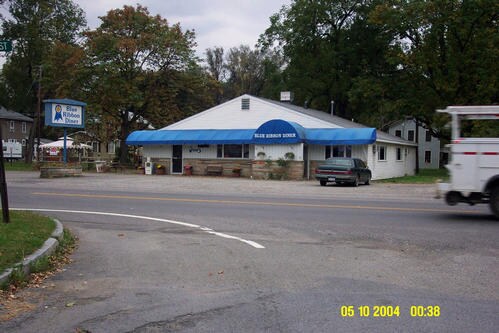
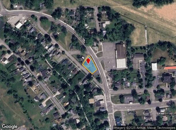
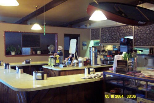
Property Record
139 N Catherine St, Montour Falls, NY 14865
NEARBY LISTINGS FOR SALE OR LEASE
-
-
View all Montour Falls listings for sale on LoopNet.com
Property Detail
139 N Catherine St
442801 76.19-3-24
Schuyler
Restaurantbuilding
New York
2025
24.000
2024
0.30 AC
950500
Ithaca/Elmira
2,750 SF
Other Market Areas
DEMOGRAPHICS near 139 N Catherine St
1 Mile
3 Mile
5 Mile
2024 Total Population
1,256
4,595
7,287
2029 Population
1,198
4,505
7,158
Pop Growth 2024-2029
(4.62%)
(1.96%)
(1.77%)
Average Age
45
46
45
2024 Total Households
570
2,153
3,309
HH Growth 2024-2029
(4.56%)
(1.86%)
(1.69%)
Median Household Inc
$52,500
$51,111
$56,282
Avg Household Size
2.10
2.00
2.10
2024 Avg HH Vehicles
2.00
2.00
2.00
Median Home Value
$121,951
$133,758
$144,535
Median Year Built
1965
1959
1962
Nearby Places
Map Layers
Map Styles
 Street
 Aerial
- Restaurants
- Banks
- Shops
- Fitness
- Groceries
PUBLIC TRANSPORTATION
AIRPORT
Elmira/Corning Regional
DRIVE
WALK
Distance
Elmira/Corning Regional
24 min
18.8 mi
Ithaca Tompkins International
DRIVE
WALK
Distance
Ithaca Tompkins International
45 min
30.0 mi
Freight Ports
Albany, NY Port
DRIVE
WALK
Distance
Albany, NY Port
253 min
212.8 mi
Nearby Properties
Address
Land Use
TOTAL SIZE
Lot Size
Zoning
Address
Land Use
TOTAL SIZE
Lot Size
Zoning
87,216 SF
1.76 AC
NA
Address
Land Use
TOTAL SIZE
Lot Size
Zoning
47,005 SF
28.95 AC
NA
Address
Land Use
TOTAL SIZE
Lot Size
Zoning
158,654 SF
17.63 AC
Address
Land Use
TOTAL SIZE
Lot Size
Zoning
18,979 SF
16.14 AC
NA
Address
Land Use
TOTAL SIZE
Lot Size
Zoning
77,232 SF
44.67 AC
NA
Address
Land Use
TOTAL SIZE
Lot Size
Zoning
117,956 SF
18.80 AC
NA
Address
Land Use
TOTAL SIZE
Lot Size
Zoning
128,772 SF
11.50 AC
NA
Address
Land Use
TOTAL SIZE
Lot Size
Zoning
86,403 SF
22.75 AC
NA
Address
Land Use
TOTAL SIZE
Lot Size
Zoning
50,280 SF
6.23 AC
NA
Address
Land Use
TOTAL SIZE
Lot Size
Zoning
52 AC
NA
Address
Land Use
TOTAL SIZE
Lot Size
Zoning
60,977 SF
4.73 AC
NA
Address
Land Use
TOTAL SIZE
Lot Size
Zoning
10,272 SF
8.56 AC
NA
Address
Land Use
TOTAL SIZE
Lot Size
Zoning
38,400 SF
17.77 AC
NA
Address
Land Use
TOTAL SIZE
Lot Size
Zoning
4.46 AC
B-1
Address
Land Use
TOTAL SIZE
Lot Size
Zoning
3,171 SF
58.60 AC
NA
Address
Land Use
TOTAL SIZE
Lot Size
Zoning
31,833 SF
1.40 AC
NA
Address
Land Use
TOTAL SIZE
Lot Size
Zoning
5,000 SF
12.40 AC
NA
Address
Land Use
TOTAL SIZE
Lot Size
Zoning
38,079 SF
2.79 AC
NA
Address
Land Use
TOTAL SIZE
Lot Size
Zoning
20,435 SF
14.08 AC
NA
Address
Land Use
TOTAL SIZE
Lot Size
Zoning
23,901 SF
1.52 AC
NA
Address
Land Use
TOTAL SIZE
Lot Size
Zoning
11,225 SF
0.23 AC
Address
Land Use
TOTAL SIZE
Lot Size
Zoning
11,160 SF
0.43 AC
NA
Address
Land Use
TOTAL SIZE
Lot Size
Zoning
22,798 SF
0.55 AC
NA
Address
Land Use
TOTAL SIZE
Lot Size
Zoning
14,156 SF
3.30 AC
NA
Address
Land Use
TOTAL SIZE
Lot Size
Zoning
14,880 SF
9.20 AC
NA
Address
Land Use
TOTAL SIZE
Lot Size
Zoning
12,312 SF
0.46 AC
NA
Address
Land Use
TOTAL SIZE
Lot Size
Zoning
17,400 SF
2.84 AC
Address
Land Use
TOTAL SIZE
Lot Size
Zoning
8,955 SF
9.79 AC
NA
Address
Land Use
TOTAL SIZE
Lot Size
Zoning
8,600 SF
0.57 AC
NA
Address
Land Use
TOTAL SIZE
Lot Size
Zoning
4,500 SF
16.18 AC
The World's #1 Commercial Real Estate Marketplace
Connect with us
© 2025 CoStar Group
The information above has been obtained from sources believed reliable. While we do not doubt its accuracy we have not verified it and make no guarantee, warranty or representation about it. It is your responsibility to independently confirm its accuracy and completeness. Any projections, opinions, assumptions, or estimates used are for example only and do not represent the current or future performance of the property. The value of this transaction to you depends on tax and other factors which should be evaluated by your tax, financial, and legal advisors. You and your advisors should conduct a careful, independent investigation of the property to determine to your satisfaction the suitability of the property for your needs.