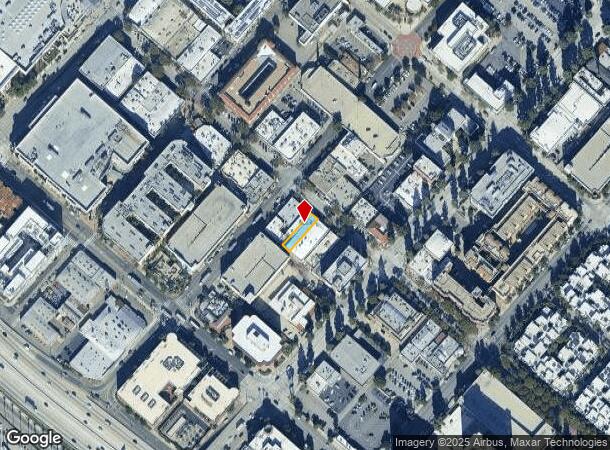
Property Record
139 N Golden Mall, Burbank, CA 91502
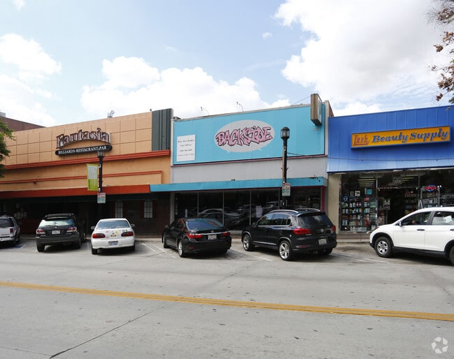
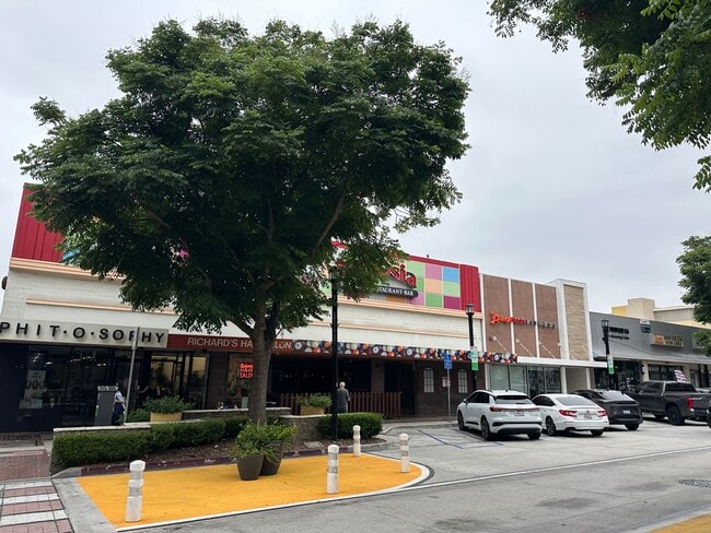
This Property Is For Sale
NEARBY LISTINGS FOR SALE OR LEASE
Property Detail
139 N Golden Mall
Los Angeles-Long Beach-Glendale, CA
817
2453-010-006
TRACT NO 817 NW 10.46 FT OF LOT F AND SE 19.54 FT OF LOT G
Storemultistory
Los Angeles
X
California
06037C1345F
f,g
2024
0.10 AC
2025
Burbank
310705
Los Angeles
3,555 SF
DEMOGRAPHICS near 139 N Golden Mall
1 Mile
3 Mile
5 Mile
2024 Total Population
36,225
145,523
457,189
2029 Population
35,013
140,518
442,866
Pop Growth 2024-2029
(3.35%)
(3.44%)
(3.13%)
Average Age
42
42
41
2024 Total Households
15,192
57,121
181,911
HH Growth 2024-2029
(3.61%)
(3.69%)
(3.33%)
Median Household Inc
$67,154
$83,678
$76,819
Avg Household Size
2.30
2.50
2.40
2024 Avg HH Vehicles
2.00
2.00
2.00
Median Home Value
$837,389
$882,989
$889,197
Median Year Built
1972
1958
1964
Nearby Places
Map Layers
Map Styles
 Street
 Aerial
- Restaurants
- Banks
- Shops
- Fitness
- Groceries
PUBLIC TRANSPORTATION
COMMUTER RAIL
Downtown Burbank (Antelope Valley Line - Southern California Regional Rail Authority (Metrolink), Ventura County Line - Southern California Regional Rail Authority (Metrolink))
DRIVE
WALK
Distance
Downtown Burbank (Antelope Valley Line - Southern California Regional Rail Authority (Metrolink), Ventura County Line - Southern California Regional Rail Authority (Metrolink))
4 min
6 min
0.3 mi
Burbank-Bob Hope Airport (Ventura County Line - Southern California Regional Rail Authority (Metrolink))
DRIVE
WALK
Distance
Burbank-Bob Hope Airport (Ventura County Line - Southern California Regional Rail Authority (Metrolink))
6 min
2.9 mi
AIRPORT
Bob Hope
DRIVE
WALK
Distance
Bob Hope
11 min
5.6 mi
Los Angeles International
DRIVE
WALK
Distance
Los Angeles International
40 min
28.1 mi
Long Beach (Daugherty Field)
DRIVE
WALK
Distance
Long Beach (Daugherty Field)
45 min
33.0 mi
Freight Ports
Port of Long Beach
DRIVE
WALK
Distance
Port of Long Beach
47 min
34.9 mi
Nearby Properties
Address
Land Use
TOTAL SIZE
Lot Size
Zoning
Address
Land Use
TOTAL SIZE
Lot Size
Zoning
152,217 SF
70.95 AC
BUM1*
Address
Land Use
TOTAL SIZE
Lot Size
Zoning
735,900 SF
34.87 AC
BUPD*
Address
Land Use
TOTAL SIZE
Lot Size
Zoning
207,766 SF
42.81 AC
BUM1*
Address
Land Use
TOTAL SIZE
Lot Size
Zoning
616,662 SF
19.66 AC
BUM1*
Address
Land Use
TOTAL SIZE
Lot Size
Zoning
359,197 SF
13.49 AC
GLENDALE M
Address
Land Use
TOTAL SIZE
Lot Size
Zoning
397,477 SF
2.75 AC
BUR4
Address
Land Use
TOTAL SIZE
Lot Size
Zoning
979,623 SF
13.36 AC
GLM2
Address
Land Use
TOTAL SIZE
Lot Size
Zoning
475,433 SF
19.35 AC
BUM1*
Address
Land Use
TOTAL SIZE
Lot Size
Zoning
489,466 SF
2.90 AC
BUM1
Address
Land Use
TOTAL SIZE
Lot Size
Zoning
452,048 SF
21.58 AC
BCCM
Address
Land Use
TOTAL SIZE
Lot Size
Zoning
696,128 SF
2.42 AC
BUC3*
Address
Land Use
TOTAL SIZE
Lot Size
Zoning
43,558 SF
30.11 AC
BUMI-C2*
Address
Land Use
TOTAL SIZE
Lot Size
Zoning
1,328,547 SF
39.36 AC
BUPD
Address
Land Use
TOTAL SIZE
Lot Size
Zoning
432,232 SF
7.17 AC
BUM2
Address
Land Use
TOTAL SIZE
Lot Size
Zoning
219,607 SF
1.51 AC
BUR4
Address
Land Use
TOTAL SIZE
Lot Size
Zoning
380,017 SF
Address
Land Use
TOTAL SIZE
Lot Size
Zoning
440,774 SF
2.20 AC
BUR4*
Address
Land Use
TOTAL SIZE
Lot Size
Zoning
462,896 SF
1.38 AC
BUR4*
Address
Land Use
TOTAL SIZE
Lot Size
Zoning
362,863 SF
1.82 AC
BUMZ
Address
Land Use
TOTAL SIZE
Lot Size
Zoning
346,186 SF
11.72 AC
BUM2*
Address
Land Use
TOTAL SIZE
Lot Size
Zoning
558,532 SF
5.20 AC
BUC4*
Address
Land Use
TOTAL SIZE
Lot Size
Zoning
660,463 SF
6.88 AC
BUR4*
Address
Land Use
TOTAL SIZE
Lot Size
Zoning
612,976 SF
3.53 AC
BUC2*
Address
Land Use
TOTAL SIZE
Lot Size
Zoning
126,452 SF
9.27 AC
GLM2*
Address
Land Use
TOTAL SIZE
Lot Size
Zoning
151,704 SF
1 AC
BUC4*
Address
Land Use
TOTAL SIZE
Lot Size
Zoning
BURAILROAD
Address
Land Use
TOTAL SIZE
Lot Size
Zoning
165,630 SF
1.19 AC
BUC2
Address
Land Use
TOTAL SIZE
Lot Size
Zoning
488,658 SF
3.85 AC
BUMDCZ*
Address
Land Use
TOTAL SIZE
Lot Size
Zoning
279,574 SF
4.01 AC
BUM2*
Address
Land Use
TOTAL SIZE
Lot Size
Zoning
299,864 SF
1.29 AC
BUC3
The World's #1 Commercial Real Estate Marketplace
Connect with us
© 2026 CoStar Group
The information above has been obtained from sources believed reliable. While we do not doubt its accuracy we have not verified it and make no guarantee, warranty or representation about it. It is your responsibility to independently confirm its accuracy and completeness. Any projections, opinions, assumptions, or estimates used are for example only and do not represent the current or future performance of the property. The value of this transaction to you depends on tax and other factors which should be evaluated by your tax, financial, and legal advisors. You and your advisors should conduct a careful, independent investigation of the property to determine to your satisfaction the suitability of the property for your needs.